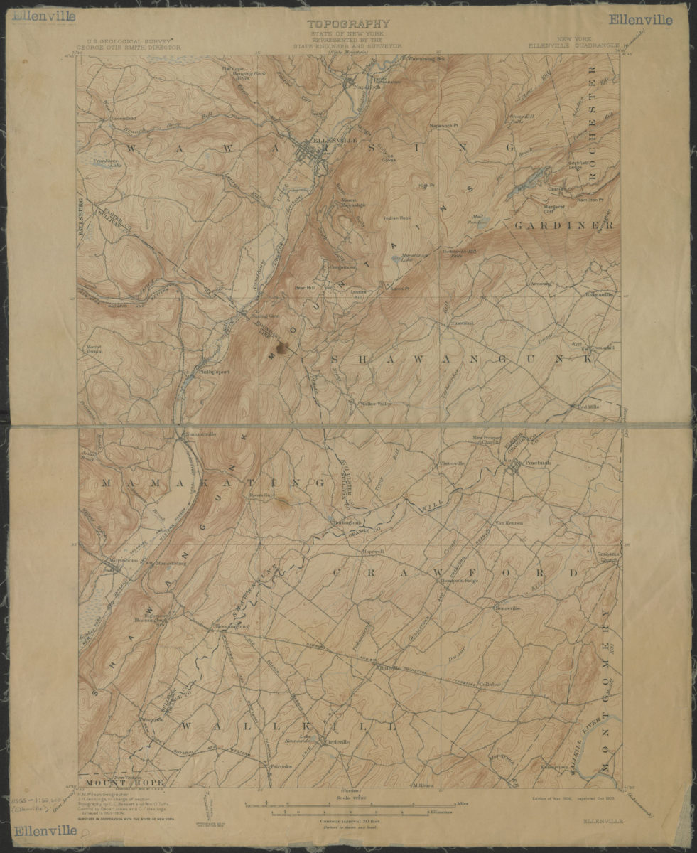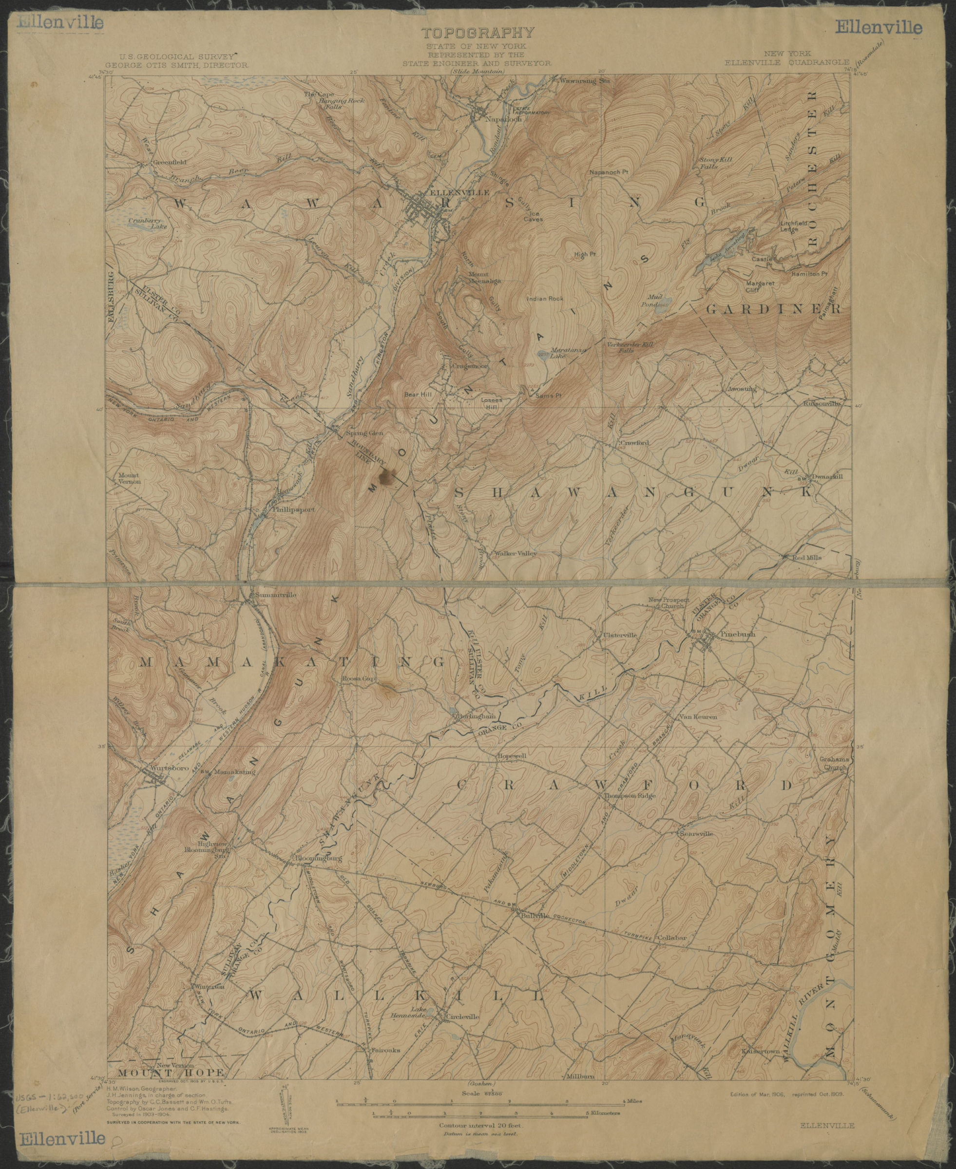
Ellenville quadrangle, New York: U.S. Geological Survey 1906; 1909
Map No. USGS-1:62,5000 (Ellenville).Fl
Shows portions of Ulster, Sullivan and Orange Counties. Relief indicated by contour lines and spot heights. “Surveyed in 1903-1904.” “H.M. Wilson, Geographer. J. H. Jennings, in charge of section. Topography by C. C. Bassett and Wm. O. Tufts. Control by Oscar Jones and C.F. Hastings.” Surveyed in cooperation with the State of New York. “Engraved Oct. 1905 by U.S.G.S.” “Edition of Mar. 1906, reprinted Oct. 1909.” Text and legend on verso.
Map area shown
Genre
Topographic mapsRelation
Full catalog recordSize
51 × 42 cmDownload
Low Resolution Image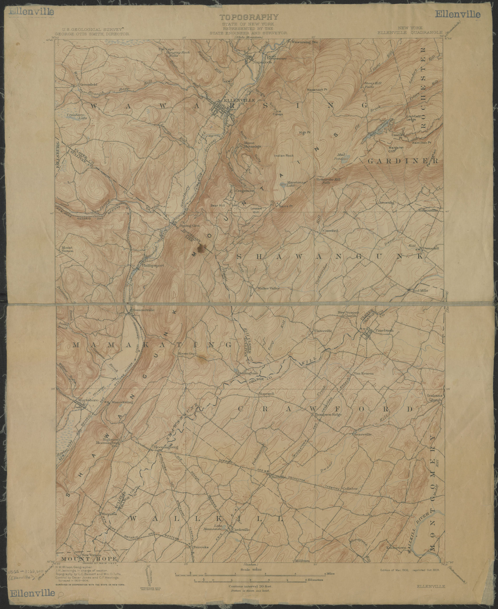
Creator
Geological Survey (U.S.),Publisher
Brooklyn Historical SocietyCitation
Ellenville quadrangle, New York: U.S. Geological Survey; 1906; 1909, Map Collection, USGS-1:62,5000 (Ellenville).Fl; Brooklyn Historical Society.Scale
Scale 1:62,500Loading zoom image...