Center for Brooklyn History
Map Collections
Search
About
Othmer Library & Archives
Submit search query
Refine 7 records
Clear filter
1
Location
Bergen County (N.J.)
6
Greenwood Lake Region (N.J. and N.Y.)
1
Orange County (N.Y.)
7
Passaic County (N.J.)
5
Pike County (Pa.)
1
Rockland County (N.Y.)
5
Sullivan County (N.Y.)
1
Sussex County (N.J.)
3
Ulster County (N.Y.)
4
Subject
Date
20th Century
469
or enter range:
from
to
Genres
Topographic maps
70
Sort by:
Date (earliest)
Date (most recent)
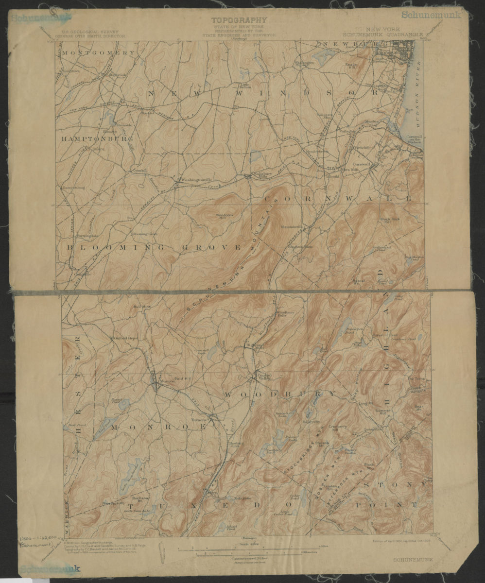
Schunemunk quadrangle, New York: U.S. Geological Survey
Schunemunk quadrangle, New York: U.S. Geological Survey
1902; 1909
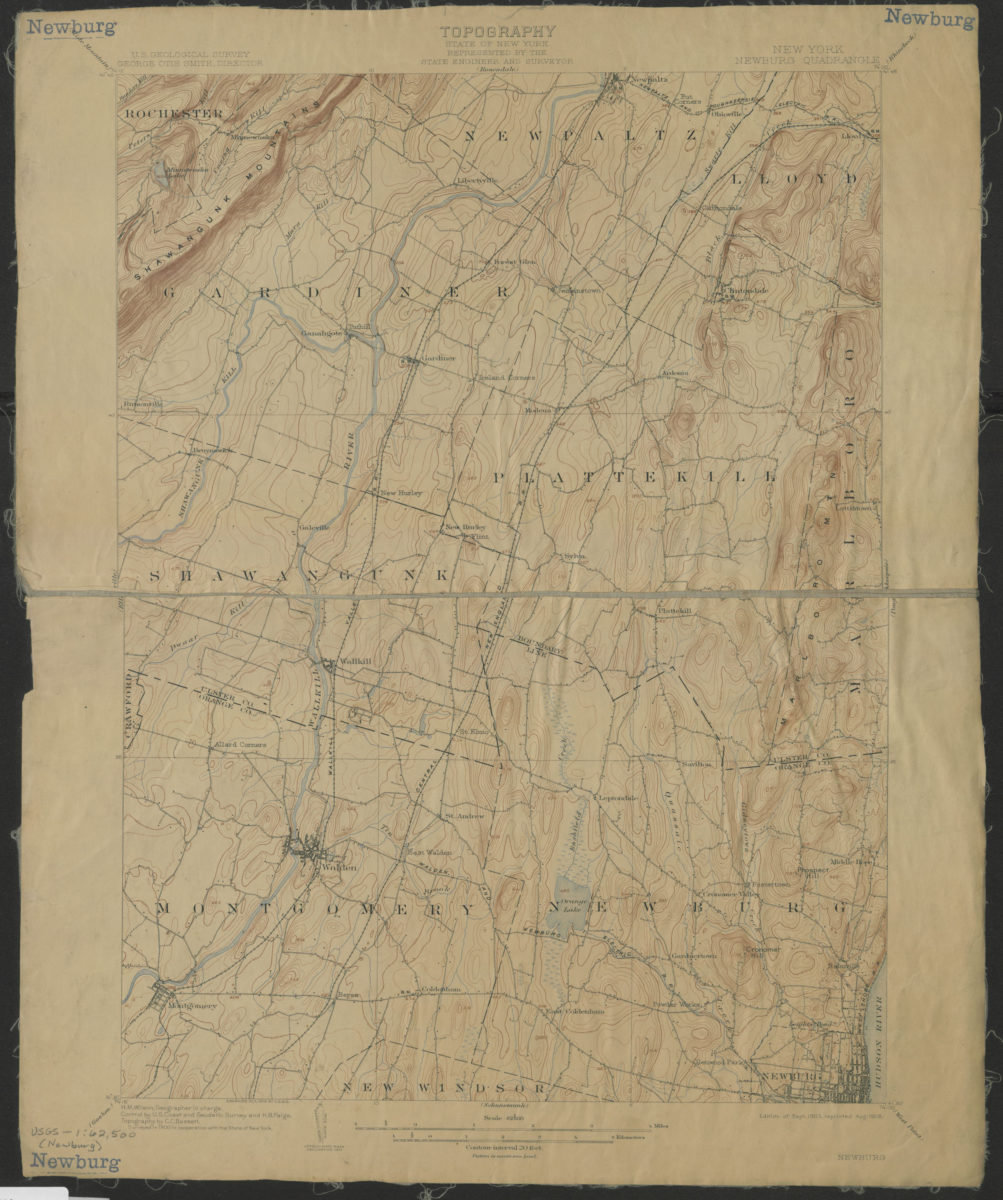
Newburg Quadrangle, New York: U.S. Geological Survey
Newburg Quadrangle, New York: U.S. Geological Survey
1903; 1908
Ellenville quadrangle, New York: U.S. Geological Survey
Ellenville quadrangle, New York: U.S. Geological Survey
1906; 1909
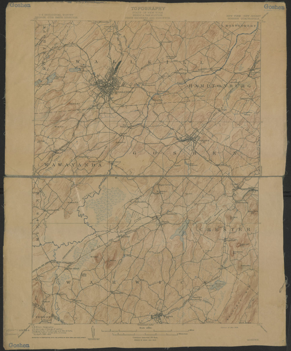
Goshen quadrangle, New York – New Jersey: U.S. Geological Survey
Goshen quadrangle, New York – New Jersey: U.S. Geological Survey
1908
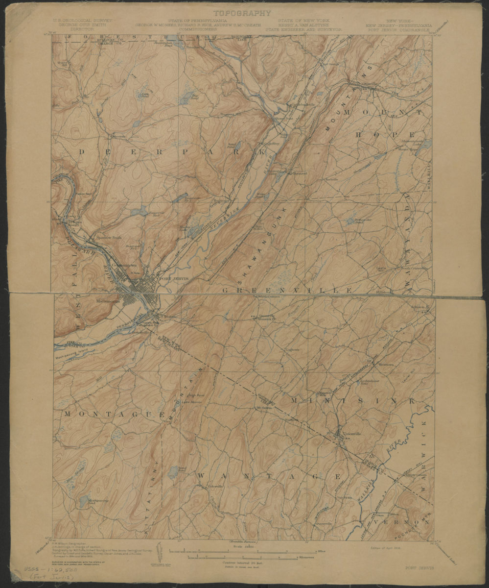
Port Jervis quadrangle, New York – New Jersey – Pennsylvania: U. S. Geological Survey
Port Jervis quadrangle, New York – New Jersey – Pennsylvania: U. S. Geological Survey
1908
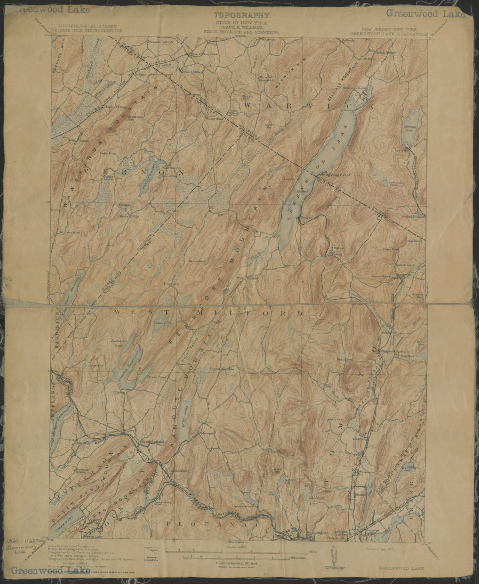
Greenwood Lake quadrangle, New York – New Jersey: U.S. Geological Survey
Greenwood Lake quadrangle, New York – New Jersey: U.S. Geological Survey
1910
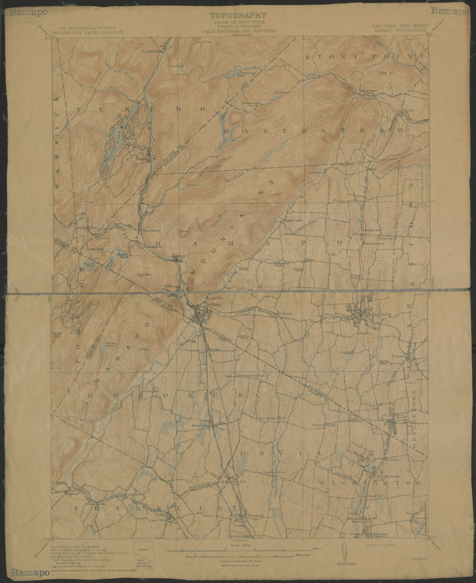
Ramapo Quadrangle, New York – New Jersey: U.S. Geological Survey
Ramapo Quadrangle, New York – New Jersey: U.S. Geological Survey
1910