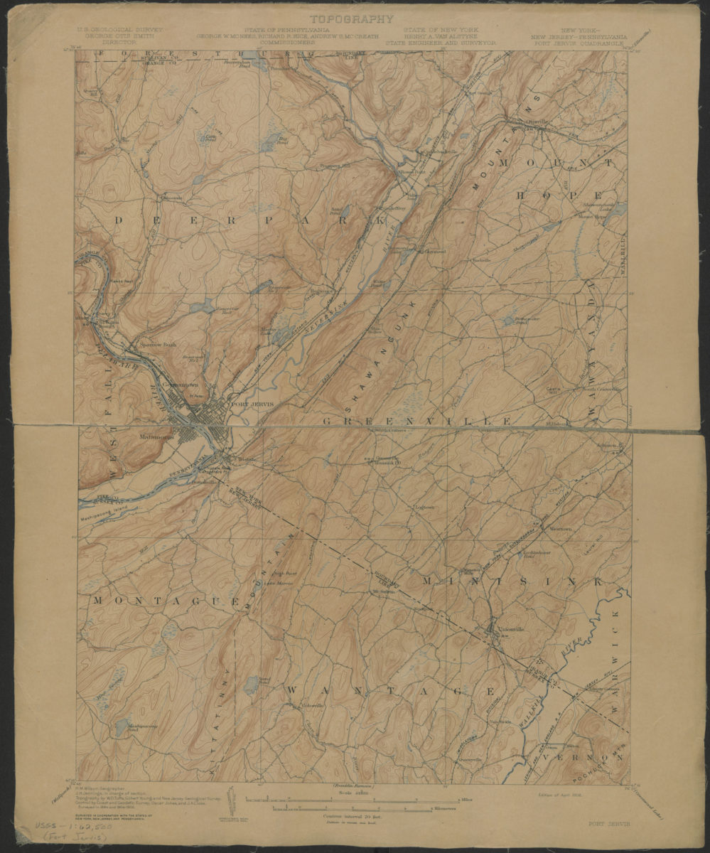
Port Jervis quadrangle, New York – New Jersey – Pennsylvania: U. S. Geological Survey 1908
Map No. USGS-1:62,500 (Port Jervis).Fl
Shows portions of Orange County in New York, Sussex County in New Jersey, and Pike County in Pennsylvania. “Surveyed in 1884 and 1904-1906.” Relief shown by contours and spot heights. “H.M. Wilson, Geographer. H.H. Jennings, in charge of section. Topography by W.O. Tufts, Gilbert Young and New Jersey Geological Survey. Control by Coast and Geodetic Survey, Oscar Jones and J.A. Close. “Surveyed in cooperation with the states of New York, New Jersey, and Pennsylvania.” “Edition of April 1908.” Text and legend on verso.
Map area shown
Genre
Topographic mapsRelation
Full catalog recordSize
51 × 42 cmDownload
Low Resolution Image
Creator
Geological Survey (U.S.),Publisher
Brooklyn Historical SocietyCitation
Port Jervis quadrangle, New York – New Jersey – Pennsylvania: U. S. Geological Survey; 1908, Map Collection, USGS-1:62,500 (Port Jervis).Fl; Brooklyn Historical Society.Scale
Scale 1:62,500Loading zoom image...