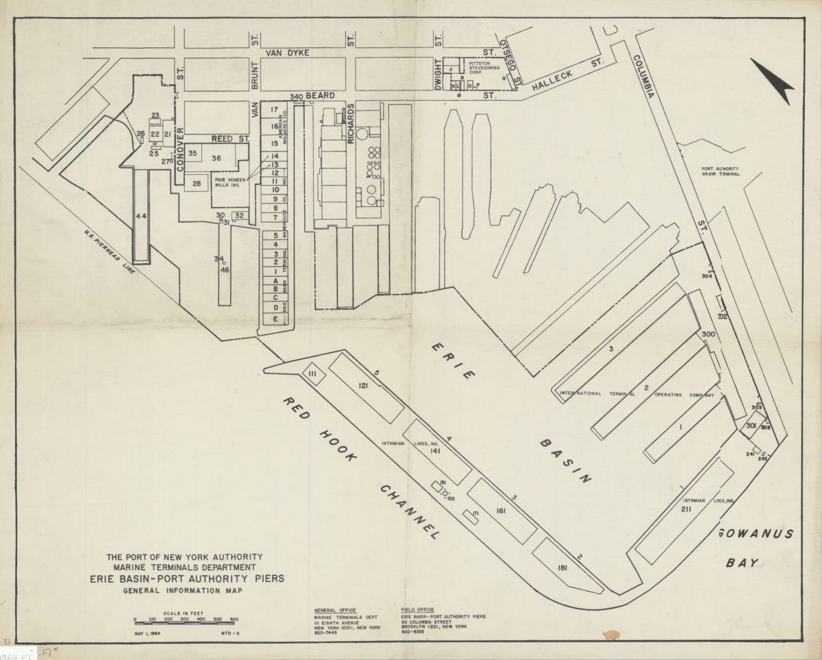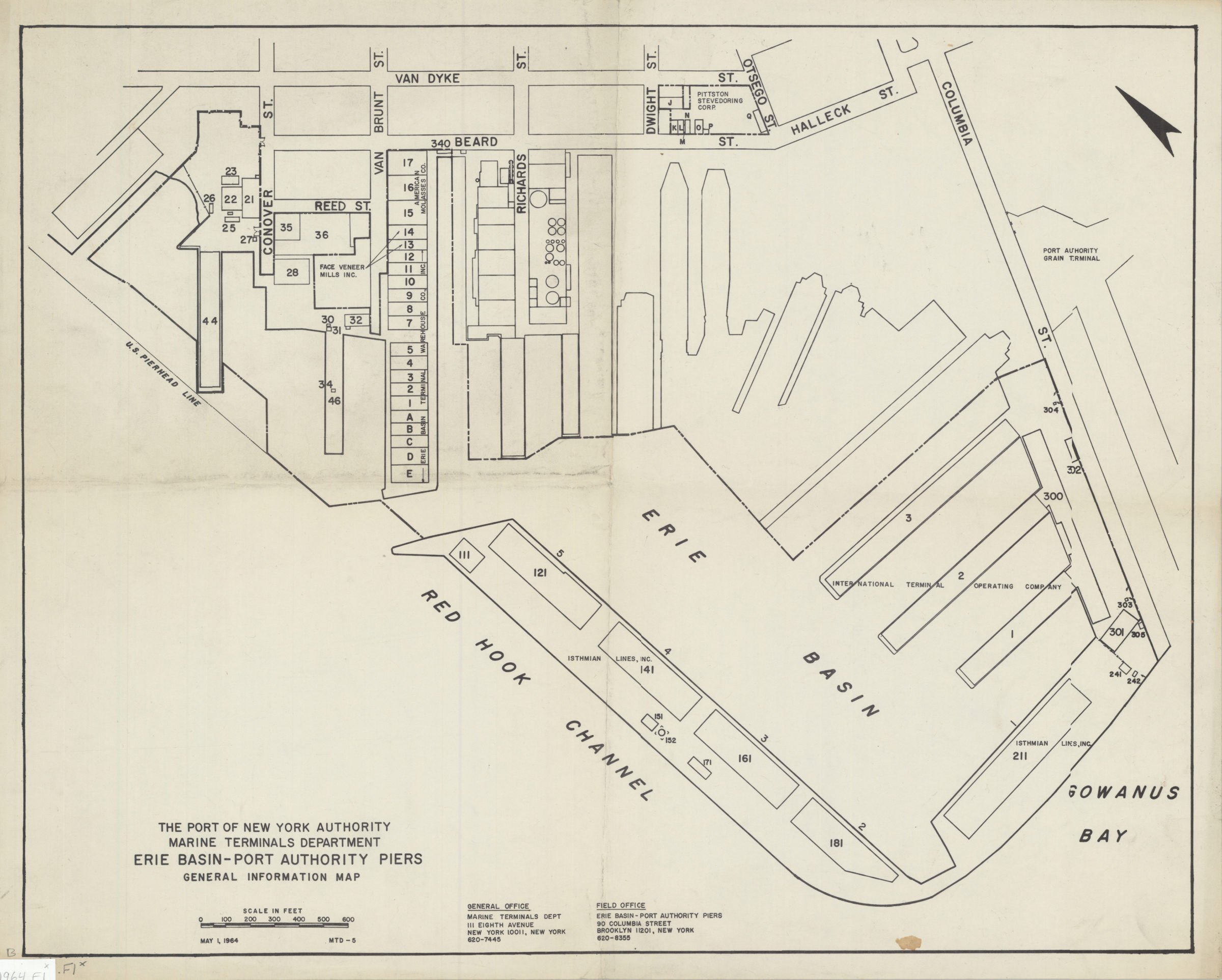
Erie Basin-Port Authority piers: general information map 1964
Map No. B A-1964.Fl
Covers the Erie Basin and the area bounded by Van Dyke Street and Columbia Street. Shows buildings and some tenants. May 1, 1964. “MTD-5.”
Subjects
Places
Map area shown
Genre
MapRelation
Full catalog recordSize
41 × 51 cmDownload
Low Resolution Image
Creator
Port of New York Authority; Marine Terminals Department,Publisher
Brooklyn Historical SocietyCitation
Erie Basin-Port Authority piers: general information map; 1964, Map Collection, B A-1964.Fl; Brooklyn Historical Society.Scale
Scale approximately 1: 3,Loading zoom image...