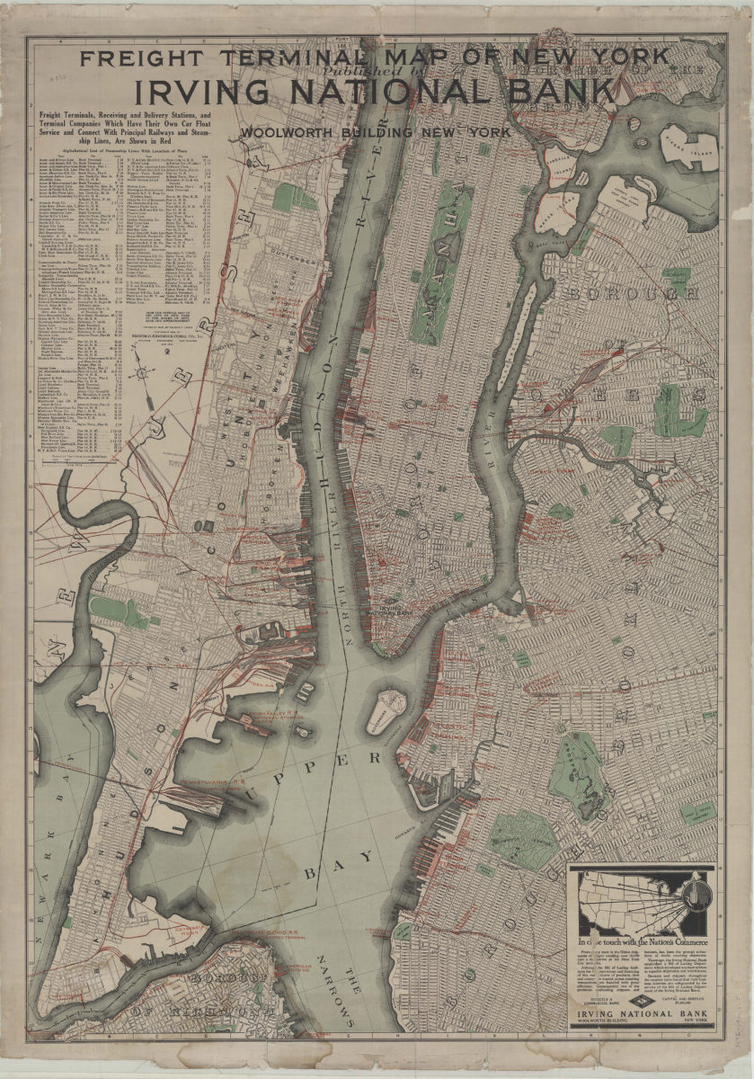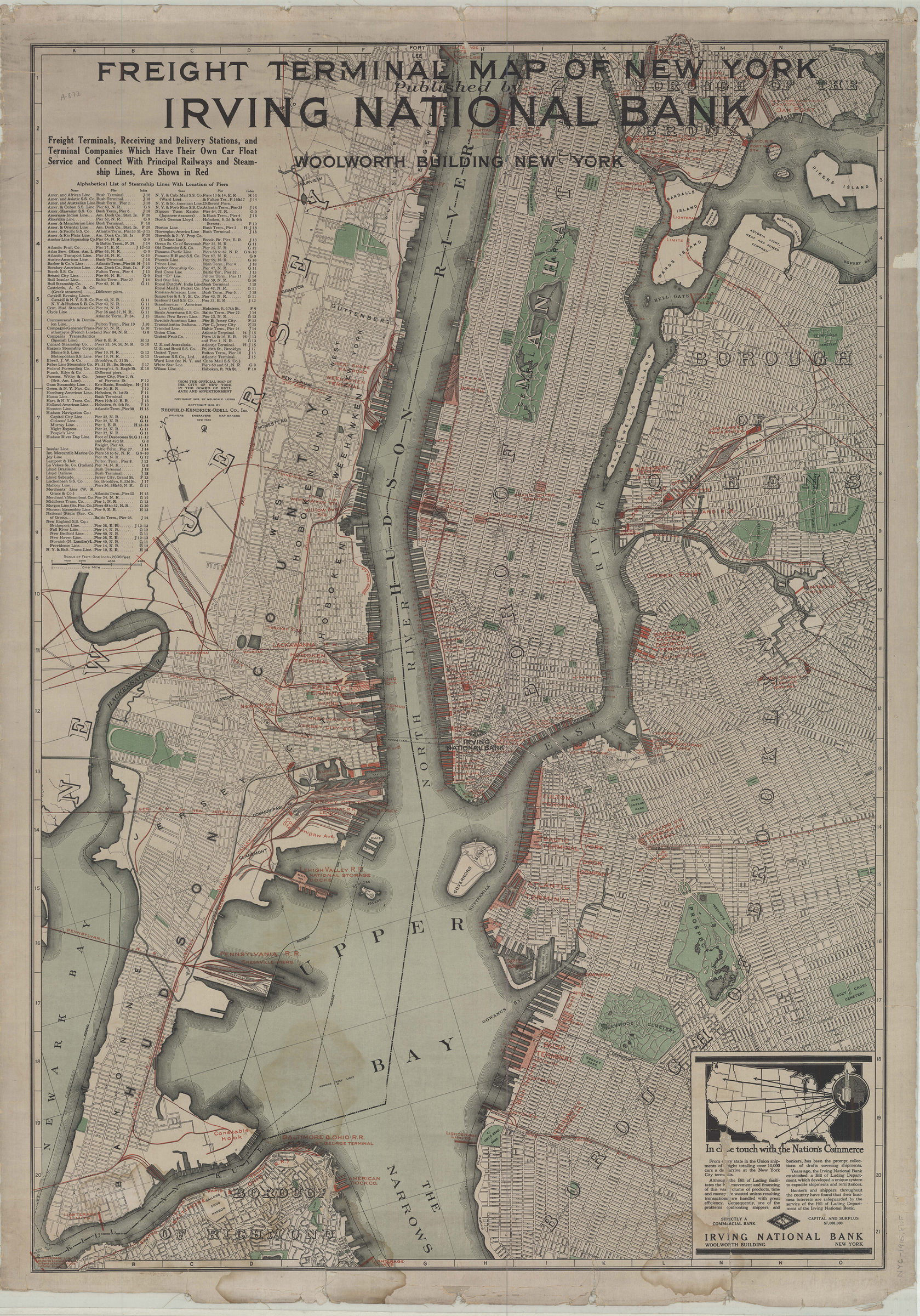
Freight terminal map of New York: published by Irving National Bank 1916
Map No. NYC-1916.Fl.Folio
Covers the Upper Bay and the Narrows portions of New York Harbor. Shows railroads lines, shipping terminals and piers on northern Staten Island, Hudson County in New Jersey, Manhattan, the South Bronx, Queens, and Brooklyn. “Freight terminals, receiving and delivery stations, and terminal companies which have their own car float service and connect with principal railways and steamship lines, are shown in red.” Includes alphabetized list of steamship lines with location of piers. “Copyright 1915 by Nelson P. Lewis copyright 1916 by Redfield-Kendrick-Odell Co., Inc.” “From the official map of the City of New York by the Board of Estimate and Apportionment.”
Subjects
Places
Map area shown
Genre
Transportation mapsRelation
Full catalog recordSize
104 × 74 cmDownload
Low Resolution Image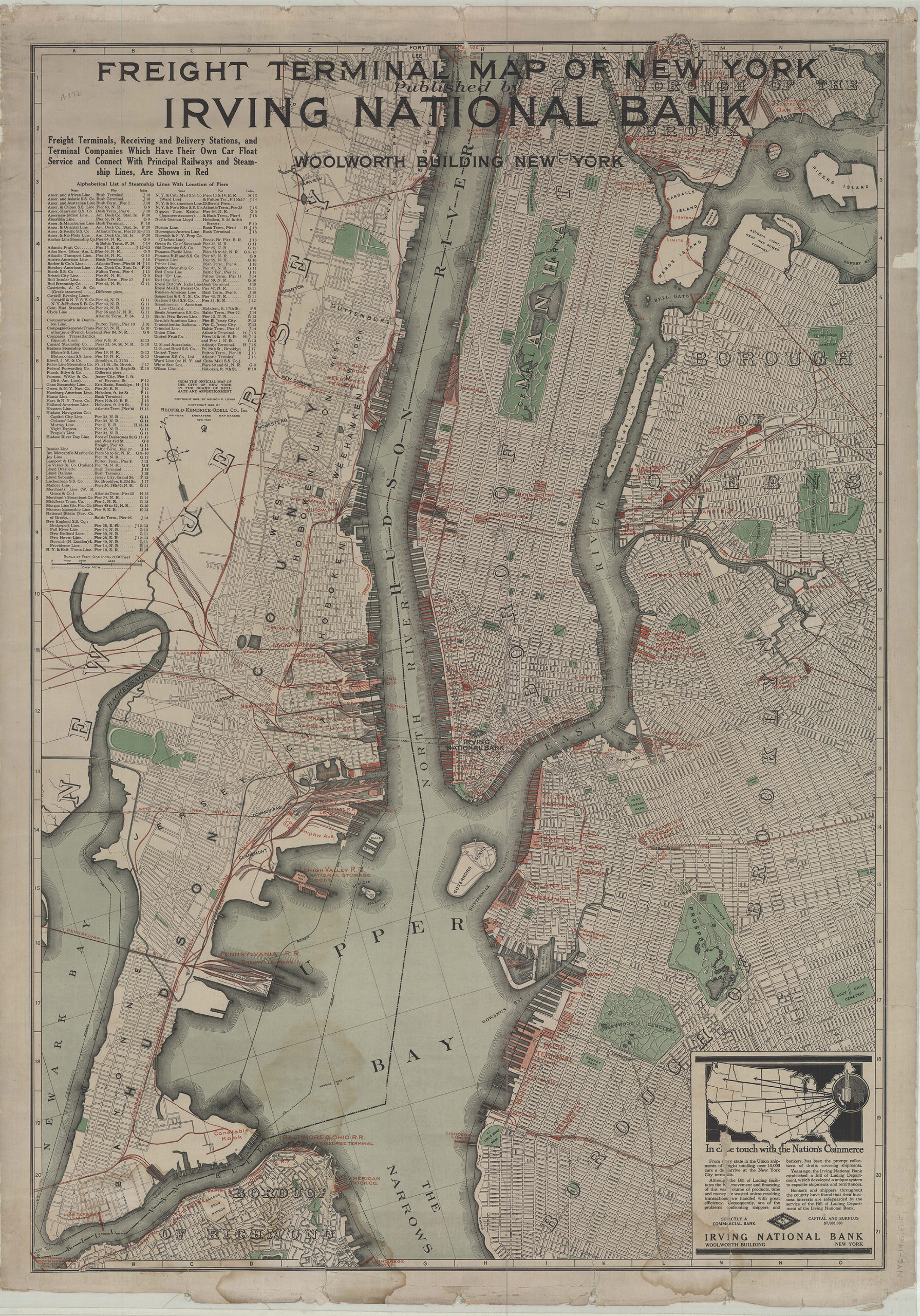
Creator
Redfield-Kendrick-Odell Co.,Publisher
Brooklyn Historical SocietyCitation
Freight terminal map of New York: published by Irving National Bank; 1916, Map Collection, NYC-1916.Fl.Folio; Brooklyn Historical Society.Scale
Scale [1:24,000] 1 in toLoading zoom image...