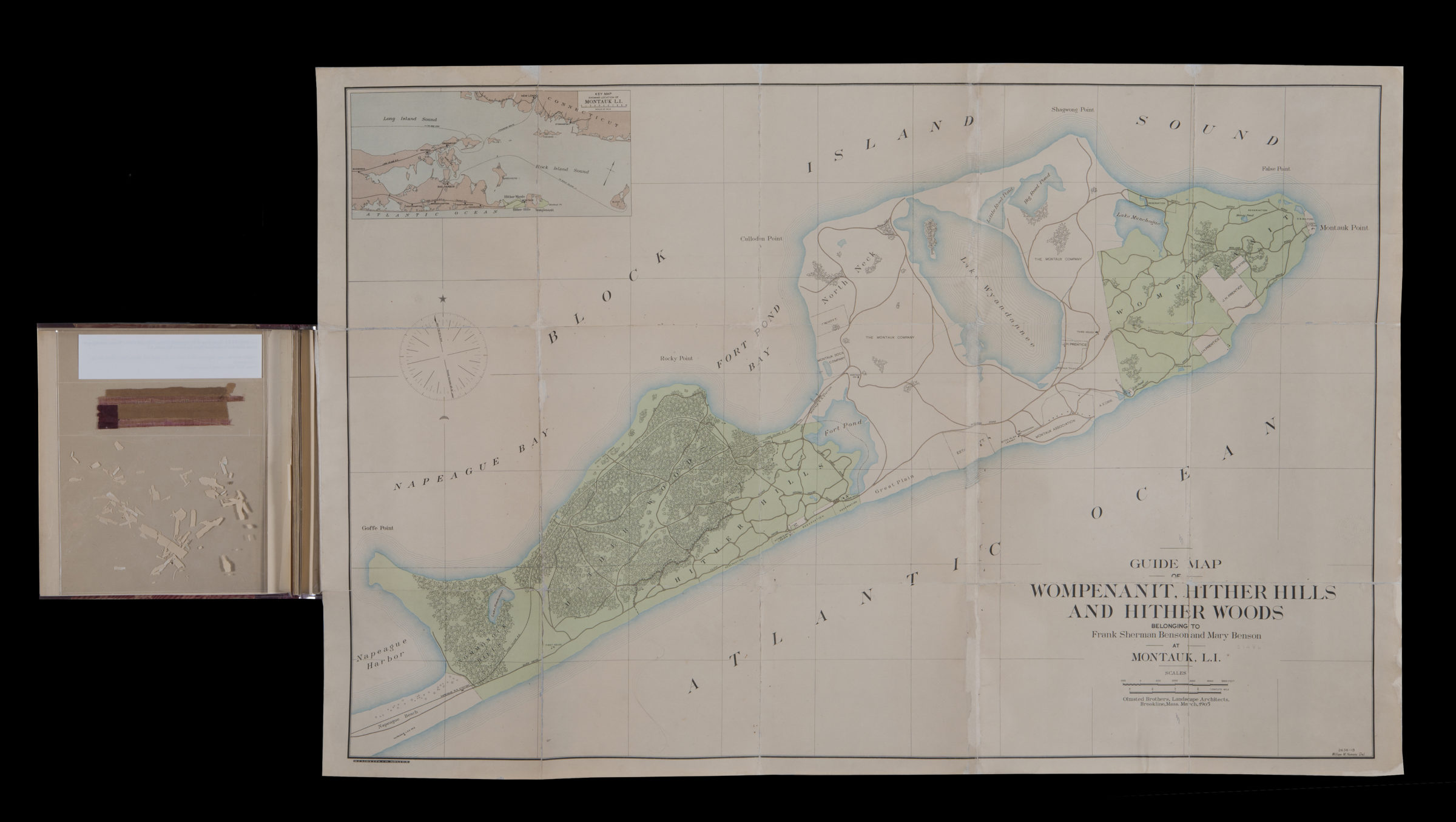
Guide map of Wompenanit, Hither Hills, and Hither Woods, belonging to Frank Sherman Benson and Mary Benson at Montauk, L.I.: Olmsted Brothers; William M. Humans, del 1905
Map No. L.I.1905.Fd.RA
Cadastral map covering Long Island east from Napeague Beach to Montauk Point. Shows names of landowners. Includes location map. “2636-13”–Lower right corner.
Map area shown
Genre
Cadastral mapsRelation
Full catalog recordSize
60 × 90 cmDownload
Low Resolution Image
Creator
Humans, William M.; Olmsted Brothers; Heliotype Printing Co.,Publisher
Brooklyn Historical SocietyCitation
Guide map of Wompenanit, Hither Hills, and Hither Woods, belonging to Frank Sherman Benson and Mary Benson at Montauk, L.I.: Olmsted Brothers; William M. Humans, del; 1905, Map Collection, L.I.1905.Fd.RA; Brooklyn Historical Society.Scale
Scale [ca. 1:20,000]Loading zoom image... 