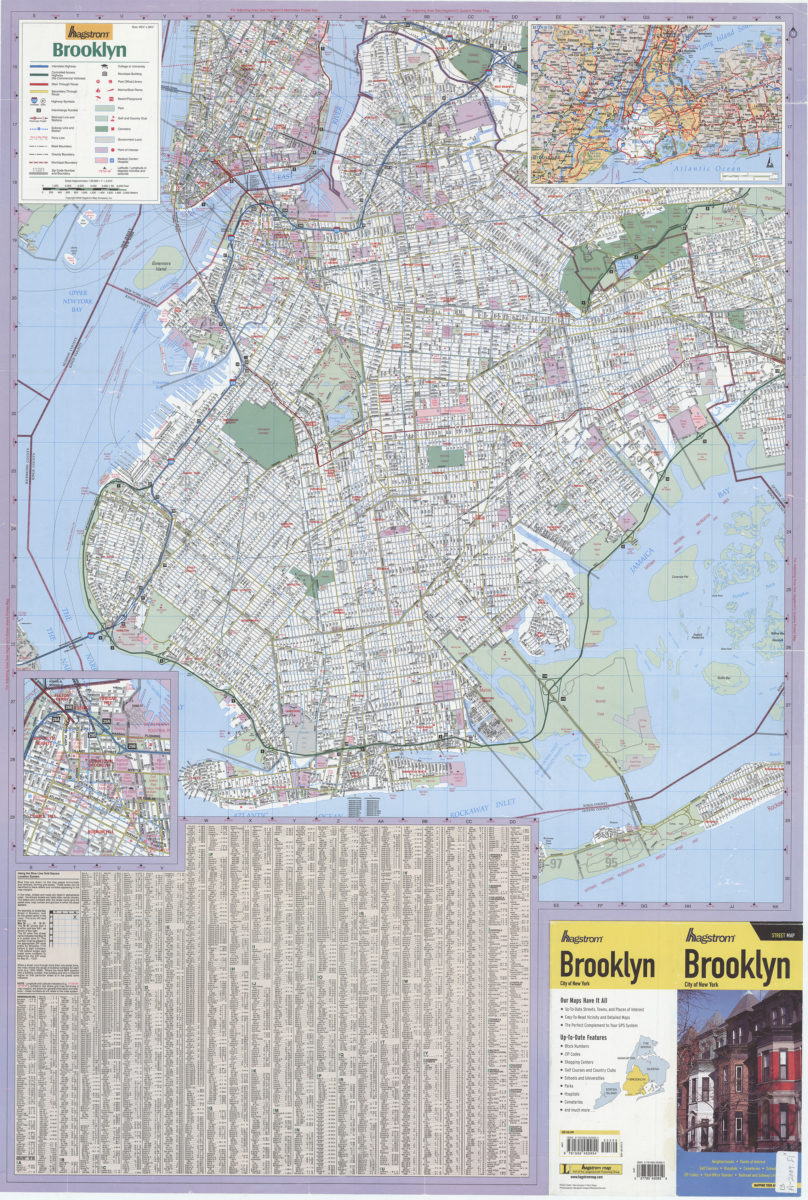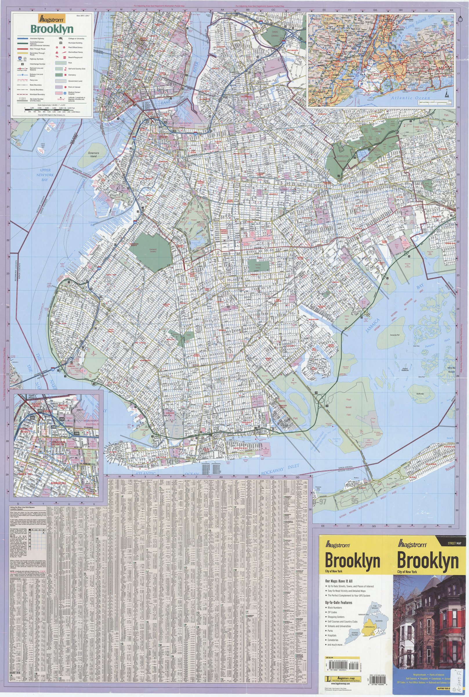
Hagstrom Brooklyn: Hagstrom Map [ca. 2009]
Map No. B A-2009.Fl
Shows Brooklyn and lower Manhattan. Includes notes, indexes, index-grid diagram, location map, color illustrations, publisher’s advertisement, and 2 insets: major roads around the Metropolitan New York area, and the Brooklyn central business district.
Map area shown
Genre
Road mapsRelation
Full catalog recordSize
98 × 65 cmDownload
Low Resolution Image
Creator
Hagstrom Map Company,Publisher
Brooklyn Historical SocietyCitation
Hagstrom Brooklyn: Hagstrom Map; [ca. 2009], Map Collection, B A-2009.Fl; Brooklyn Historical Society.Scale
Scale ca. 1:28,500. 1 inLoading zoom image...