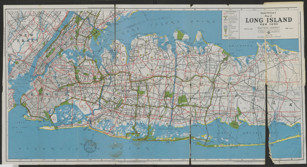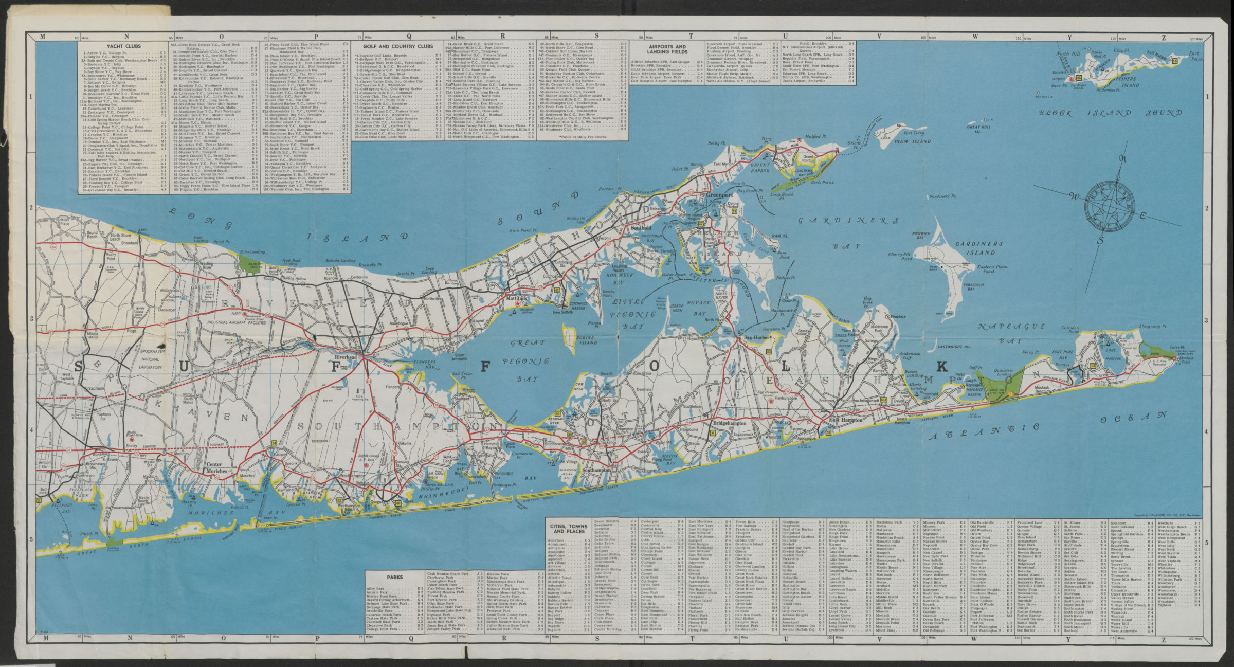
Hagstrom’s map of Long Island, New York [1962]
Map No. L.I.-[1962].Fl
Road map also covers Brooklyn, Queens, Manhattan, the Bronx, portions of Staten Island and northern New Jersey. Shows railroad lines and stations, ferries, parks, golf and country clubs, yacht clubs, airports, beaches, lighthouse and life saving stations. Includes indexes. “Map 2520A.” Date based on Hagstrom code: S-RA.
Map area shown
Genre
Road mapsRelation
Full catalog recordSize
43 × 79 cmDownload
Low Resolution Image
Creator
Hagstrom Company,Publisher
Brooklyn Historical SocietyCitation
Hagstrom’s map of Long Island, New York; [1962], Map Collection, L.I.-[1962].Fl; Brooklyn Historical Society.Scale
Scale approximately 1:140Loading zoom image...