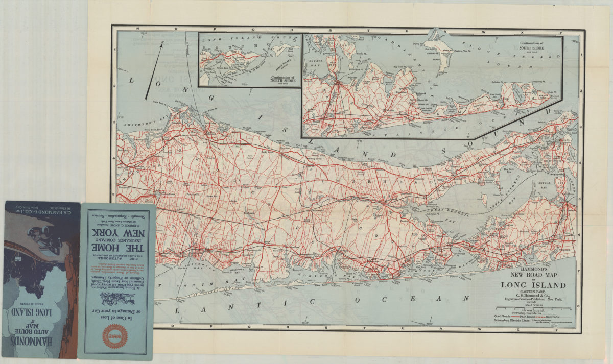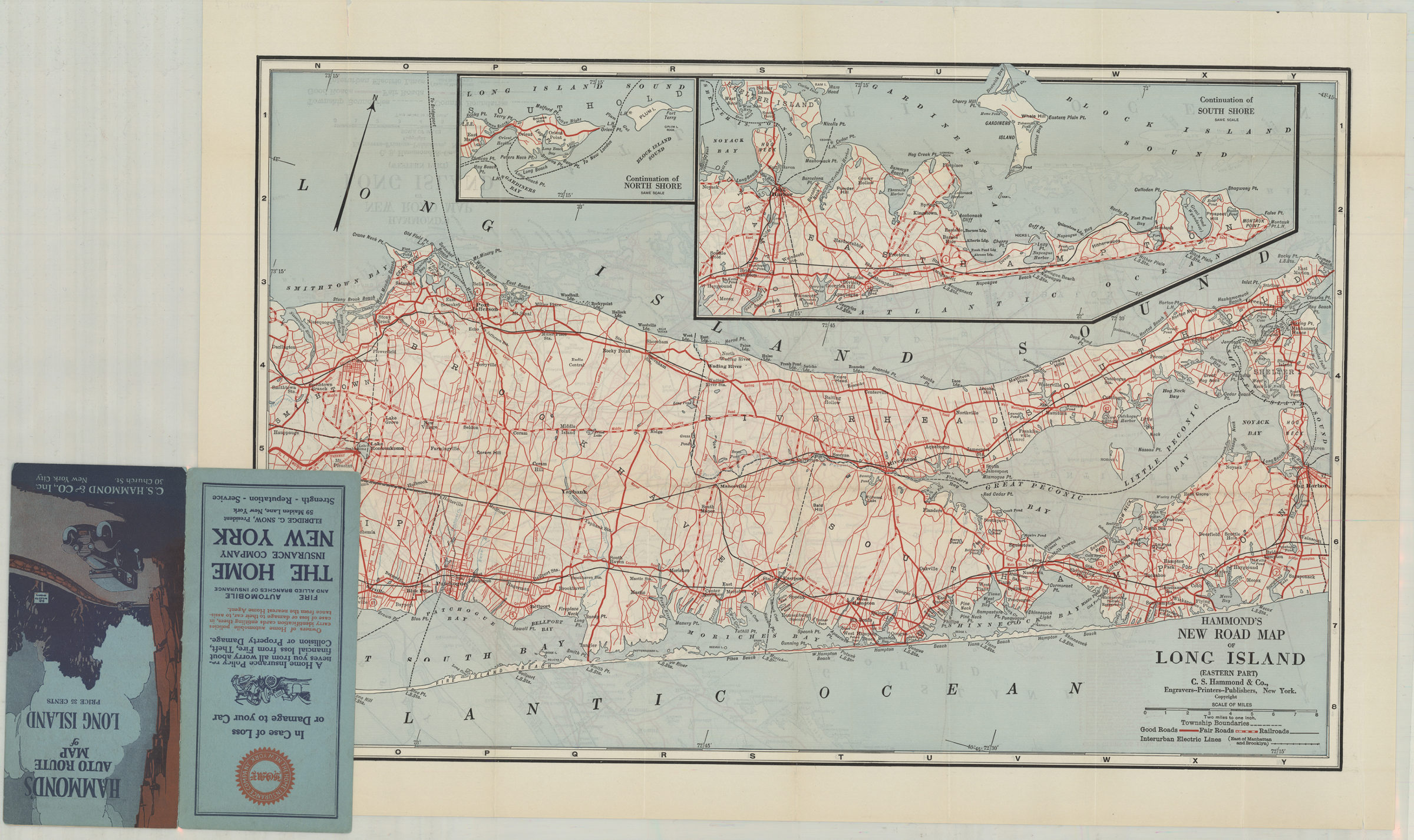
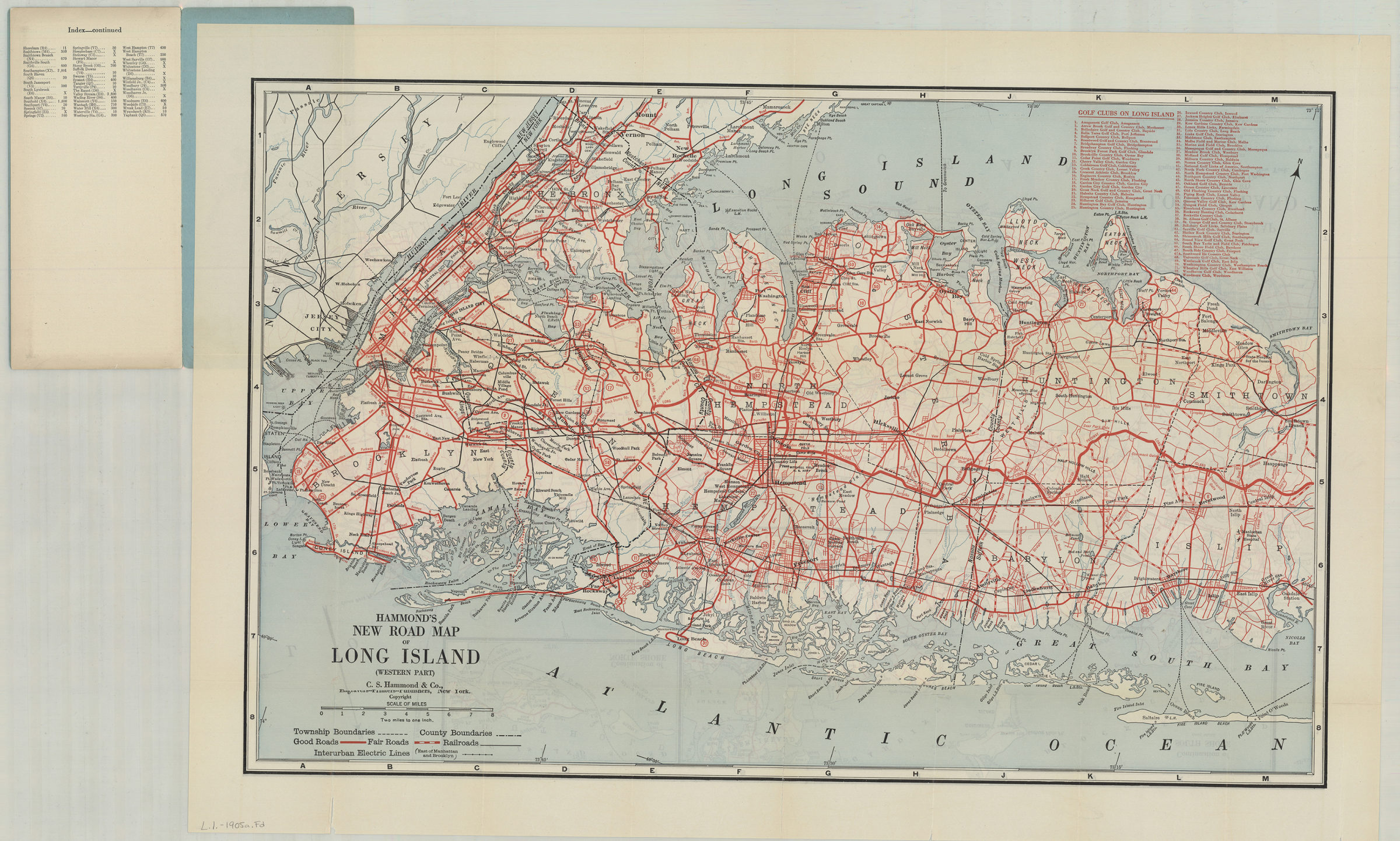
Hammond’s new road map of Long Island: C.S. Hammond & Co [19??]
Map No. L.I.-1905a.Fl
Shows roads, railroads, and interurban electric lines. Includes list of golf clubs on Long Island. Accompanying booklet includes index of cities and towns, mileage tables, and 3 ancillary maps of major auto routes: Manhattan, the Bronx and Eastern exits, Long Island, and Suburban Long Island.
Map area shown
Relation
Full catalog recordSize
40 × 125 cmDownload
Low Resolution Image
Creator
C.S. Hammond & Company,Publisher
Brooklyn Historical SocietyCitation
Hammond’s new road map of Long Island: C.S. Hammond & Co; [19??], Map Collection, L.I.-1905a.Fl; Brooklyn Historical Society.Scale
Scale 1:145,000Loading zoom image...