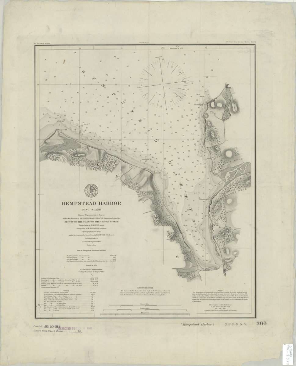
Hempstead Harbor, Long Island: from a trigonometrical survey under the direction of F.R. Hassler and A.D. Bache, superintendents of the Survey of the Coast of the United States [1888]
Map No. U.S.C.S.-366(1879).Fl
Nautical chart showing seafloor terrain. Relief shown by hachures. Depths shown by bathymetric tints and soundings (in feet and fathoms). “C.P. Patterson Superintendent.” “J.E. Hilgard Assistant in charge of office.” Date of publication conjectured from stamp on BHS copy. BHS copy stamped: Printed Aug 20 1888. Corrected to Sep 2 1889. “Aids to Navigation corrected to 1888.” “Electrotype Copy No. 1 by G. Mathiot U.S.C.S.”–Upper right margin. Includes notes, key, seal, and tidal information. “No. 366”–Upper left margin.
Map area shown
Genre
Nautical chartsRelation
Full catalog recordSize
45 × 36 cmDownload
Low Resolution Image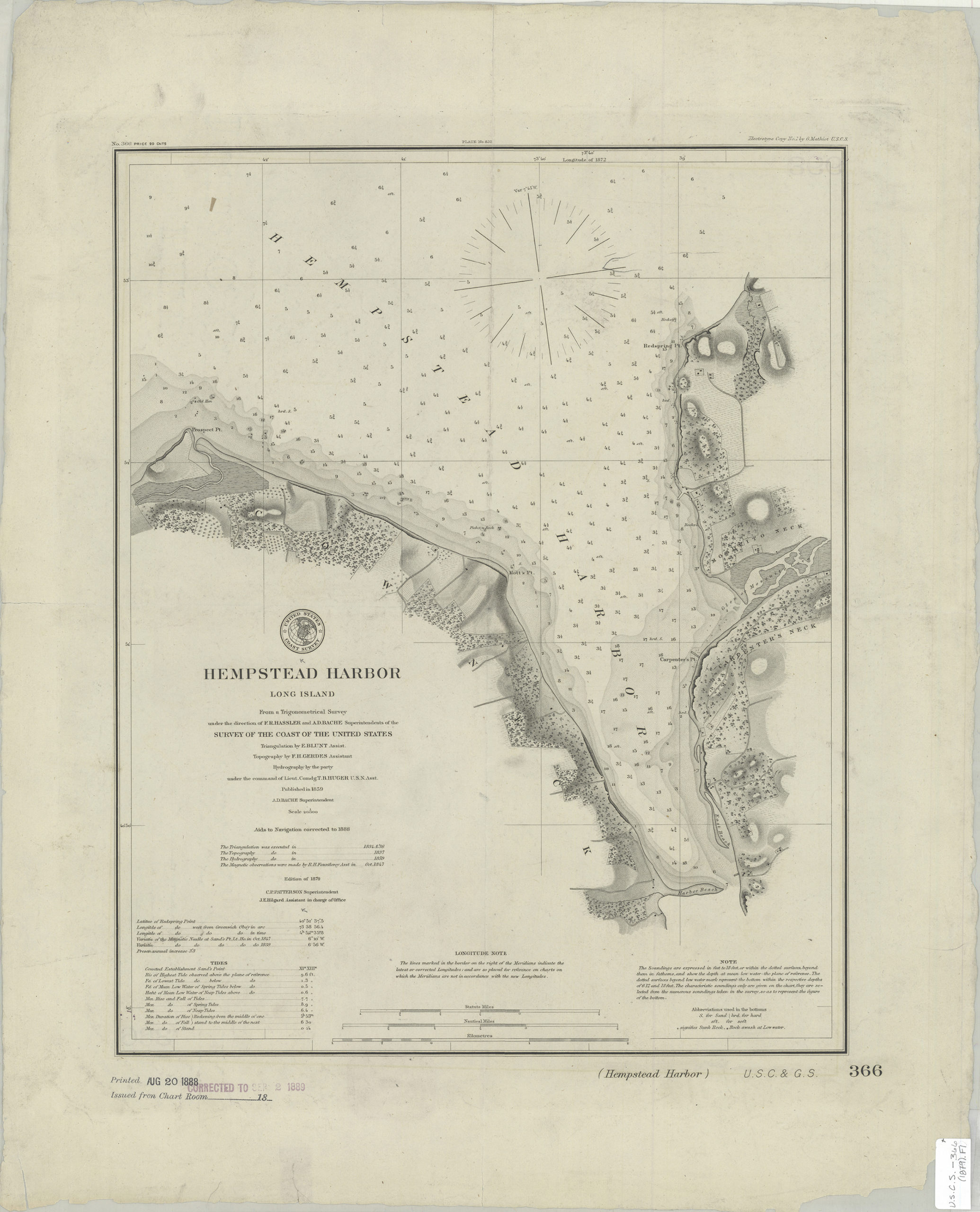
Creator
U.S. Coast and Geodetic Survey,Publisher
Brooklyn Historical SocietyCitation
Hempstead Harbor, Long Island: from a trigonometrical survey under the direction of F.R. Hassler and A.D. Bache, superintendents of the Survey of the Coast of the United States; [1888], Map Collection, U.S.C.S.-366(1879).Fl; Brooklyn Historical Society.Scale
Scale 1:20,000Loading zoom image...