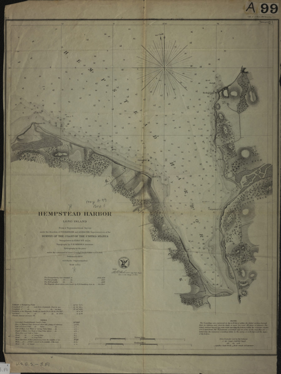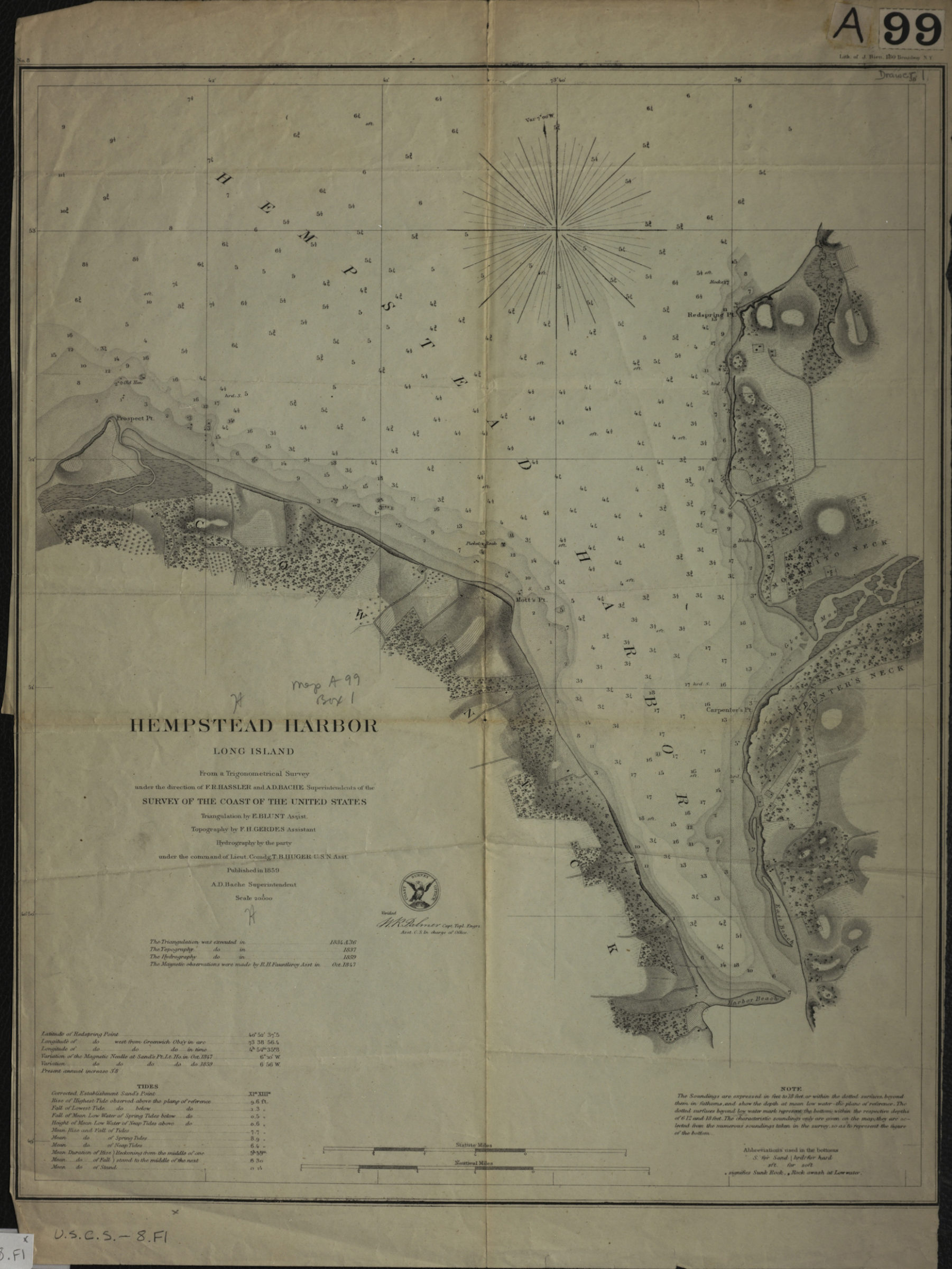
Hempstead Harbor, Long Island: from a trigonometrical survey under the direction of F.R. Hassler and A.D. Bache, superintendents of the Survey of the Coast of the United States 1859
Map No. U.S.C.S.-8.Fl
Nautical chart showing seafloor terrain. Relief shown by hachures. Depths shown by bathymetric tints and soundings (in feet and fathoms). “Triangulation by E. Blunt Assist.” “Topography by F.H. Gerdes Assistant.” “Hydrography by the party under the command of Lieut. Comdg. T.B. Huger U.S.N. Asst.” “A.D. Bache Superintendent.” “Verified [by] W.R. Palmer Capt. Topl. Engrs. Asst. C.S. in charge of office.” Includes notes, key, seal, and tidal information. “No. 8”–Upper left margin.
Map area shown
Genre
Nautical chartsRelation
Full catalog recordSize
44 × 36 cmDownload
Low Resolution Image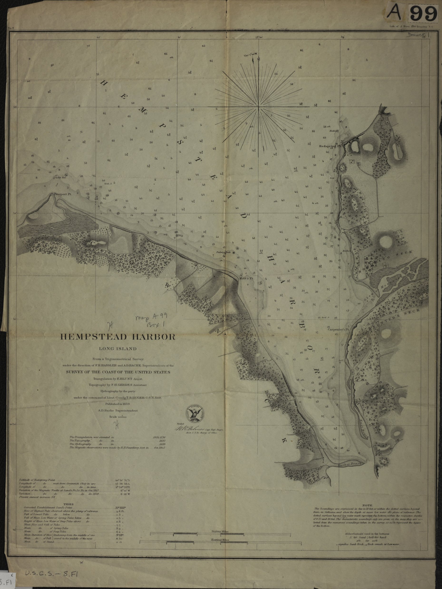
Creator
United States Coast Survey,Publisher
Brooklyn Historical SocietyCitation
Hempstead Harbor, Long Island: from a trigonometrical survey under the direction of F.R. Hassler and A.D. Bache, superintendents of the Survey of the Coast of the United States; 1859, Map Collection, U.S.C.S.-8.Fl; Brooklyn Historical Society.Scale
Scale 1:20,000Loading zoom image...