
Higginson’s map of New York and vicinity: embracing the counties of Kings & Richmond, N.Y., Hudson, N.J. and parts of Queens, Westchester & Rockland, N.Y., Bergen, Passaic, Union, Essex & Middlesex, N.J. 1860
Map No. NYC-1860.Fd.Folio
Cadastral map. Also shows administrative divisions, railroads, names of landowners, and ferry lines. Relief shown by hachures. Depths shown by soundings. “Engraved by W. Hatfield …” “Printed by D. & J. McLellan …” “Entered according to Act of Congress in the Year 1859, by J.H. Higginson, in the Clerks Office of the Southern District of New York.” Includes decorative border.
Map area shown
Genre
Cadastral mapsRelation
Full catalog recordSize
107 × 98 cmDownload
Low Resolution Image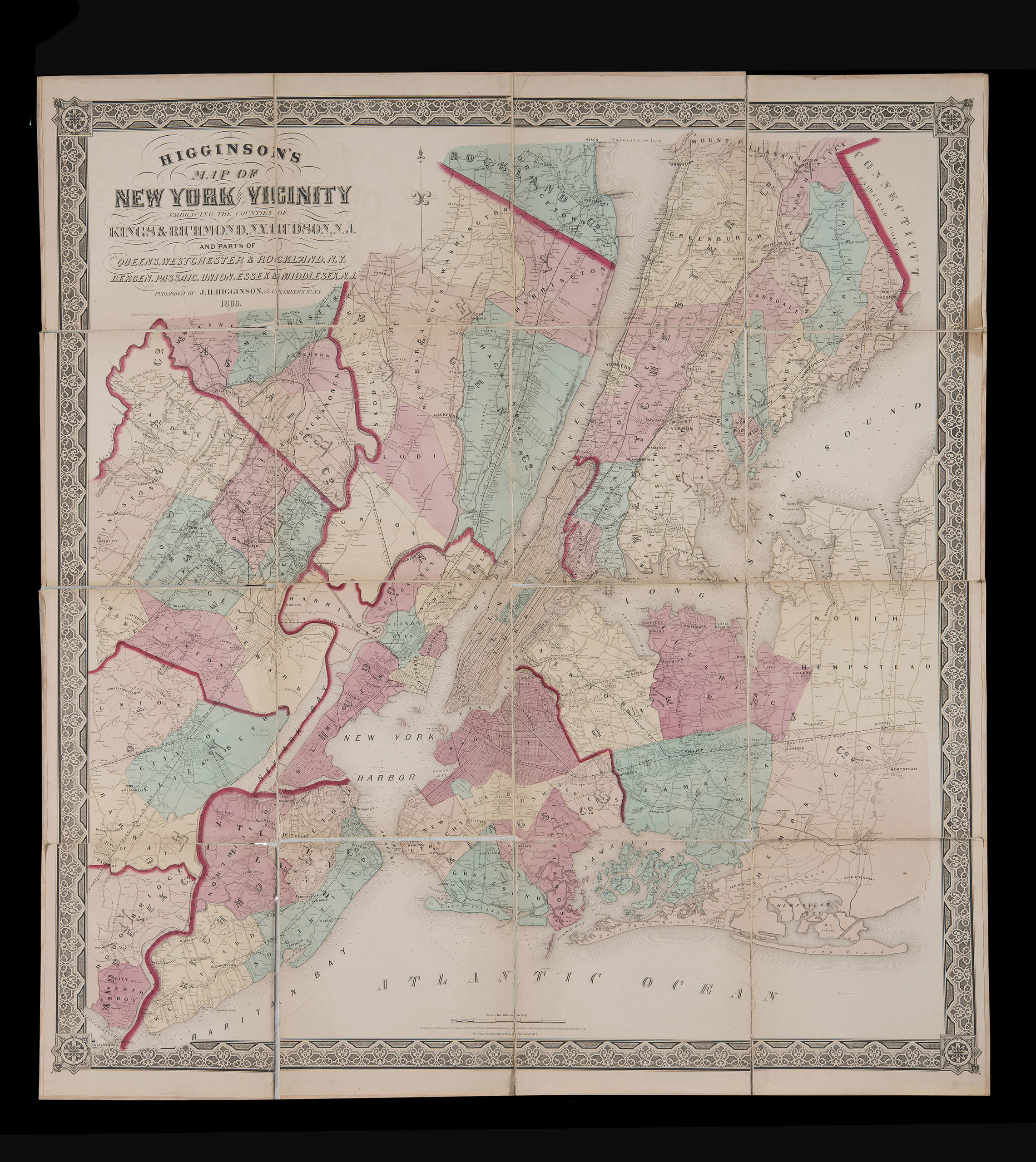
Creator
Higginson, J. H.,Publisher
Brooklyn Historical SocietyCitation
Higginson’s map of New York and vicinity: embracing the counties of Kings & Richmond, N.Y., Hudson, N.J. and parts of Queens, Westchester & Rockland, N.Y., Bergen, Passaic, Union, Essex & Middlesex, N.J.; 1860, Map Collection, NYC-1860.Fd.Folio; Brooklyn Historical Society.Scale
Scale [1:63,360] 1 in toLoading zoom image... 