
Historic Long Island: a map showing its towns & villages and the outstanding events during its development over a period of more than three hundred years: designed by Stephen J. Voorhies [ca. 1936]
Map No. L.I.-1600-1924 (1936).Fl;L.I.-1600-1924 (1936).Fl c.2
Also covers Manhattan and portions of Staten Island, New Jersey, the Bronx, and Connecticut. Relief shown pictorially and by hachures. Includes text, ill., decorative cartouche, and 2 insets. Ill. show historic events in Long Island from 1600-1700. Insets: Block’s map of Long Island — A detail map of the Dutch settlements on western Long Island, now the borough of Brooklyn. BHS has 2 copies.
Places
Map area shown
Genre
Historical mapsRelation
Full catalog recordSize
51 × 69 cmDownload
Low Resolution Image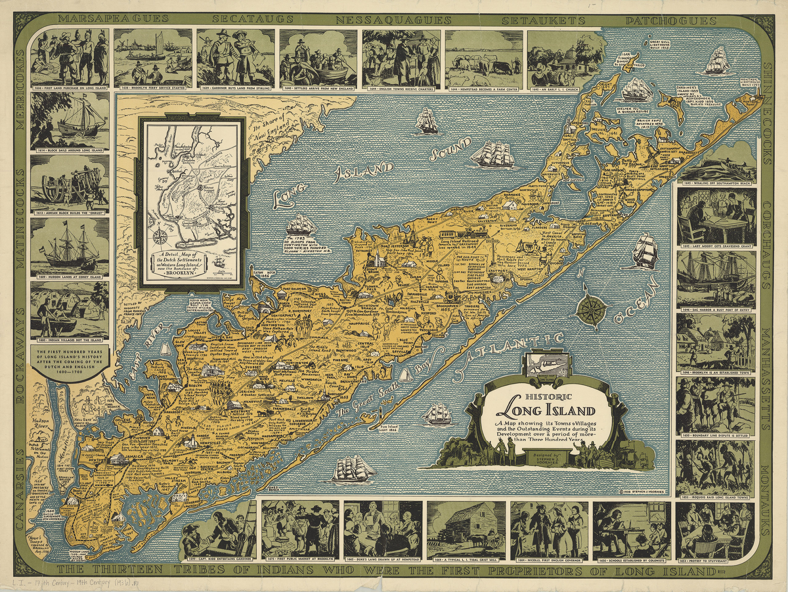
Creator
Voorhies, Stephen J.,Publisher
Brooklyn Historical SocietyCitation
Historic Long Island: a map showing its towns & villages and the outstanding events during its development over a period of more than three hundred years: designed by Stephen J. Voorhies; [ca. 1936], Map Collection, L.I.-1600-1924 (1936).Fl;L.I.-1600-1924 (1936).Fl c.2; Brooklyn Historical Society.Scale
Scale not givenLoading zoom image... 