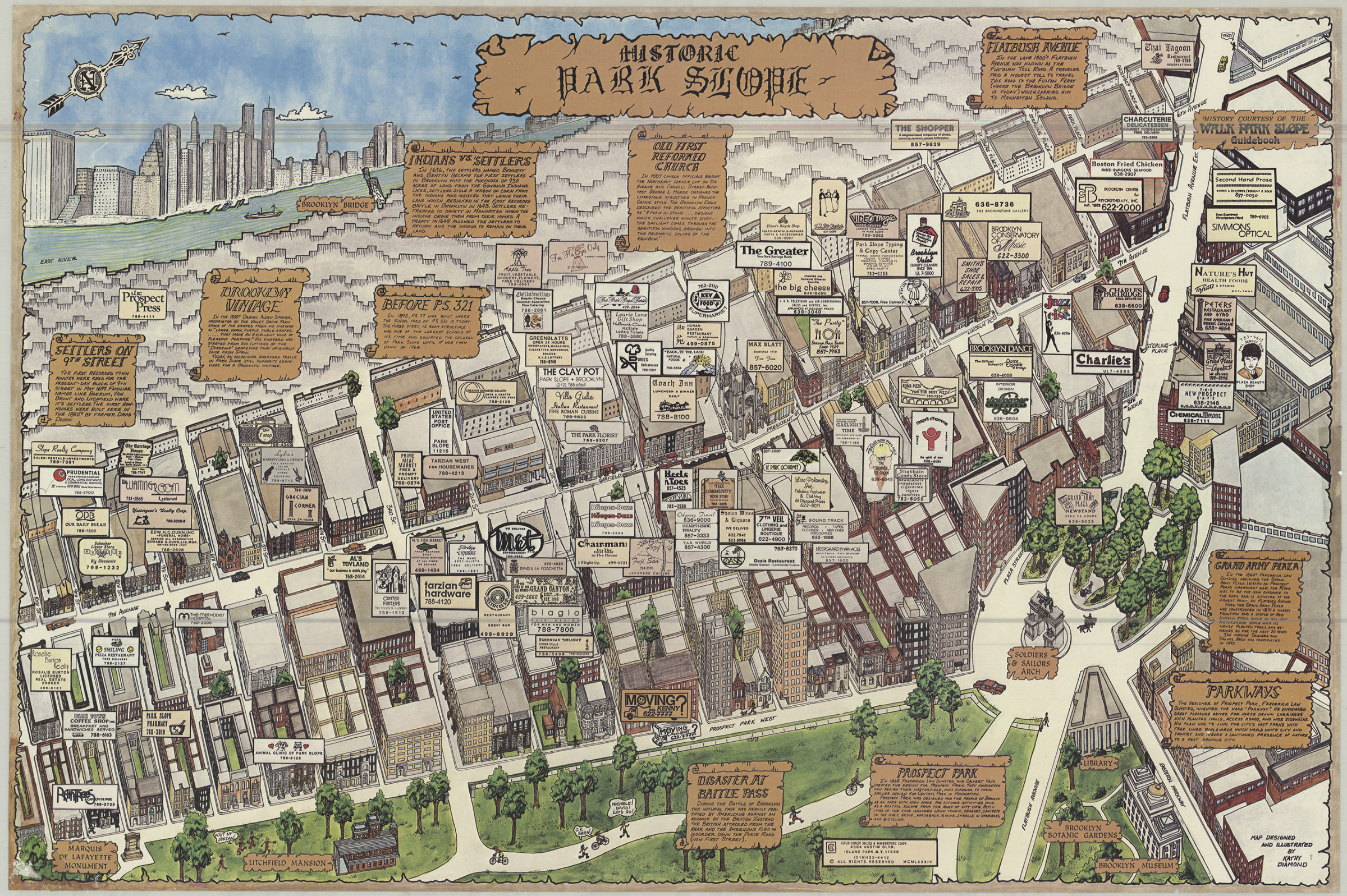
Historic Park Slope: map designed and ilustrated by Kathy Diamond [1984; 1984]
Map No. B A-1984.Fl.Folio
Covers Park Slope from 10th Street to Flatbush Avenue Extension and from 6th Avenue to Prospect Park West. Shows points of historical interest and advertiser business locations. Includes text panels on points of historical interest. Oriented with north to the upper right. Pictorial map.
Map area shown
Genre
Pictorial mapsRelation
Full catalog recordSize
61 × 92 cmDownload
Low Resolution Image
Creator
Diamond, Kathy,Publisher
Brooklyn Historical SocietyCitation
Historic Park Slope: map designed and ilustrated by Kathy Diamond; [1984; 1984], Map Collection, B A-1984.Fl.Folio; Brooklyn Historical Society.Scale
Scale not givenLoading zoom image... 