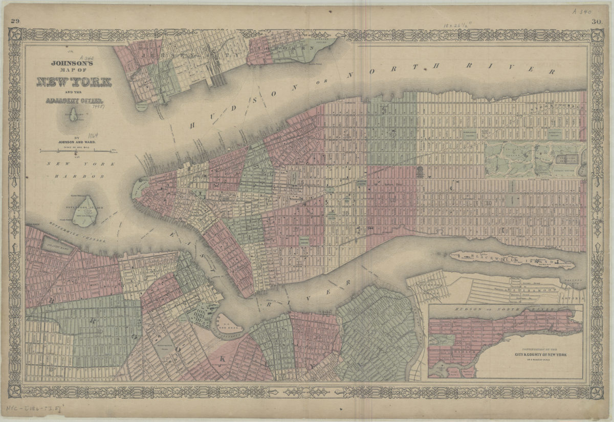
Johnson’s map of New York and the adjacent cities: by Johnson and Ward [186?]
Map No. NYC-[186-?].Fl
Shows streets and wards for Manhattan north to 87th St., and parts of Brooklyn, Jersey City, and Hoboken shows buildings on Blackwells Island. Extracted from an atlas by A.J. Johnson? Includes decorative border and inset. Inset: Continuation of the City & County of New York on a reduced scale. “Geographical index or ready reference” (unrelated to main map) on verso. “29”–Upper left margin of recto. “30”–Upper right margin of recto. “41”–Upper left margin of verso. “42”–Upper right margin of verso. BHS copy mounted on linen.
Map area shown
Genre
MapRelation
Full catalog recordSize
39 × 62 cmDownload
Low Resolution Image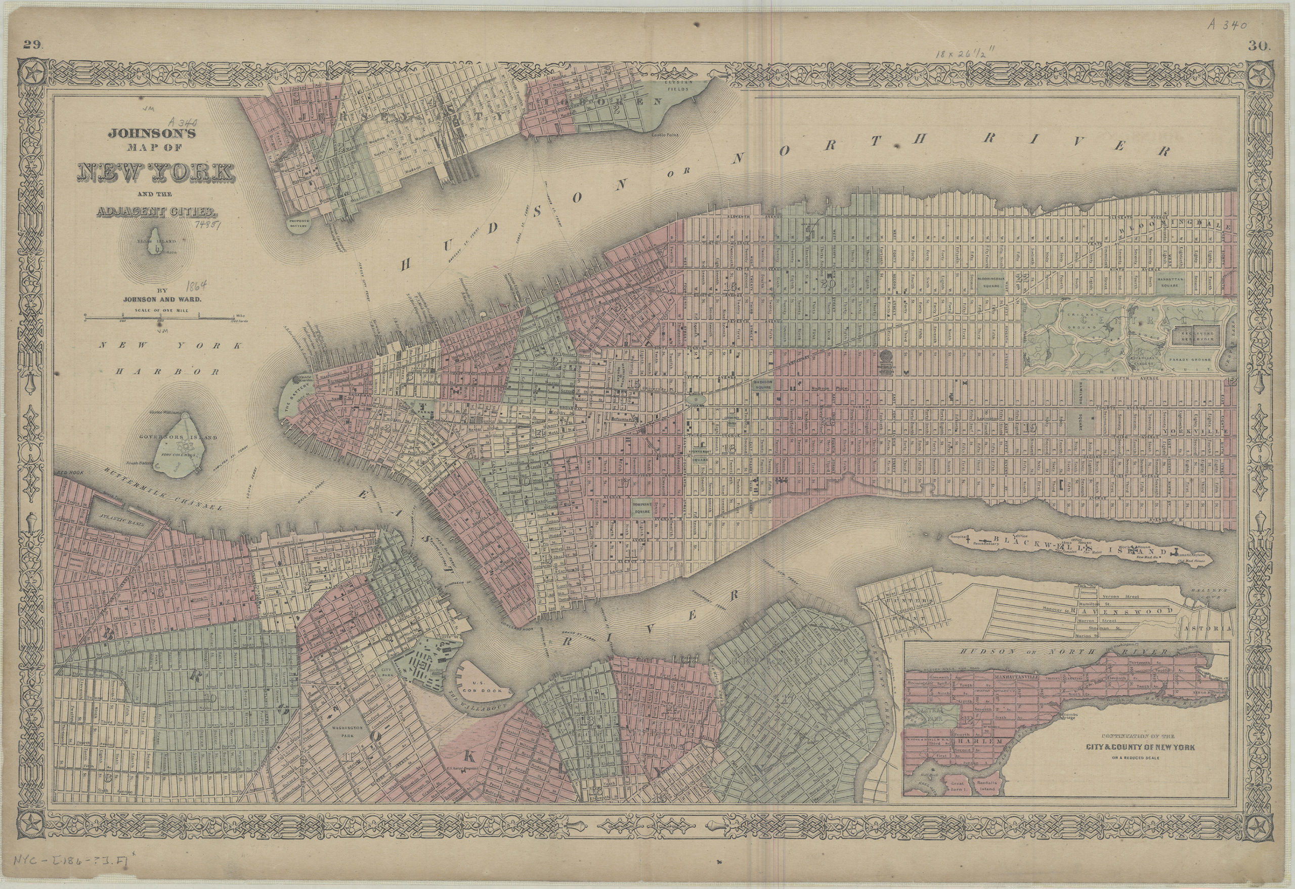
Creator
Johnson and Ward,Publisher
Brooklyn Historical SocietyCitation
Johnson’s map of New York and the adjacent cities: by Johnson and Ward; [186?], Map Collection, NYC-[186-?].Fl; Brooklyn Historical Society.Scale
Scale [ca. 1:20,500]Loading zoom image...