Long Island and Eastern States Line [1891]
Map No. L.I.-[1891].Fl
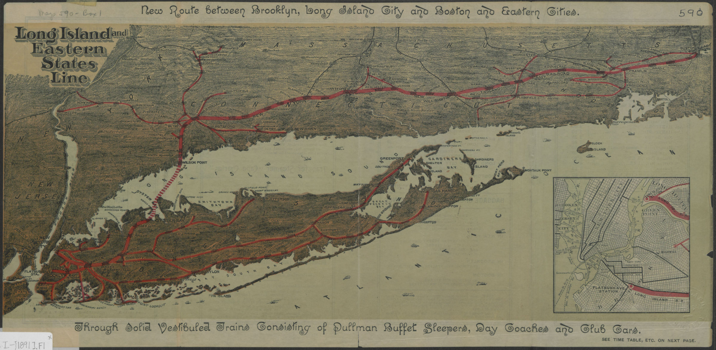
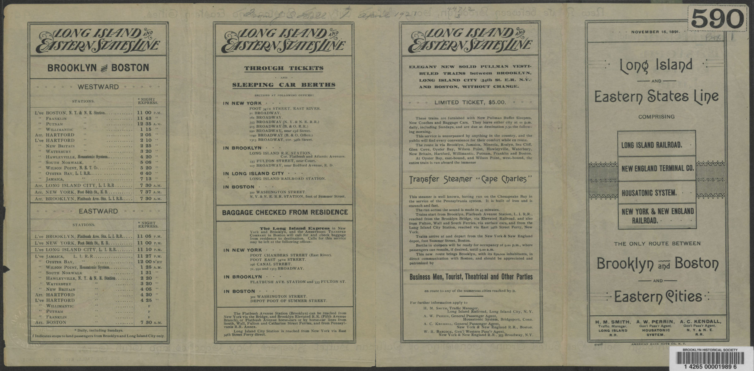
Covers the entirety of Long Island also covers Long Island Sound and portions of New York City, eastern New Jersey, and the southern coast of Connecticut. Shows the Long Island and Eastern States Line, which consisted of tracks of the Long Island Railroad, the Housatonic Railroad, and the New York and New England Railroad. “American Bank Note Co., N.Y.”–Panel. “November 15, 1891”–Panel. Includes text and inset of Lower Manhattan and eastern Brooklyn. On verso: Railroad timetables. “40408”–Panel.
Map area shown
Genre
Transportation mapsRelation
Full catalog recordSize
23 × 48 cmDownload
Low Resolution Image
Creator
American Bank Note Company,Publisher
Brooklyn Historical SocietyCitation
Long Island and Eastern States Line; [1891], Map Collection, L.I.-[1891].Fl; Brooklyn Historical Society.Scale
Scale not givenLoading zoom image... 