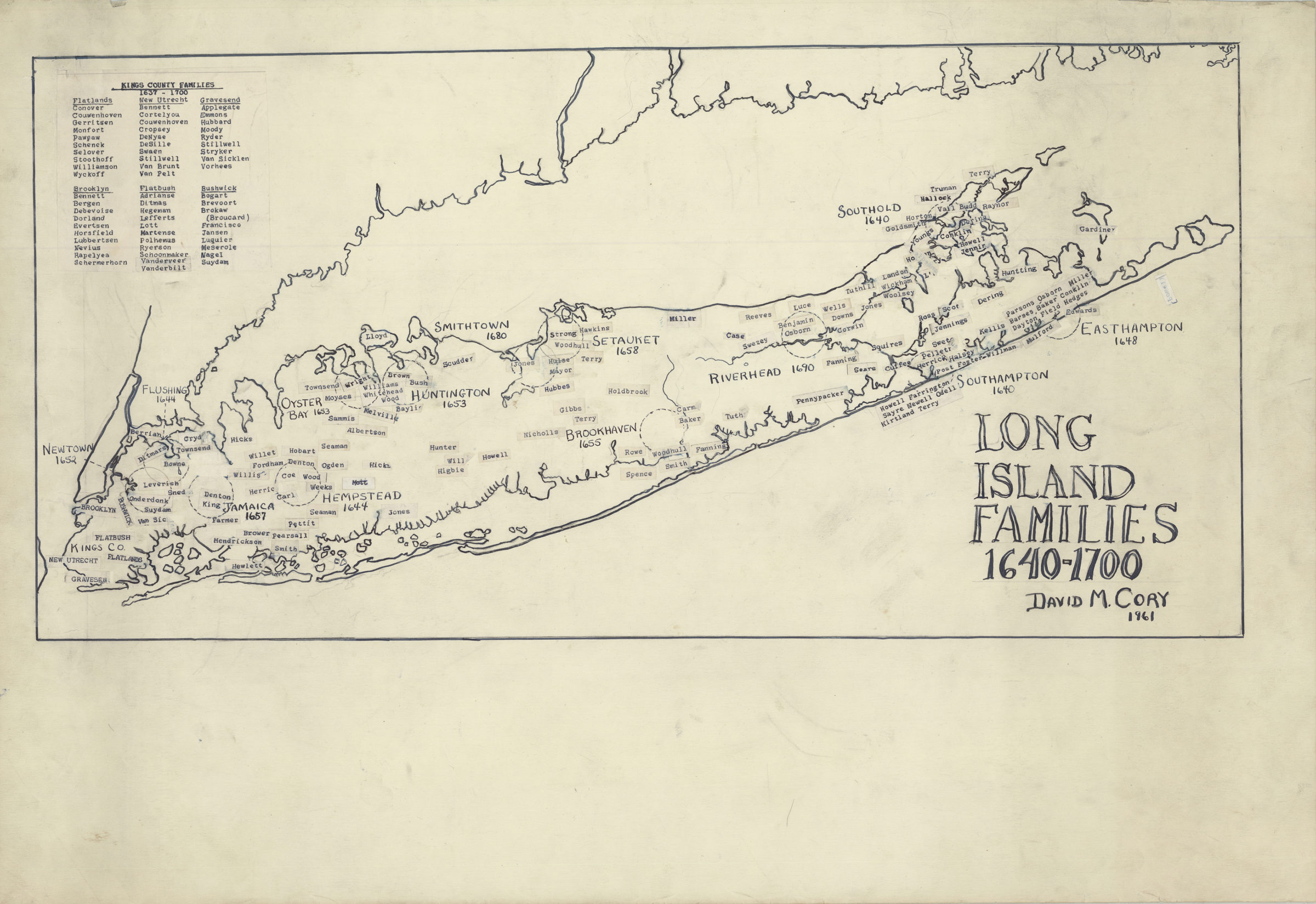
Long Island families, 1640-1700 1961
Map No. L.I.-1640-1700 (1961).Fl
Family names pasted-on map. Includes list of Kings County families from 1637-1700, divided by town. In BHS vertical file: Pasted-on names that fell off map.
Map area shown
Relation
Full catalog recordSize
34 × 70 cmDownload
Low Resolution Image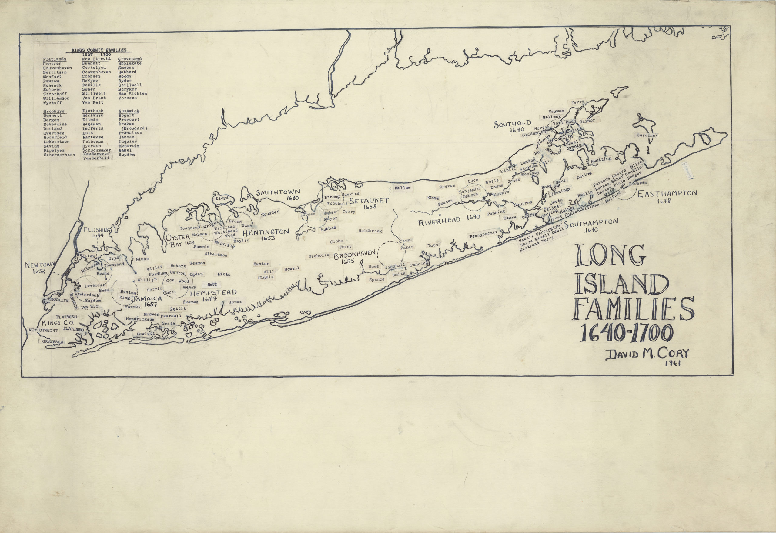
Creator
Cory, David M.,Publisher
Brooklyn Historical SocietyCitation
Long Island families, 1640-1700; 1961, Map Collection, L.I.-1640-1700 (1961).Fl; Brooklyn Historical Society.Scale
Scale not givenLoading zoom image... 