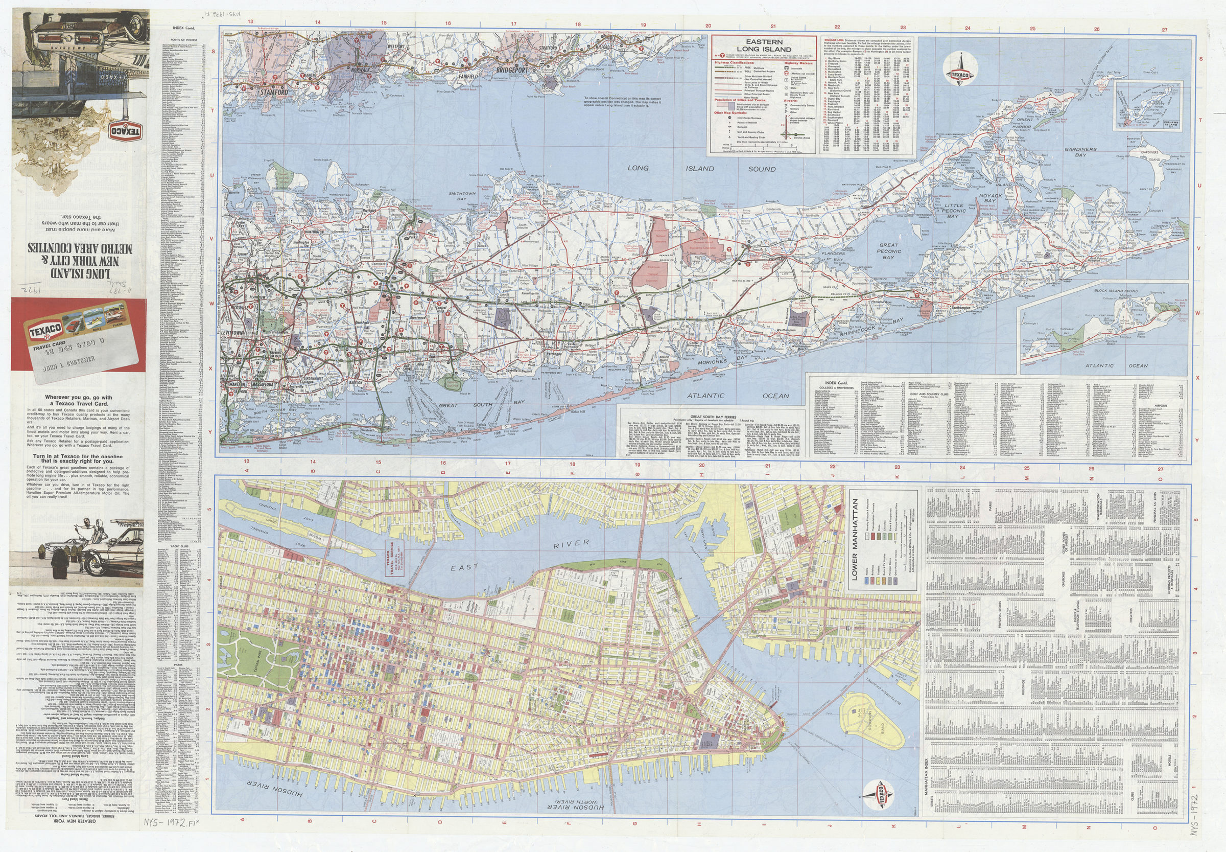
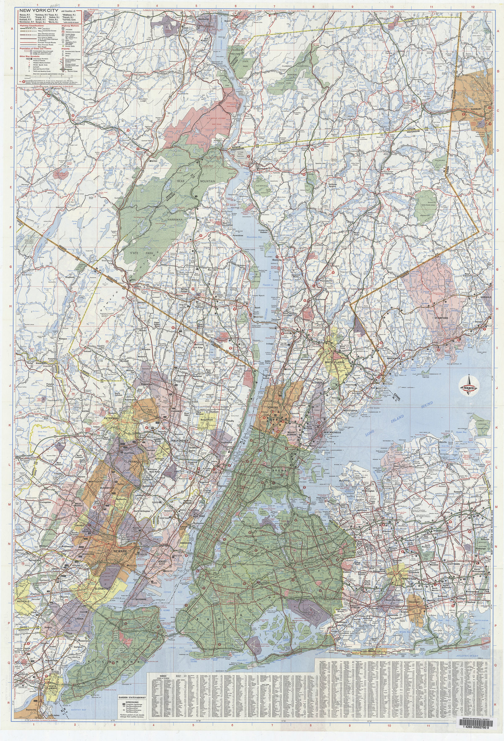
Long Island, New York City & metro area counties [1972]
Map No. NYS-1972.Fl
Panel title. Indexed. Includes text, indexes, advertisements, and two insets: Fishers Island N.Y. and the tip of the South Fork. Distributed by Texaco. “726905-3.” New York City. Eastern Long Island. Lower Manhattan.
Map area shown
Genre
Road mapsRelation
Full catalog recordSize
91 × 62 cmDownload
Low Resolution Image
Creator
Rand McNally and Company,Publisher
Brooklyn Historical SocietyCitation
Long Island, New York City & metro area counties; [1972], Map Collection, NYS-1972.Fl; Brooklyn Historical Society.Scale
Scales differLoading zoom image... 