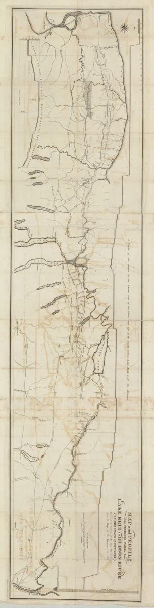
Map and profile of the proposed canal from Lake Erie to Hudson River in the State of New York: contracted by direction of the Canal Commissioners from the maps of the engineers in 1817 [1817]
Map No. NYS-[1817].Fl.O
Includes “A profile of the extent of the levels and of the places and lifts of the locks between Lake Erie and the Hudson” and “A profile of the southern route of the Genesee River.”
Map area shown
Genre
MapRelation
Full catalog recordSize
39 × 169 cmDownload
Low Resolution Image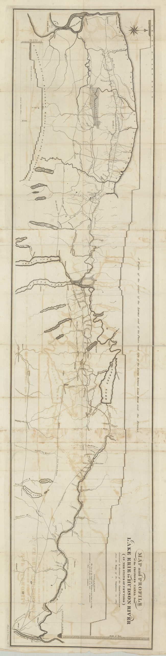
Creator
Valentine, Elias,Publisher
Brooklyn Historical SocietyCitation
Map and profile of the proposed canal from Lake Erie to Hudson River in the State of New York: contracted by direction of the Canal Commissioners from the maps of the engineers in 1817; [1817], Map Collection, NYS-[1817].Fl.O; Brooklyn Historical Society.Scale
Scale [1:253,440] 1 in toLoading zoom image...