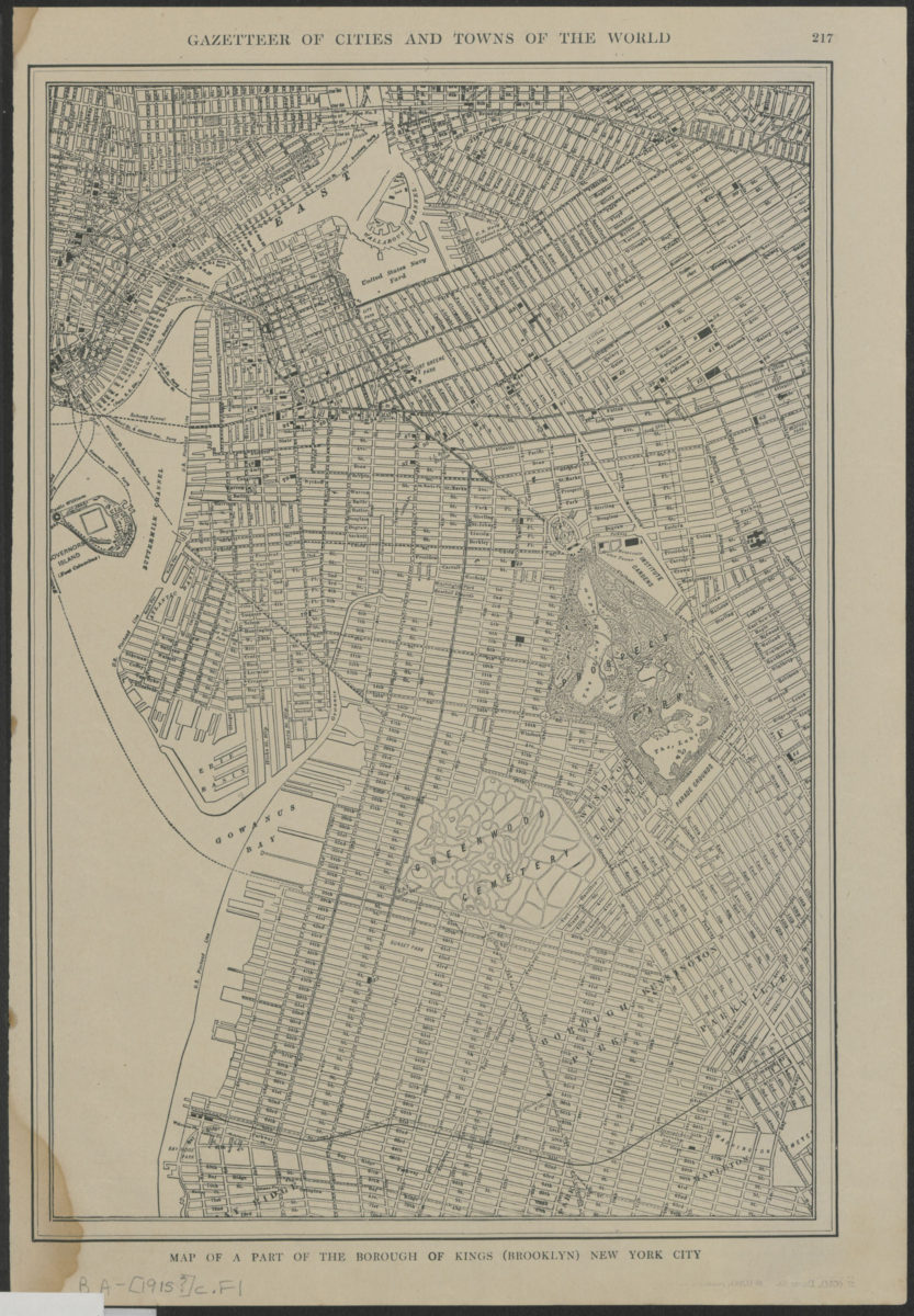

Map of a part of the borough of Kings (Brooklyn) New York City [1915]
Map No. B A-[1915?].Fl
Covers Brooklyn from South 4th Street in modern-day Williamsburg to 67th Street in modern-day Sunset Park, and east to Bushwick, Kensington and Parkville, and Mapleton. Also covers a portion of lower Manhattan. Shows streets and neighborhoods. Title from caption. Extracted from an unknown atlas. Text and 2 segment maps of Long Island on verso.
Map area shown
Genre
MapRelation
Full catalog recordSize
41 × 30 cmDownload
Low Resolution Image
Creator
P.F. Collier & Son Corporation,Publisher
Brooklyn Historical SocietyCitation
Map of a part of the borough of Kings (Brooklyn) New York City; [1915], Map Collection, B A-[1915?].Fl; Brooklyn Historical Society.Scale
Scale not givenLoading zoom image...