[Map of Jamaica Bay] [19??]
Map No. B A-[19--?].Fl.Folio
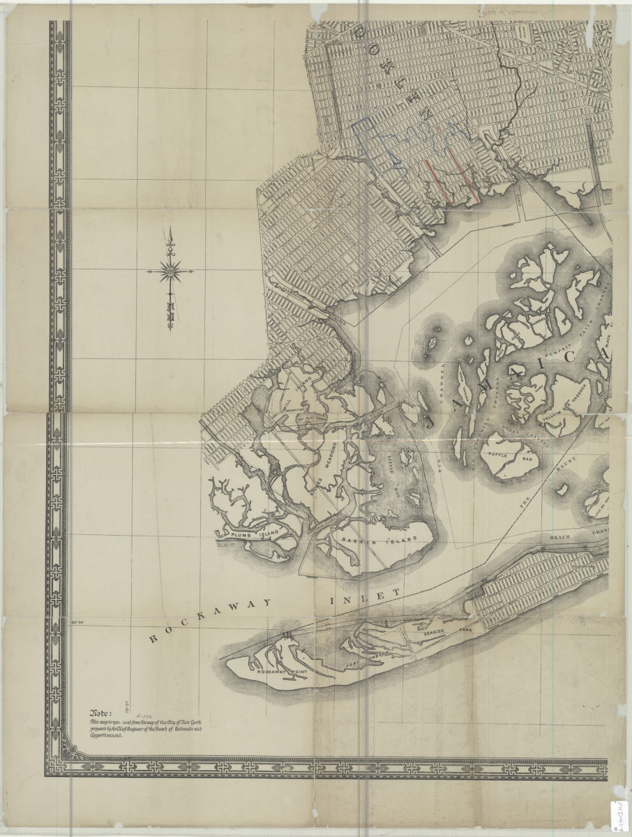
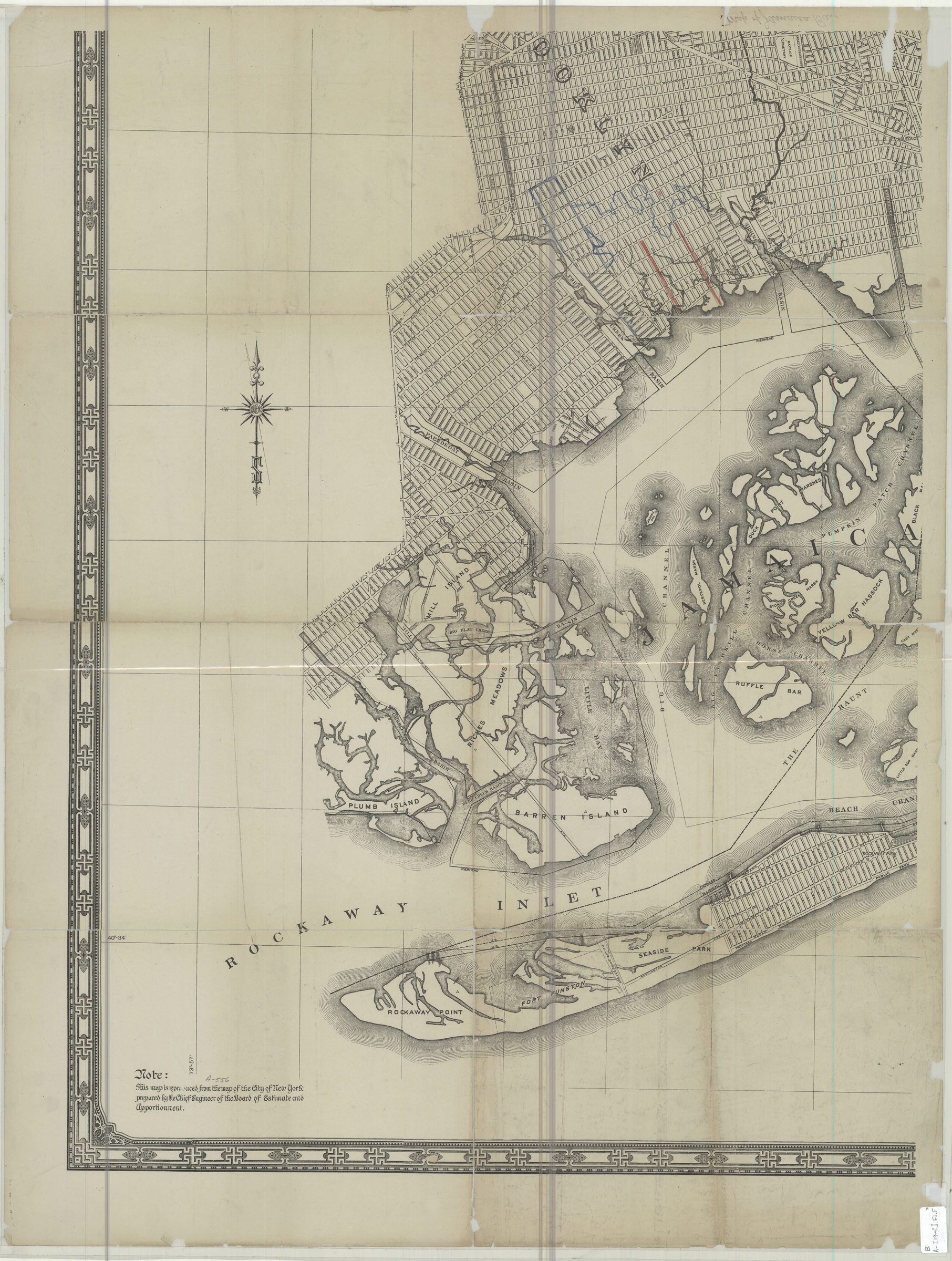
Covers area east from Rockaway Point to Yellow Bar Hassock and north to Bayside Cemetery (includes modern-day Canarsie and East New York). Title devised by cataloger. “Note: This map is reproduced from the map of the City of New York prepared by the Chief Engineer of the Board of Estimate and Apportionment.” One sheet of a larger set BHS only has Jamaica Bay sheet. Includes decorative border. BHS copy annotated in red and blue pencil.
Subjects
Places
Map area shown
Genre
MapRelation
Full catalog recordSize
86 × 65 cmDownload
Low Resolution Image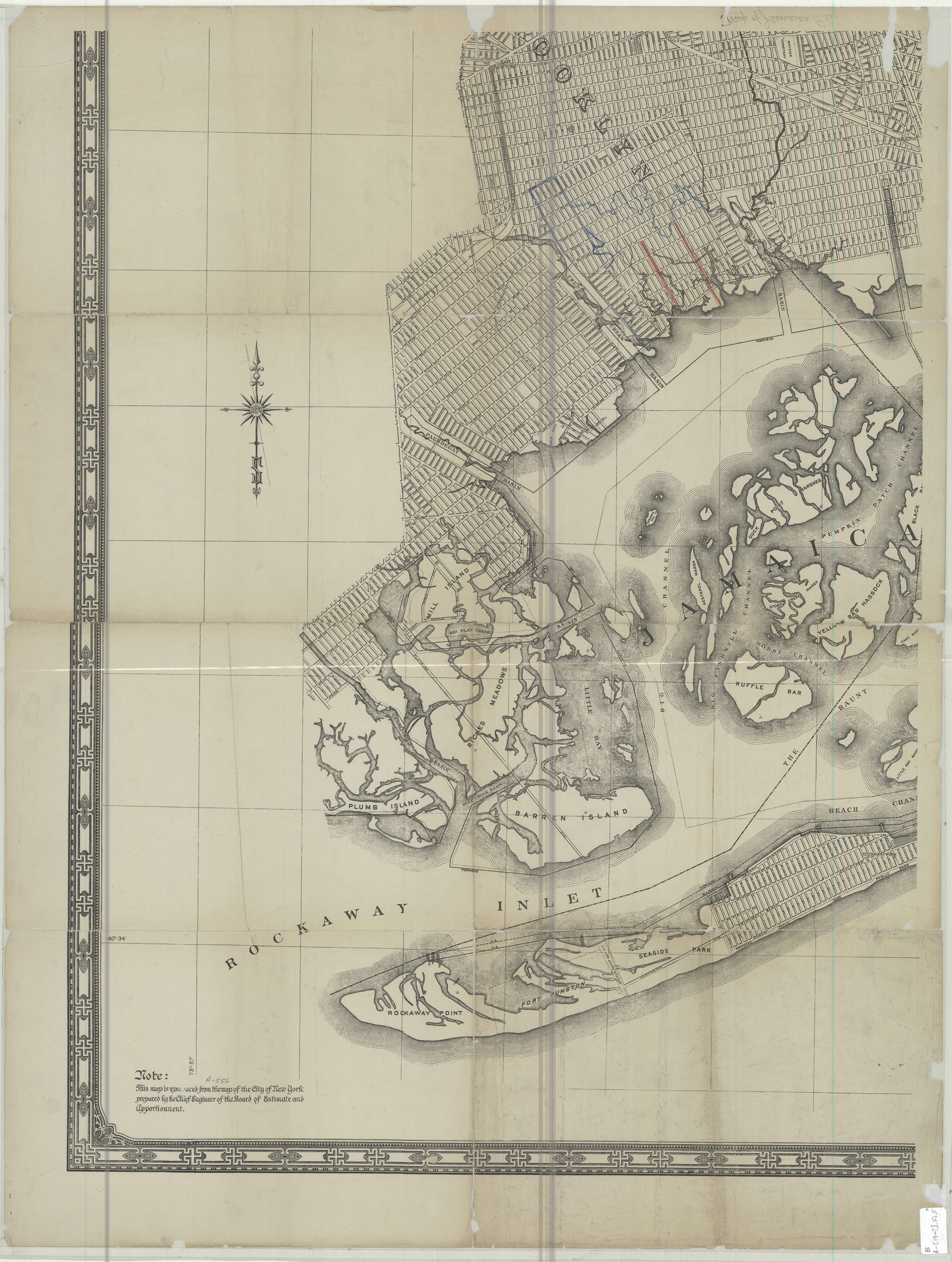
Creator
New York (N.Y.),Publisher
Brooklyn Historical SocietyCitation
[Map of Jamaica Bay]; [19??], Map Collection, B A-[19--?].Fl.Folio; Brooklyn Historical Society.Scale
Scale not givenLoading zoom image...