Center for Brooklyn History
Map Collections
Search
About
Othmer Library & Archives
Submit search query
Refine 5 records
Clear filter
1
Location
Brooklyn (New York, N.Y.)
891
Canarsie (New York, N.Y.)
18
East Flatbush (New York, N.Y.)
23
East New York (New York, N.Y.)
16
Jamaica Bay (N.Y.)
5
Manhattan (New York, N.Y.)
120
New York (N.Y.)
164
Queens (New York, N.Y.)
83
Rockaway (New York, N.Y.)
1
Subject
Bays
5
Bulkheads
1
Coasts
4
Real property
619
Shorelines
3
Waterfronts
5
Waterways
2
Date
19th Century
945
20th Century
469
or enter range:
from
to
Genres
Aerial views
15
Cadastral maps
597
Manuscript maps
365
Map
191
Nautical charts
30
Thematic maps
60
Topographic maps
70
Sort by:
Date (earliest)
Date (most recent)
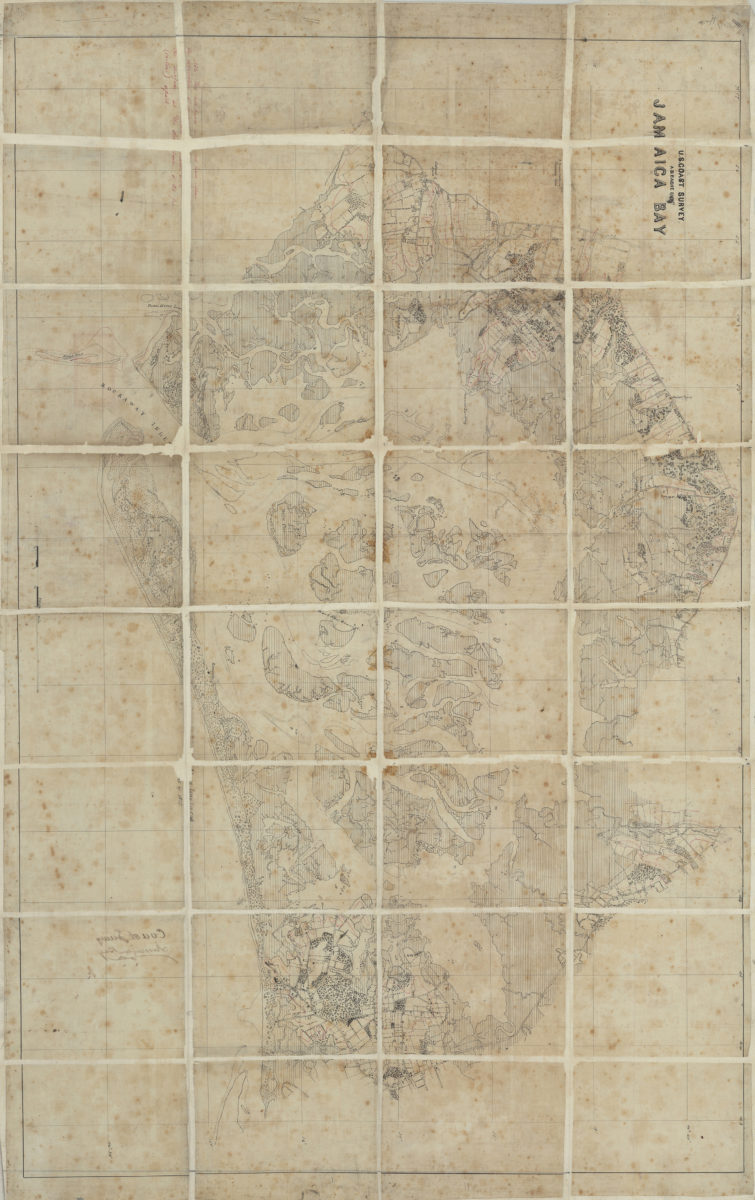
Jamaica Bay: U.S. Coast Survey, A.D. Bache, supt
Jamaica Bay: U.S. Coast Survey, A.D. Bache, supt
[185?]
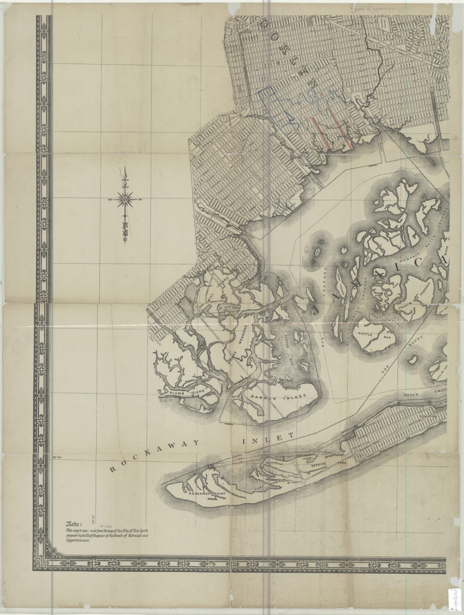
[Map of Jamaica Bay]
[Map of Jamaica Bay]
[19??]
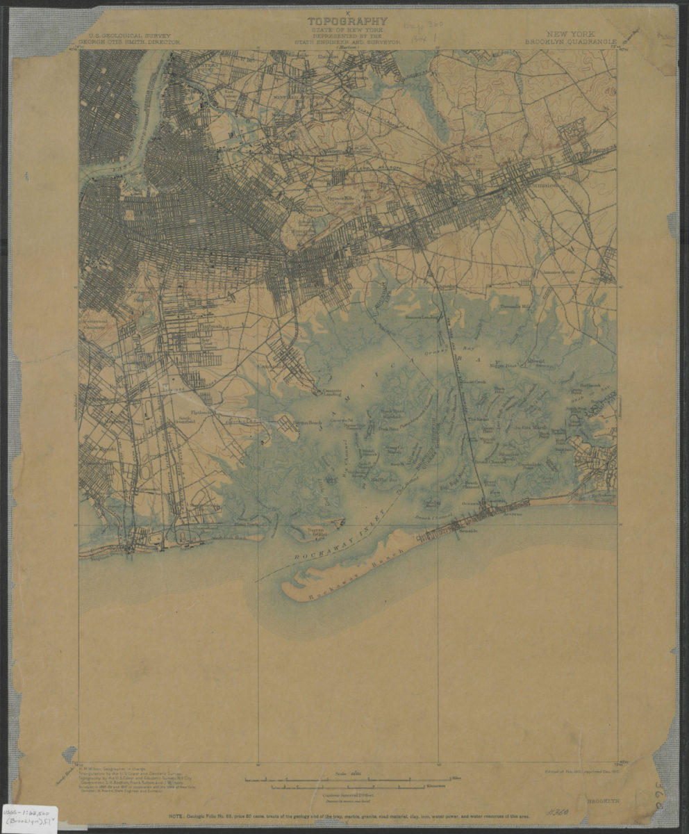
Brooklyn quadrangle, New York: U.S. Geological Survey
Brooklyn quadrangle, New York: U.S. Geological Survey
1900; 1910
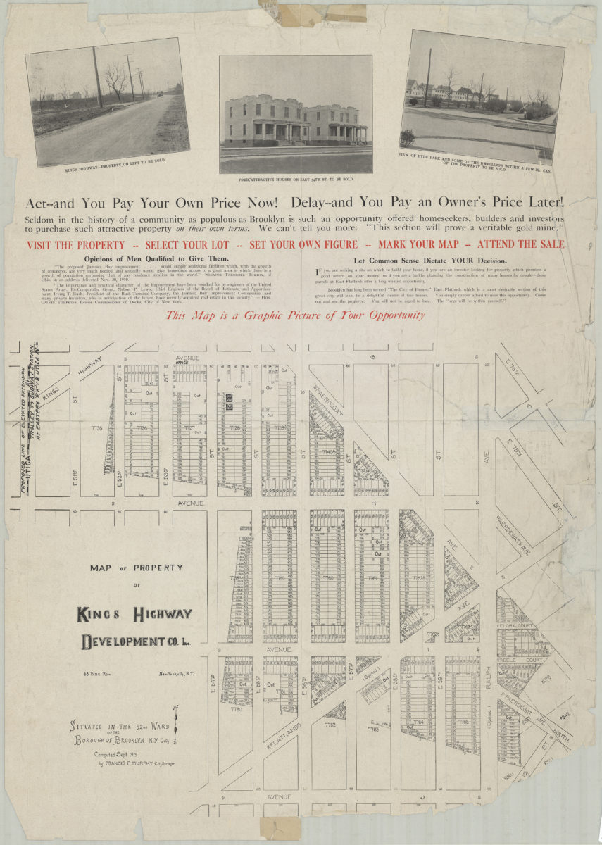
Map of property of Kings Highway Developmental Co. Inc.: situated in the 32nd Ward of the Borough of Brooklyn, N.Y. City: computed Sept. 1915 by Francis P. Murphy, City Surveyor
Map of property of Kings Highway Developmental Co. Inc.: situated in the 32nd Ward of the Borough of Brooklyn, N.Y. City: computed Sept. 1915 by Francis P. Murphy, City Surveyor
1915
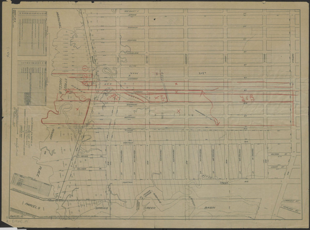
Part of parcel 8 and parcel 9 of damage map in the matter of acquiring title to property required for the improvement of the water front and harbor of the City of New York on Jamaica Bay, City of New York
Part of parcel 8 and parcel 9 of damage map in the matter of acquiring title to property required for the improvement of the water front and harbor of the City of New York on Jamaica Bay, City of New York
1929