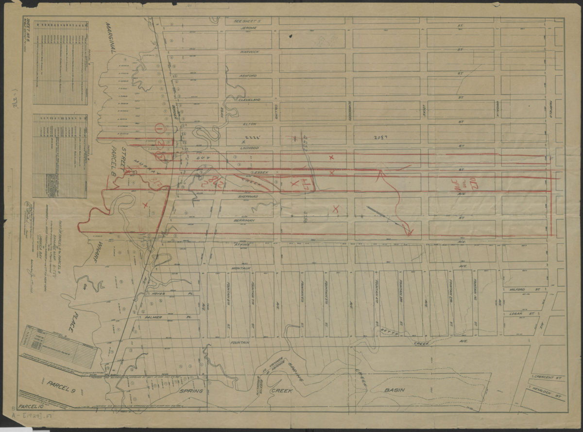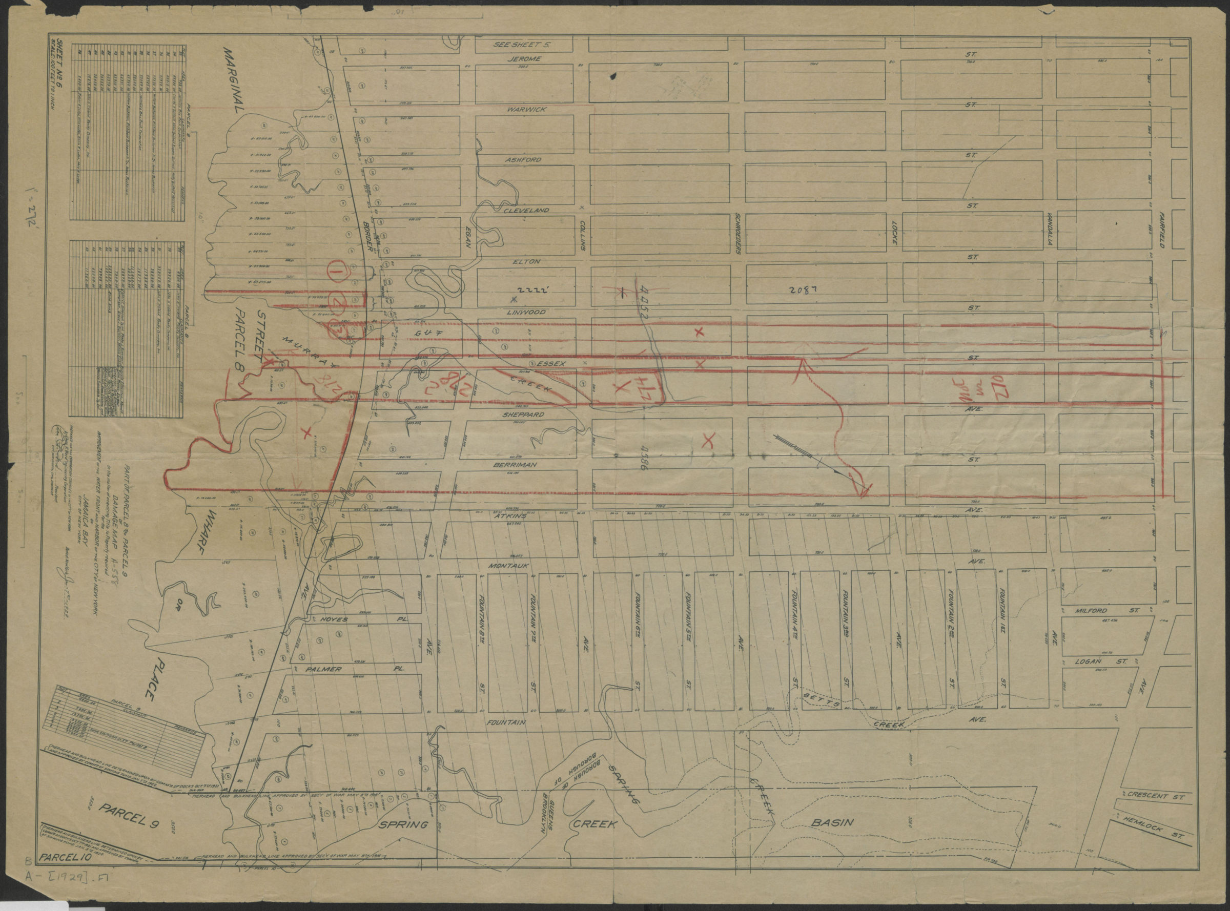
Part of parcel 8 and parcel 9 of damage map in the matter of acquiring title to property required for the improvement of the water front and harbor of the City of New York on Jamaica Bay, City of New York 1929
Map No. B A-[1929].Fl
Covers area bounded by Fairfield Avenue, Spring Creek, Jamaica Bay, and Jerome Street in modern-day East New York. Shows streets, creeks, shoreline, approved bulkhead lines, and parcels divided into plots and areas. Includes tables showing claimants for some plots. “Prepared for the Corporation Counsel of the City of New York by Chas. R. Ward, Engineering Corporation.” “Sheet no. 6.”
Subjects
Places
Map area shown
Genre
Thematic mapsRelation
Full catalog recordSize
55 × 40 cmDownload
Low Resolution Image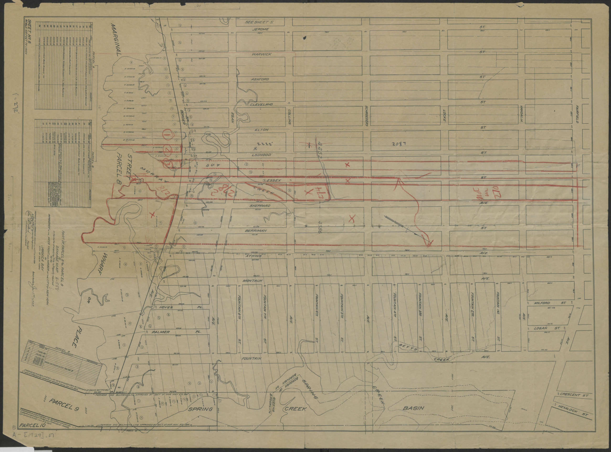
Creator
Ward, Chas. R.,Publisher
Brooklyn Historical SocietyCitation
Part of parcel 8 and parcel 9 of damage map in the matter of acquiring title to property required for the improvement of the water front and harbor of the City of New York on Jamaica Bay, City of New York; 1929, Map Collection, B A-[1929].Fl; Brooklyn Historical Society.Scale
Scale 1:1200. 1 in to 100Loading zoom image...