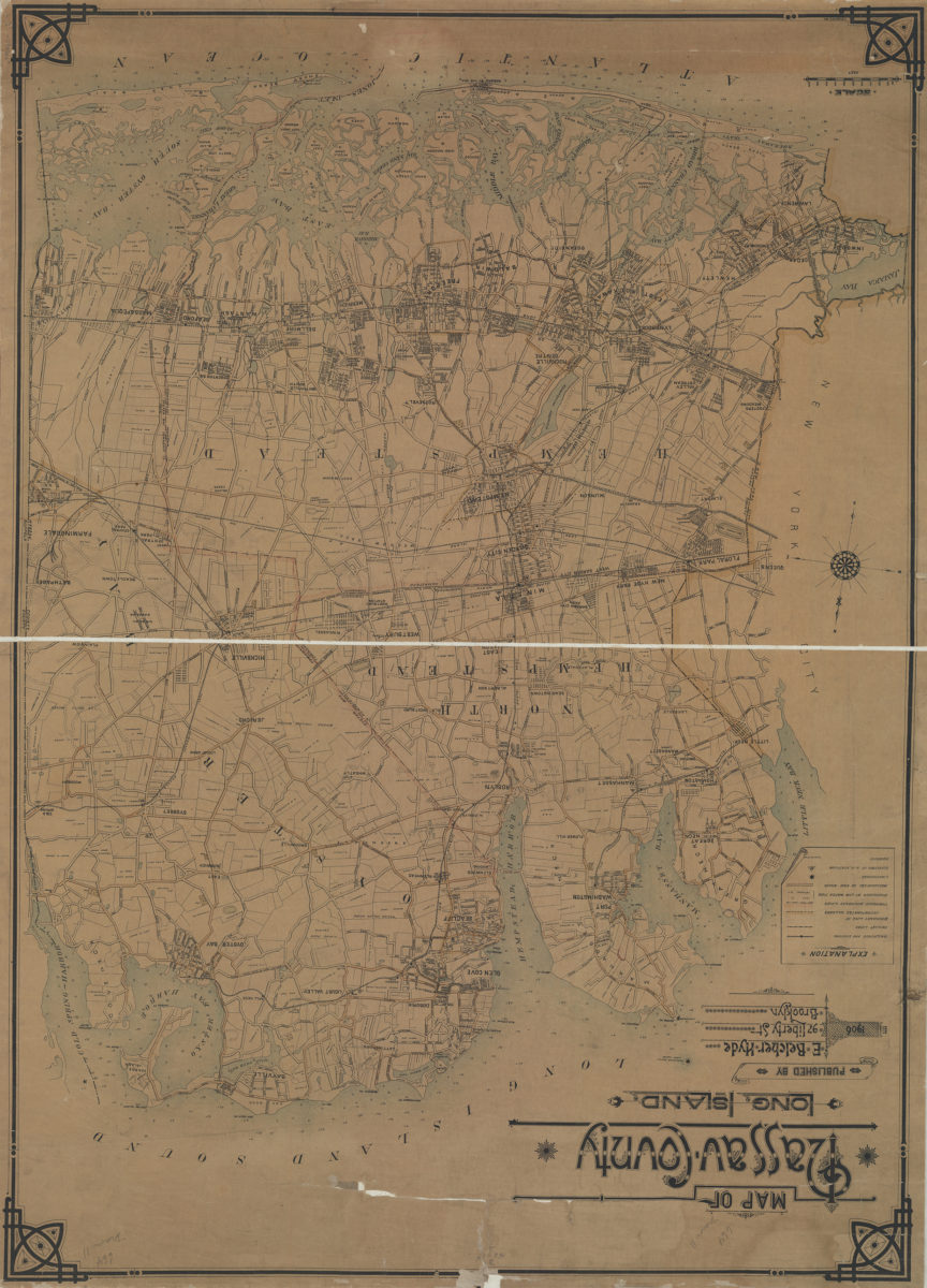
Map of Nassau County, Long Island: C.W. Hooper del 1906
Map No. L.I.-1906a.Fl
Shows railroads, roads, tract lines, landowners’ names, trolley lines, boundaries of incorporated villages and townships, lighthouses, elevation at railroad stations, and aqueducts. Depths shown by soundings in feet and fathoms. Water areas printed in light blue boundaries and main roads emphasized by hand coloring. Publisher’s advertisement (text) and specimen map on cover. Includes key. BHS copy varnished, mounted on linen, missing cover.
Map area shown
Relation
Full catalog recordSize
94 × 67 cmDownload
Low Resolution Image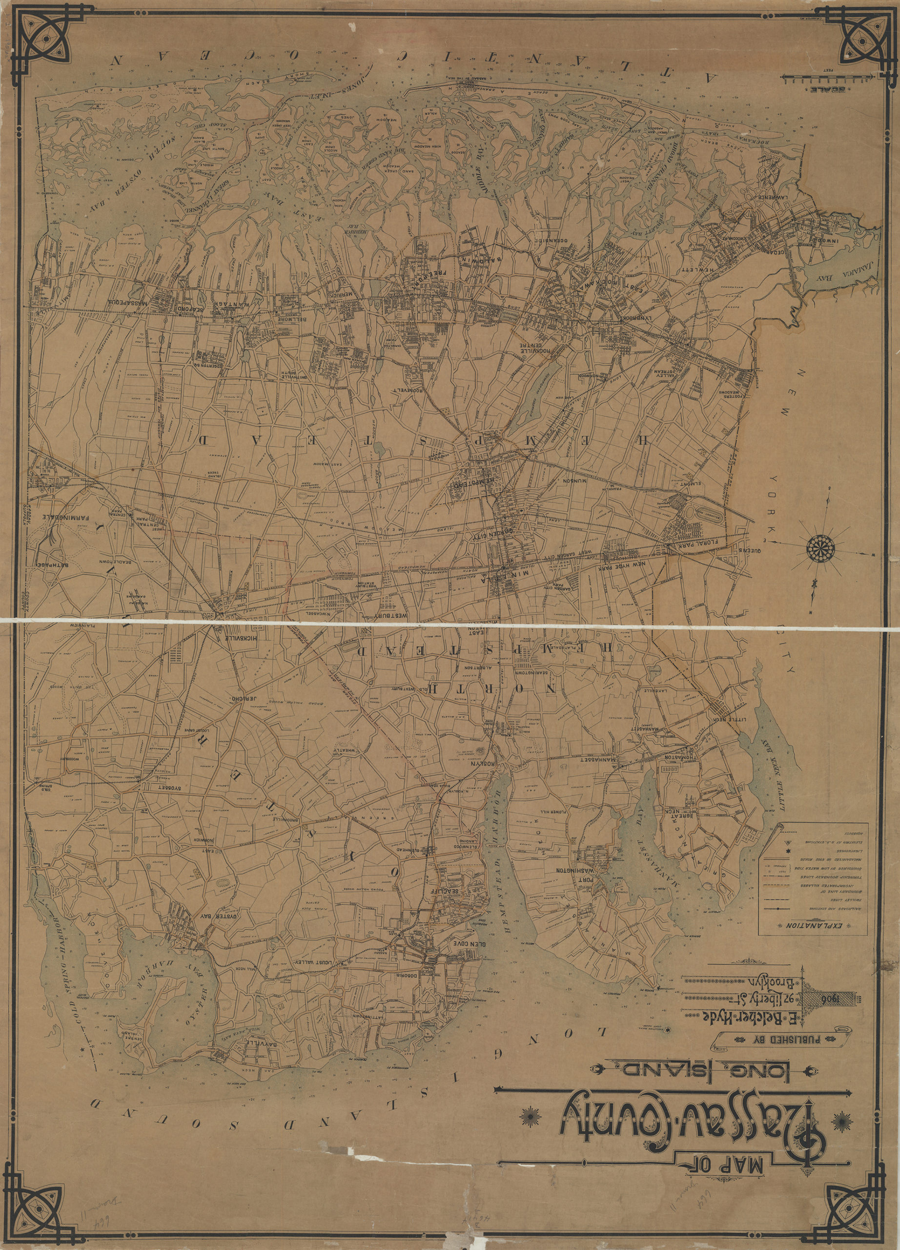
Creator
Hyde, E. Belcher,Publisher
Brooklyn Historical SocietyCitation
Map of Nassau County, Long Island: C.W. Hooper del; 1906, Map Collection, L.I.-1906a.Fl; Brooklyn Historical Society.Scale
Scale [ca. 1:150,000]Loading zoom image...