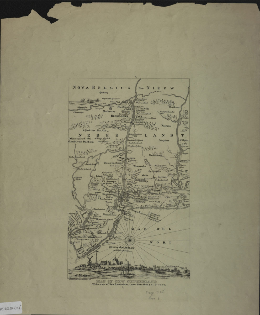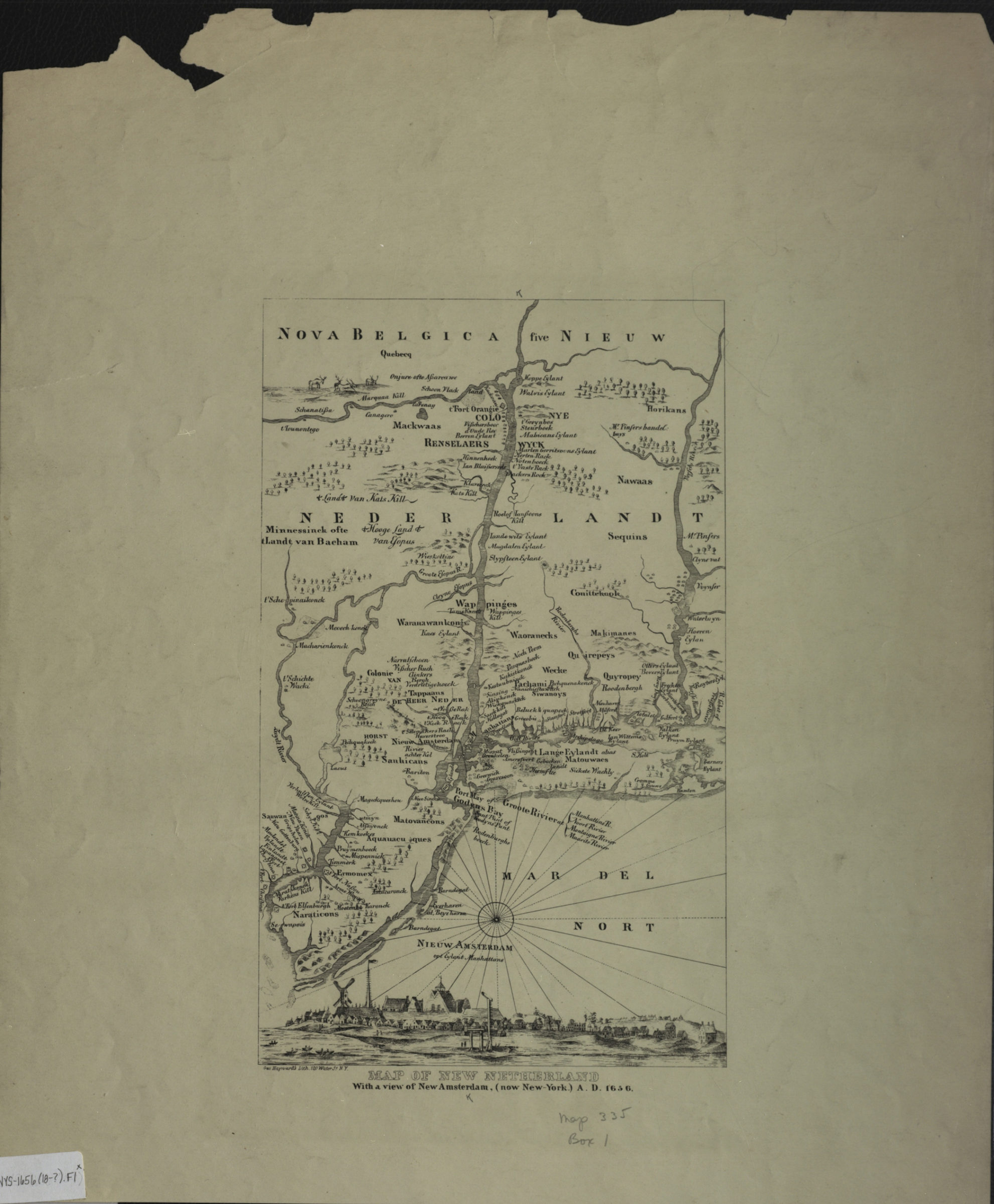
Map of New Netherland with a view of New Amsterdam (now New York), A.D. 1656 [18??]
Map No. NYS-1656 (18--?).Fl
Covers portions of New Jersey, New York, and Connecticut (modern-day New York metropolitan area). Relief shown pictorially. Includes ill. and view. View: Nieuw Amsterdam opt Eylant Manhattans.
Map area shown
Genre
Historical mapsRelation
Full catalog recordSize
19 × 30 cmDownload
Low Resolution Image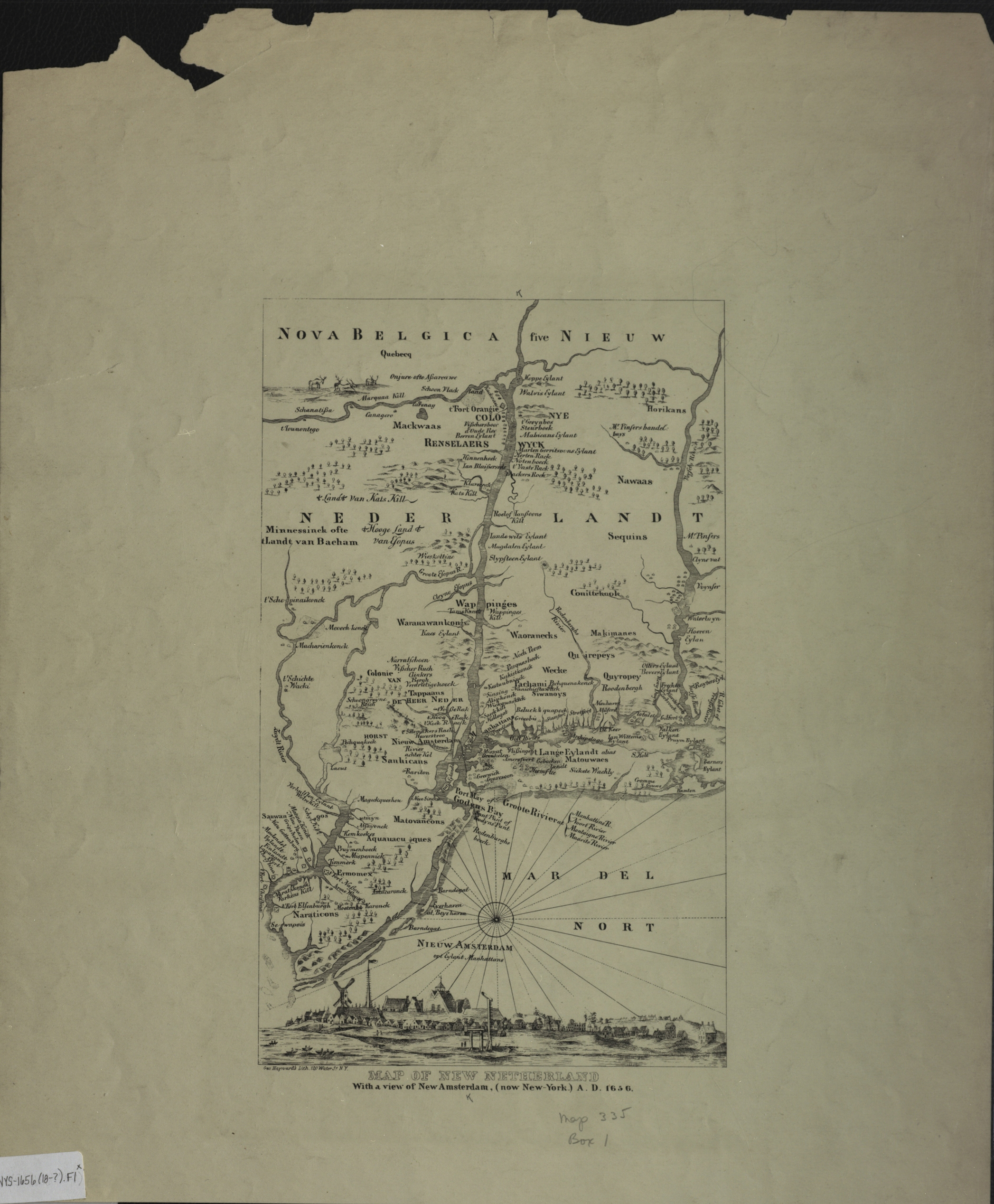
Creator
Hayward, George,Publisher
Brooklyn Historical SocietyCitation
Map of New Netherland with a view of New Amsterdam (now New York), A.D. 1656; [18??], Map Collection, NYS-1656 (18--?).Fl; Brooklyn Historical Society.Scale
Scale not givenLoading zoom image...