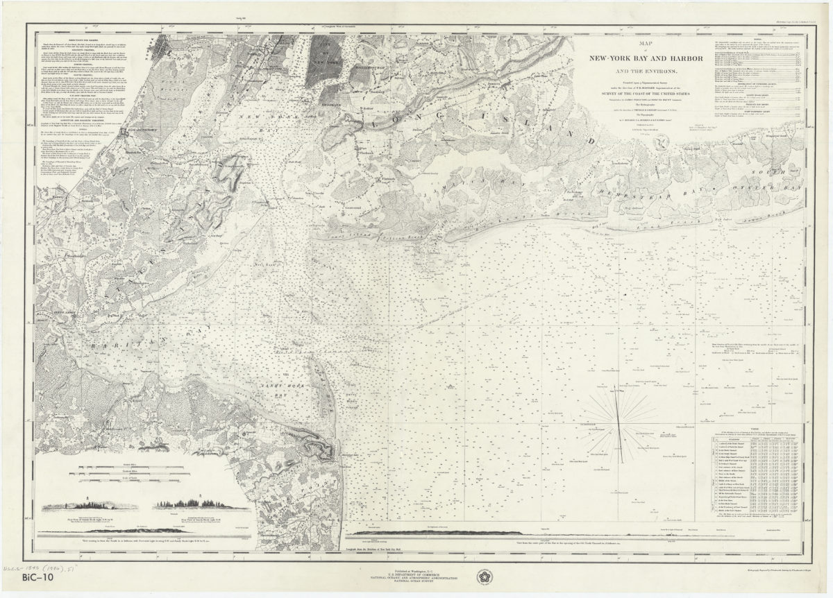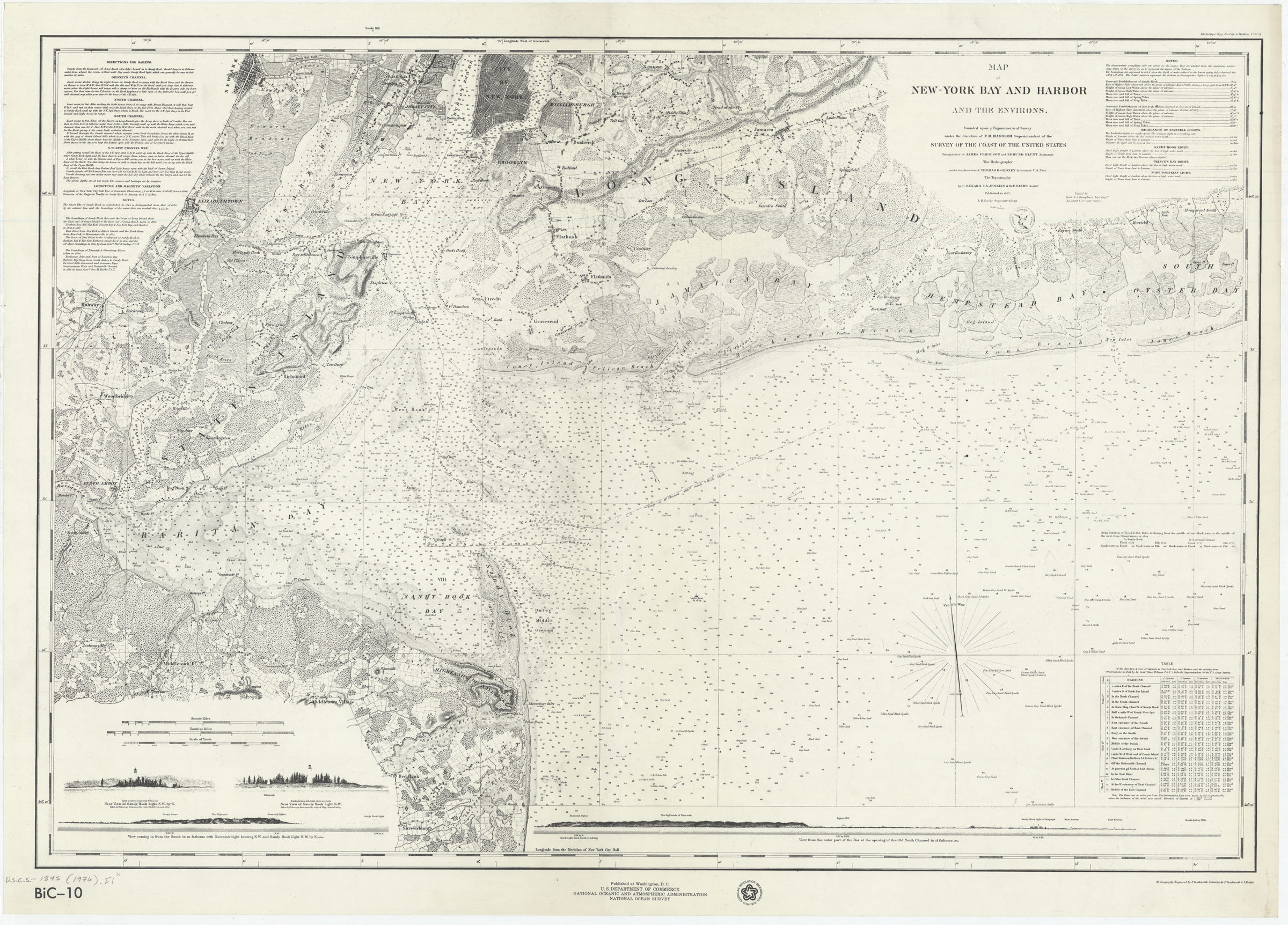
Map of New-York Bay and Harbor and the environs: founded upon a trigonometrical survey under the direction of F.R. Hassler, superintendent of the Survey of the Coast of the United States [1976]
Map No. U.S.C.S.-1845 (1976).Fl
Facsimile covering New York Harbor north from Shrewsbury, New Jersey and east from Raritan Bay to Jones Beach. Shows portions of New Jersey, Long Island and Manhattan. Also shows structures, seafloor terrain, and channels. Relief shown by hachures. Depths shown by bathymetric tints and soundings. “American Revolution Bicentennial 1776-1976.” Includes text, table of currents, notes, 4 coastal panoramas, and seal. “BiC-10”–Lower left.
Subjects
Places
Map area shown
Relation
Full catalog recordSize
62 × 90 cmDownload
Low Resolution Image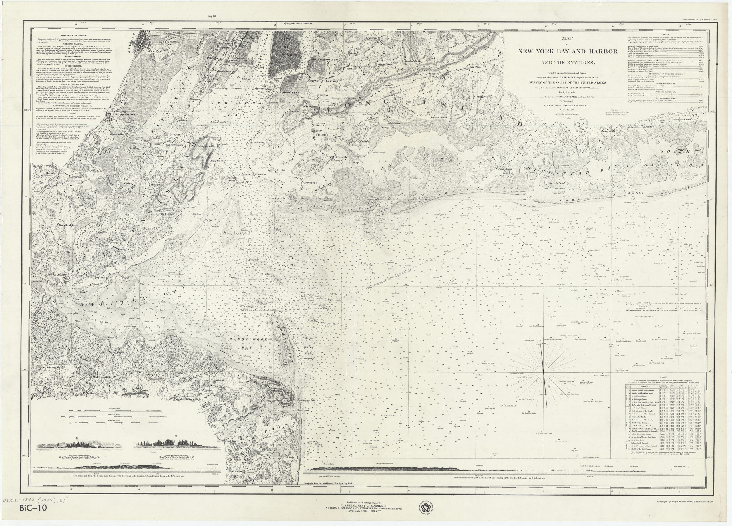
Creator
United States Coast Survey,Publisher
Brooklyn Historical SocietyCitation
Map of New-York Bay and Harbor and the environs: founded upon a trigonometrical survey under the direction of F.R. Hassler, superintendent of the Survey of the Coast of the United States; [1976], Map Collection, U.S.C.S.-1845 (1976).Fl; Brooklyn Historical Society.Scale
Scale 1:80,000Loading zoom image...