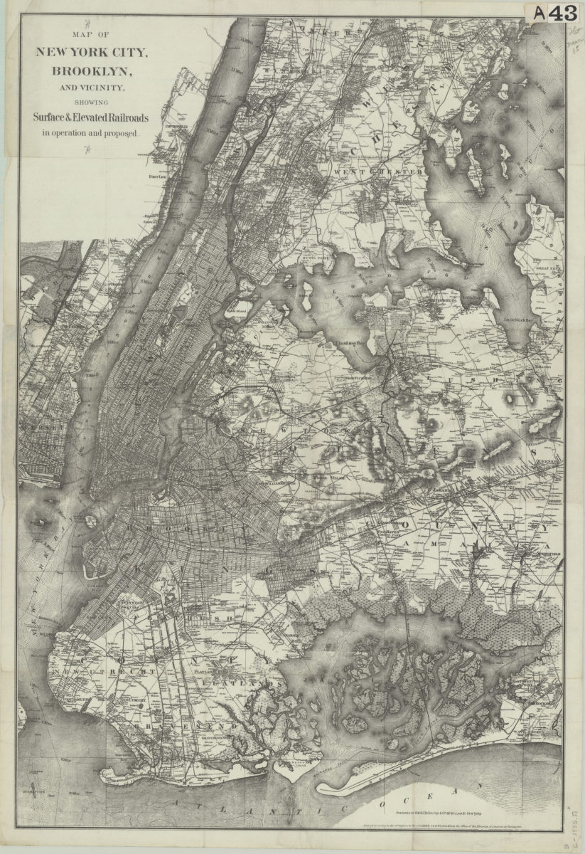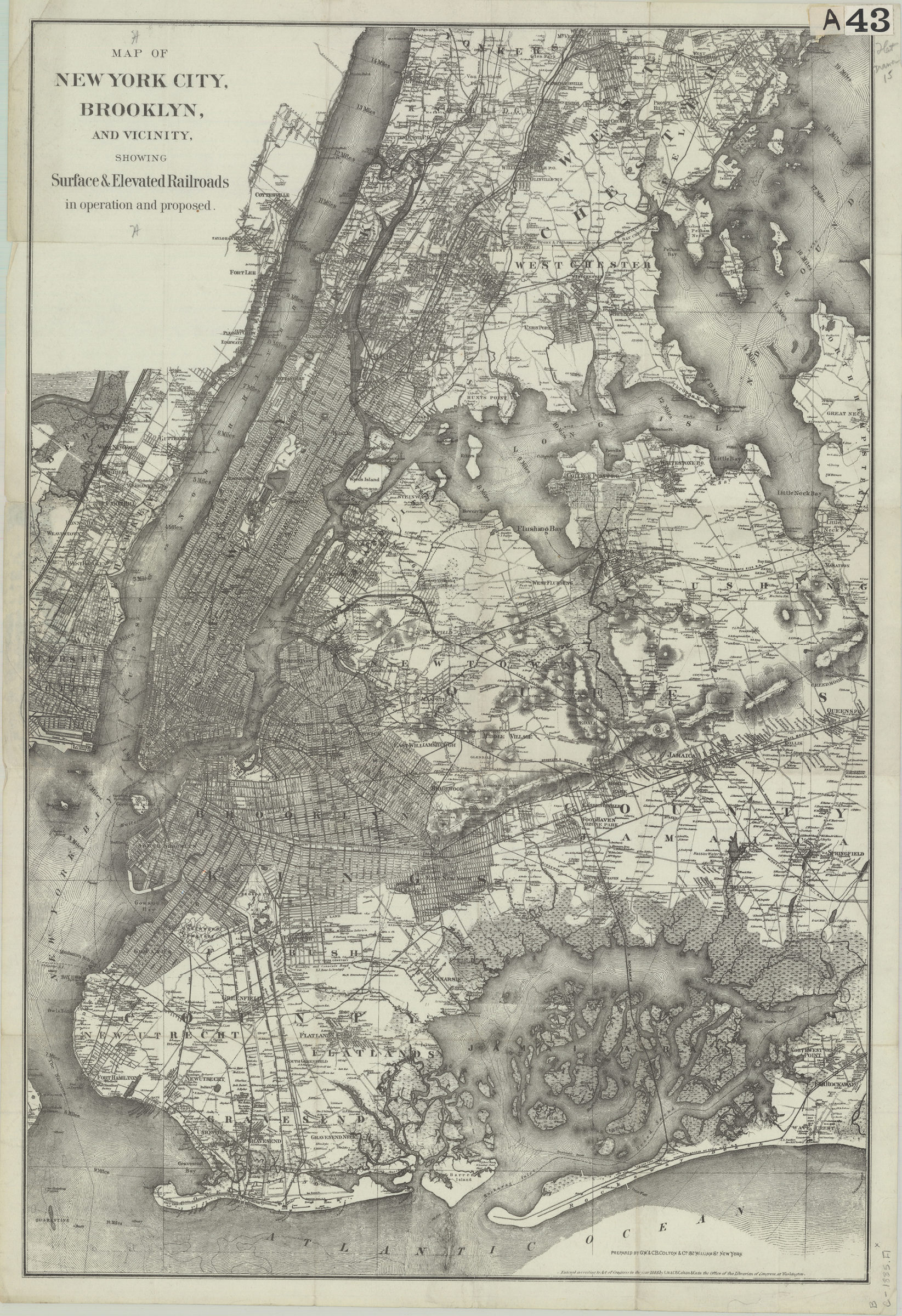
Map of New York City, Brooklyn, and vicinity: showing surface & elevated railroads in operation and proposed [ca. 1885]
Map No. B C-1885.Fl;B C-1885.Fl c.2
Covers all of the boroughs of Brooklyn and Manhattan also shows significant portions of Queens, eastern New Jersey, and Westchester County. Shows ferry lines, names of property owners, and distances from New York City Hall. Relief shown by hachures. Depths shown by isolines. “Entered according to Act of Congress in the year 1885 by G.W. & C.B. Colton & Co. in the Office of the Librarian of Congress at Washington.” Title in gilt on black fabric cover. Publisher’s list on inside of front cover. BHS has 2 copies copy 2 missing cover. Pasted on inside cover of copy 1: Wilbur & Hastings, Stationers, Printers, Lithographers, and Blank Book Manufacturers 40 Fulton St. New York.
Subjects
Places
Map area shown
Genre
Transportation mapsRelation
Full catalog recordSize
68 × 46 cmDownload
Low Resolution Image
Creator
G.W. & C.B. Colton & Co.,Publisher
Brooklyn Historical SocietyCitation
Map of New York City, Brooklyn, and vicinity: showing surface & elevated railroads in operation and proposed; [ca. 1885], Map Collection, B C-1885.Fl;B C-1885.Fl c.2; Brooklyn Historical Society.Scale
Scale not givenLoading zoom image...