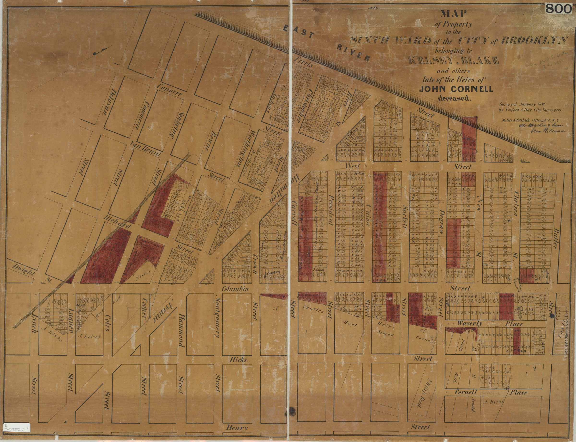
Map of property in the Sixth Ward of the city of Brooklyn belonging to Kelsey, Blake and others late of the heirs of John Cornell, deceased: surveyed, January 1838 by Tolford & Day, city surveyors [1838]
Map No. B P-[1838].Fl
Cadastral map covering area west from Henry St. to the East River and north from Lynch St. to Butler St. (modern-day Carroll Gardens). Shows property (including lot numbers and dimensions), and names of landowners. Oriented with north to the right. BHS copy annotated in black ink some lots hand-colored in red.
Subjects
Places
Map area shown
Genre
Cadastral mapsRelation
Full catalog recordSize
61 × 80 cmDownload
Low Resolution Image
Creator
Tolford, R.,Publisher
Brooklyn Historical SocietyCitation
Map of property in the Sixth Ward of the city of Brooklyn belonging to Kelsey, Blake and others late of the heirs of John Cornell, deceased: surveyed, January 1838 by Tolford & Day, city surveyors; [1838], Map Collection, B P-[1838].Fl; Brooklyn Historical Society.Scale
Scale not givenLoading zoom image... 