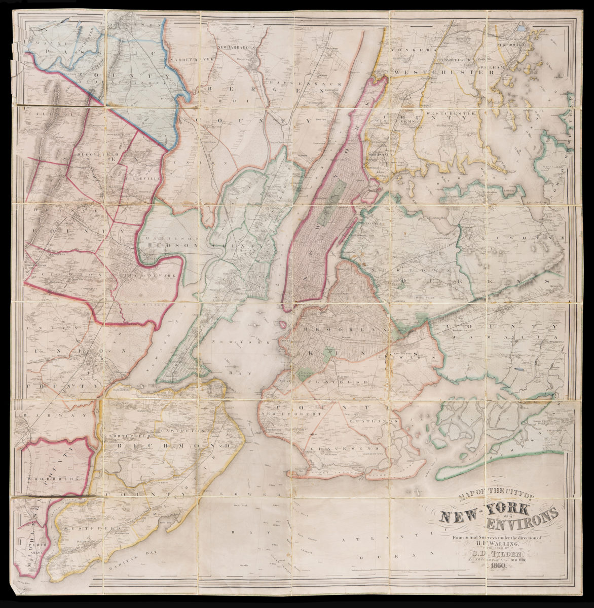
Map of the City of New-York and it’s environs: from actual surveys under the direction of H.F. Walling 1860
Map No. NYC-1860a.Fd.Folio
Road map. Covers all of modern New York (N.Y.) and adjacent areas as far as New Rochelle (N.Y.), Fairfield (N.J.) and Perth Amboy (N.J.) Shows some buildings and property owner names in rural areas. Also shows wetlands, railroads and other natural and manmade features. Shows relief by hachures. Prime meridien: New York. NYHS copies (5): frayed, discolored, brittle to varying degrees. Copies 1-4 mounted on cloth copy 5 mounted on stiff paper. five copies: M009705.1, M009705.2, M009705.3, M009705.4, M009705.5
Subjects
Places
Map area shown
Relation
Full catalog recordSize
163 × 159 cmDownload
Low Resolution Image
Creator
Walling, Henry Francis,Publisher
Brooklyn Historical SocietyCitation
Map of the City of New-York and it’s environs: from actual surveys under the direction of H.F. Walling; 1860, Map Collection, NYC-1860a.Fd.Folio; Brooklyn Historical Society.Scale
Scale 1:30,000Loading zoom image...