Center for Brooklyn History
Map Collections
Search
About
Othmer Library & Archives
Submit search query
Refine 3 records
Clear filter
1
Location
Brooklyn (New York, N.Y.)
891
Essex County (N.J.)
4
Hudson County (N.J.)
3
Jersey City (N.J.)
4
Manhattan (New York, N.Y.)
120
Middlesex County (N.J.)
4
New York (N.Y.)
164
Staten Island (N.Y.)
10
Union County (N.J.)
1
Westchester County (N.Y.)
11
Subject
Buildings
12
Landowners
434
Railroads
72
Railroads, Elevated
24
Wetlands
6
Date
19th Century
945
20th Century
469
or enter range:
from
to
Genres
Cadastral maps
597
Map
191
Topographic maps
70
Sort by:
Date (earliest)
Date (most recent)
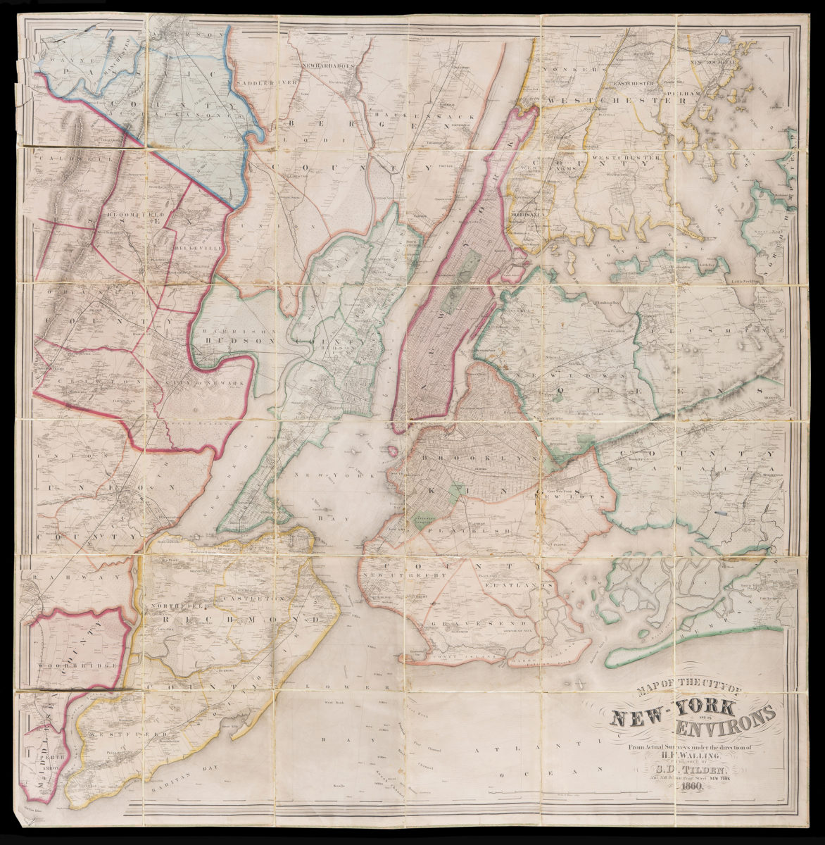
Map of the City of New-York and it’s environs: from actual surveys under the direction of H.F. Walling
Map of the City of New-York and it’s environs: from actual surveys under the direction of H.F. Walling
1860
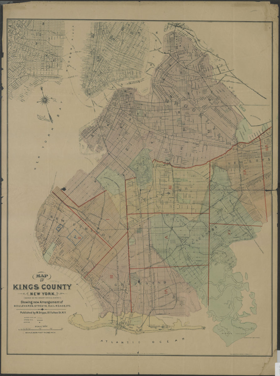
Map of Kings County New York (based on the recent official survey): showing new arrangement of boulevards, streets, railroads, etc
Map of Kings County New York (based on the recent official survey): showing new arrangement of boulevards, streets, railroads, etc
[1879]
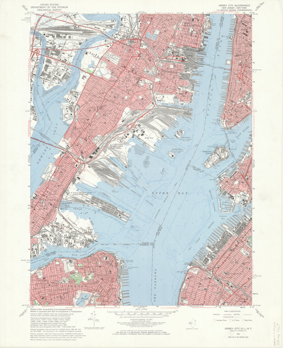
Jersey City quadrangle, New Jersey – New York: mapped, edited, and published by the Geological Survey ; revised in cooperation with New York Dept. of Transportation
Jersey City quadrangle, New Jersey – New York: mapped, edited, and published by the Geological Survey ; revised in cooperation with New York Dept. of Transportation
1967