Map of the city of New York with part of Brooklyn and Williamsburgh ; Vicinity of New York [1853]
Map No. NYC-[1853?].Fl
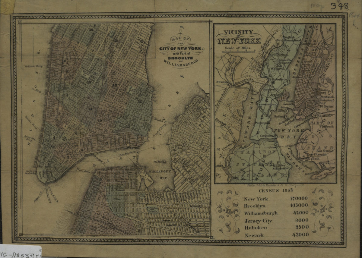
“Map of the City of New York …” covers Brooklyn north from approximately Wyckoff St. to N. 13 St. and east to Kent St. Covers Lower Manhattan north to 33rd St. Shows Manhattan wards and ferry lines. “Vicinity of New York” covers portions of Staten Island, Brooklyn, Queens, Manhattan and eastern New Jersey. Includes ill., decorative border, and census data from 1853.
Map area shown
Genre
MapRelation
Full catalog recordSize
19 × 26 cmDownload
Low Resolution Image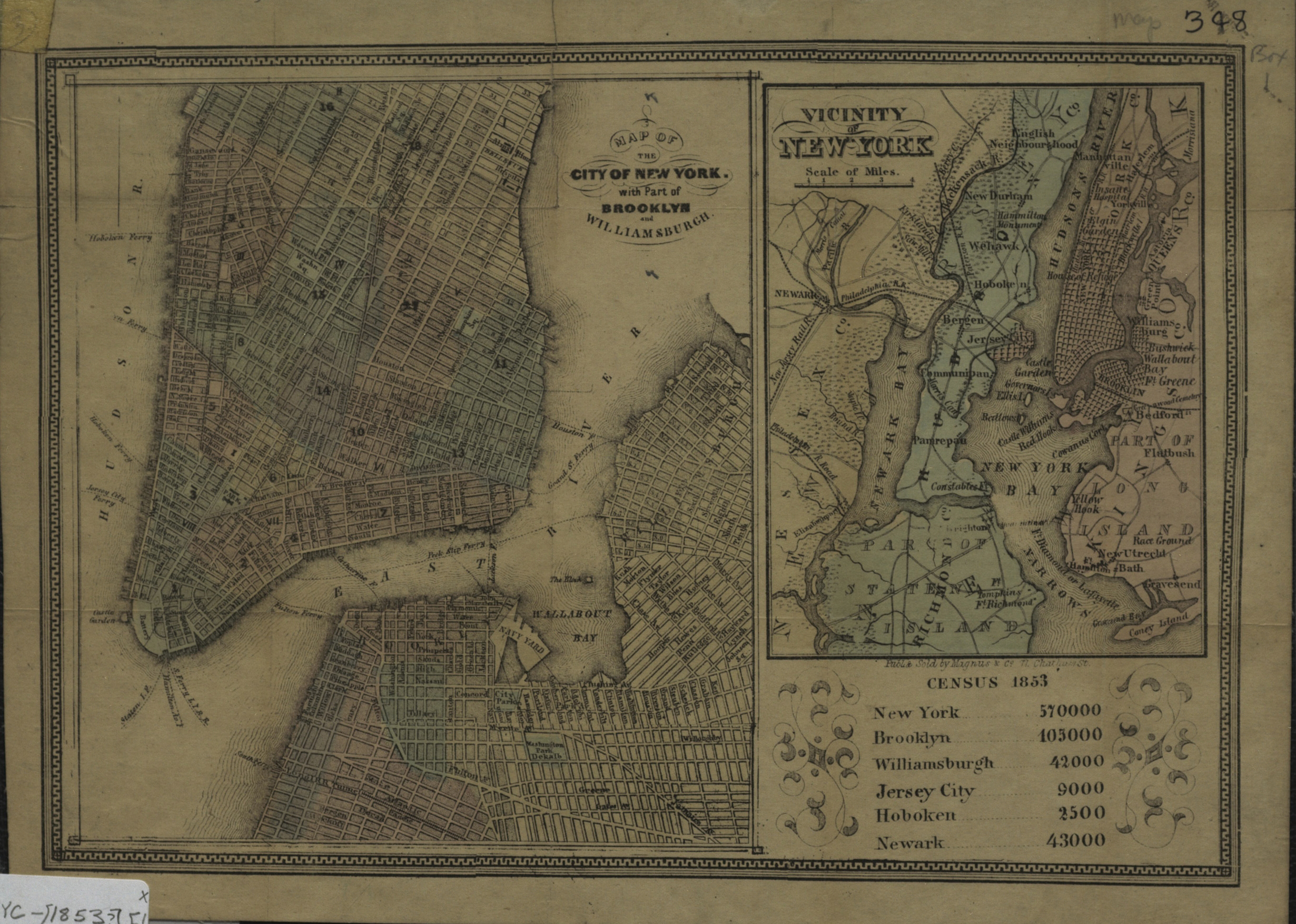
Creator
Charles Magnus & Co.,Publisher
Brooklyn Historical SocietyCitation
Map of the city of New York with part of Brooklyn and Williamsburgh ; Vicinity of New York; [1853], Map Collection, NYC-[1853?].Fl; Brooklyn Historical Society.Scale
Scales differLoading zoom image...