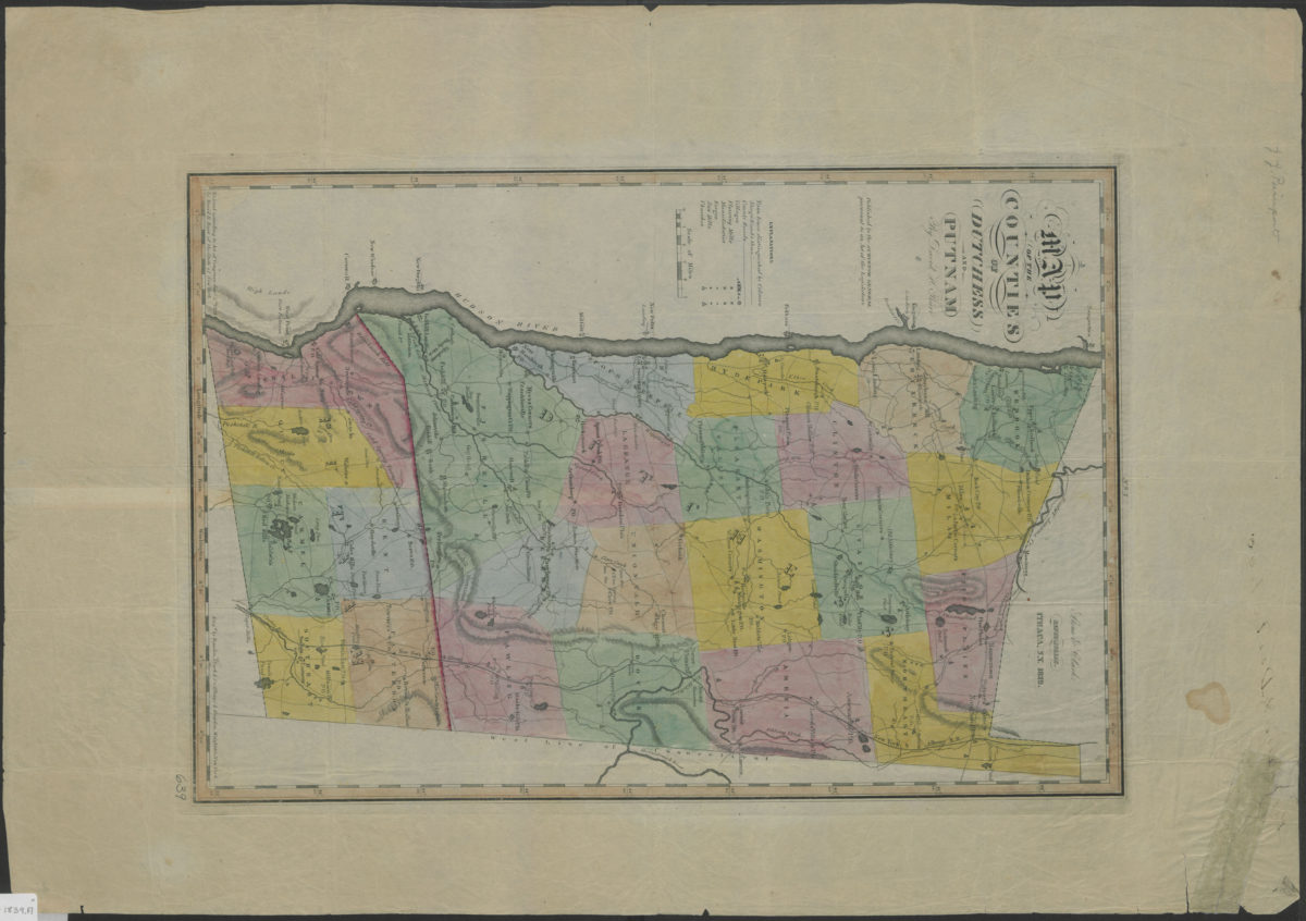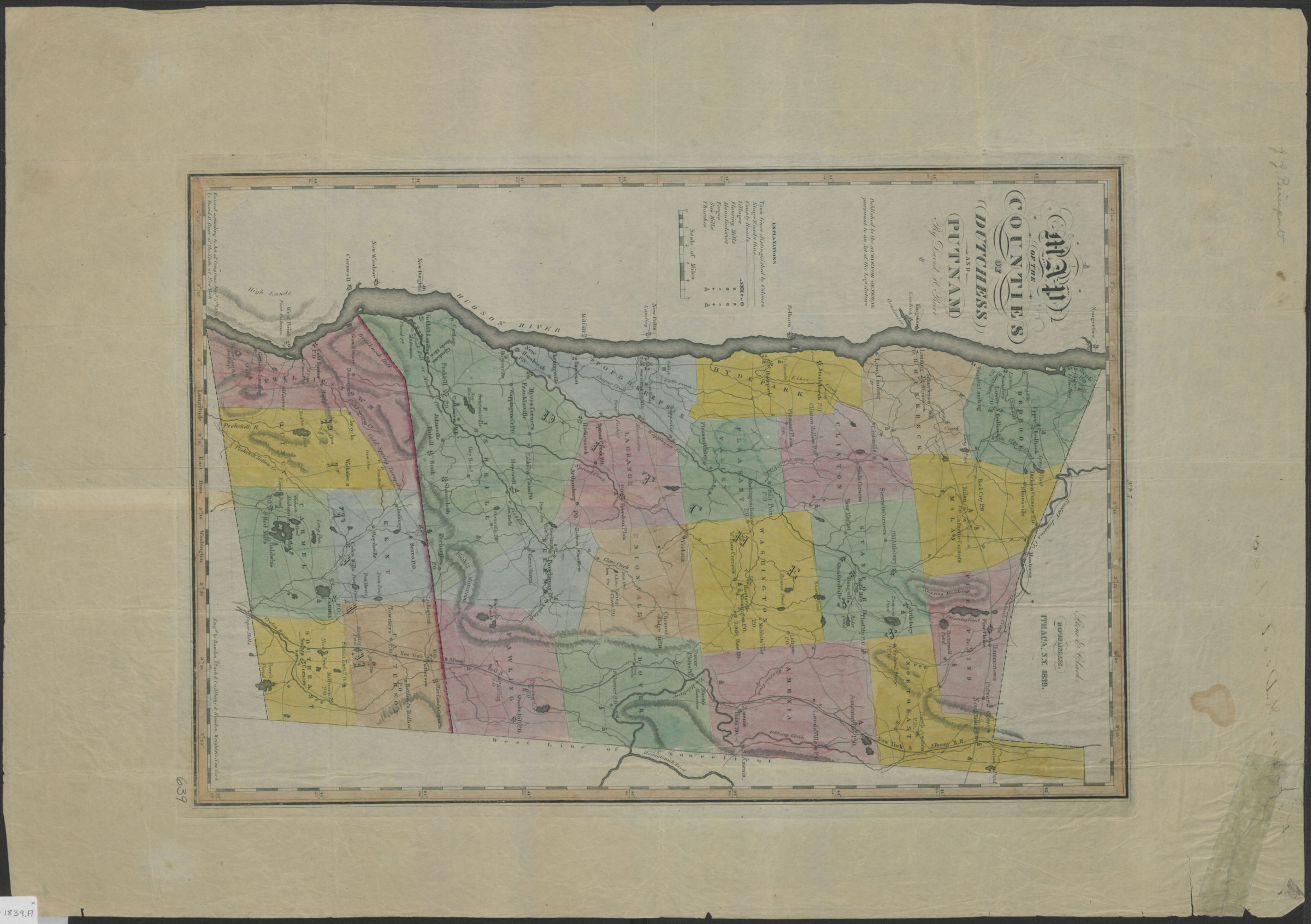
Map of the counties of Dutchess and Putnam: by David H. Burr 1839
Map No. NYS-1839.Fl
Shows administrative divisions, flouring mills, factories, forges, saw mills, churches, and parcels. Relief shown by hachures. Extracted from: Burr, David H., 1803-1875. Atlas of the state of New York. Ithaca, N.Y. : Stone & Clark, 1839. Prime meridian: Washington, D.C. “Engd. by Rawdon, Clark & Co., Albany, & Rawdon, Wright & Co., New York.” Includes key. “No. 7”–Upper center margin.
Map area shown
Genre
MapRelation
Full catalog recordSize
50 × 34 cmDownload
Low Resolution Image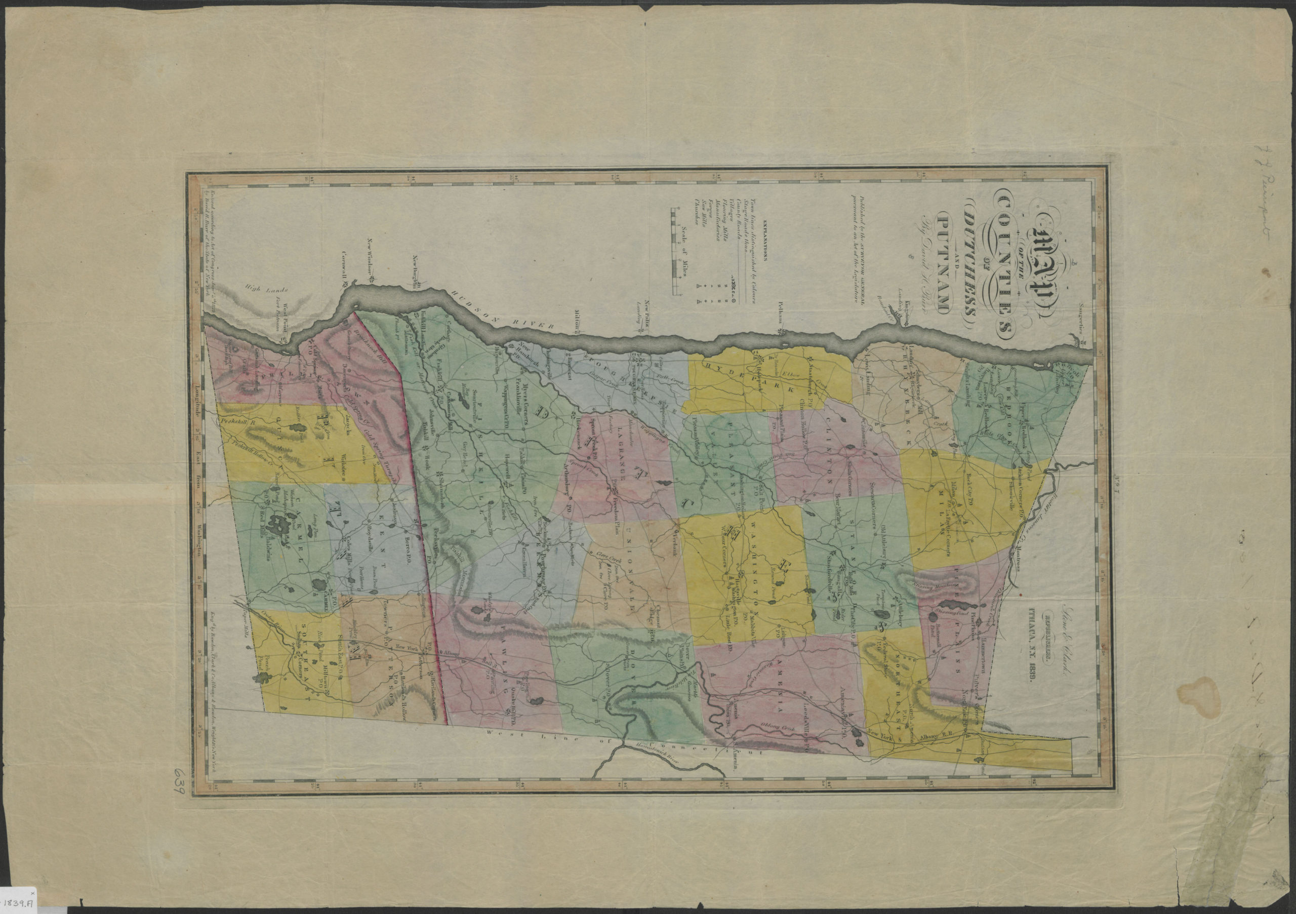
Creator
Burr, David H.,Publisher
Brooklyn Historical SocietyCitation
Map of the counties of Dutchess and Putnam: by David H. Burr; 1839, Map Collection, NYS-1839.Fl; Brooklyn Historical Society.Scale
Scale [ca. 1:151,000]Loading zoom image...