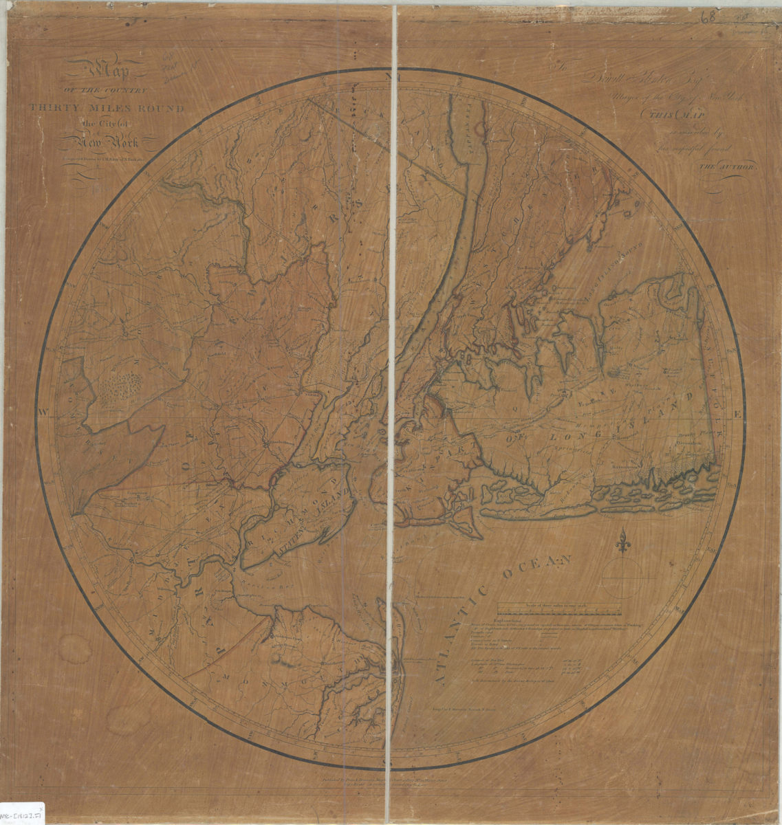
Map of the country thirty miles round the City of New York: designed & drawn by I.H. Eddy of N. York 1812 ; engrd. by P. Maverick, Newark, N. Jersey 1812
Map No. NYC-[1812].Fl
Road map. Covers parts of New York and New Jersey. Shows relief by hachures. Map is circular, of diameter 51 cm. Printed dedication: “To Dewitt Clinton Esqr. Mayor of the City of New York THIS MAP is inscribed by his respectful friend THE AUTHOR.” Includes key. NYHS copy 1 soiled, abraded, frayed. Dissected, mounted on cloth and folded in volume. Cover lost. Copy 2, mounted on acid paper by collector Cozzens, now brittle, discolored, frayed and torn. NYHS copy 2 has text on verso of backing: No 81. from Portfolio of Isaacher Cozzens | Mr Eddy’s Map of New York | Mr. Eddy was a Blind Man | This map I bought of Pryor + Dunning | for {dollar}3,00 in 1812. | bookstore + stationers Water Street. M006841, M008060.2
Places
Map area shown
Genre
Intaglio printsRelation
Full catalog recordSize
59 × 59 cmDownload
Low Resolution Image
Creator
Eddy, John H.,Publisher
Brooklyn Historical SocietyCitation
Map of the country thirty miles round the City of New York: designed & drawn by I.H. Eddy of N. York 1812 ; engrd. by P. Maverick, Newark, N. Jersey; 1812, Map Collection, NYC-[1812].Fl; Brooklyn Historical Society.Scale
Scale [1:190,000] 1 in toLoading zoom image...