
Map of the country twenty five miles round the city of New York [1842]
Map No. NYC-[1842?].Fl
Covers New York metropolitan area south of Rockland County west of Long Island north of Monmouth County, New Jersey and east of Morris County, New Jersey. Shows railroads and wetlands. Relief shown by hachures. Depths shown by isolines. Likely extracted from: Greenleaf, J. A new universal atlas, 1842, no. 37. Includes note on latitude and longitude of New York.
Map area shown
Relation
Full catalog recordSize
33 × 30 cmDownload
Low Resolution Image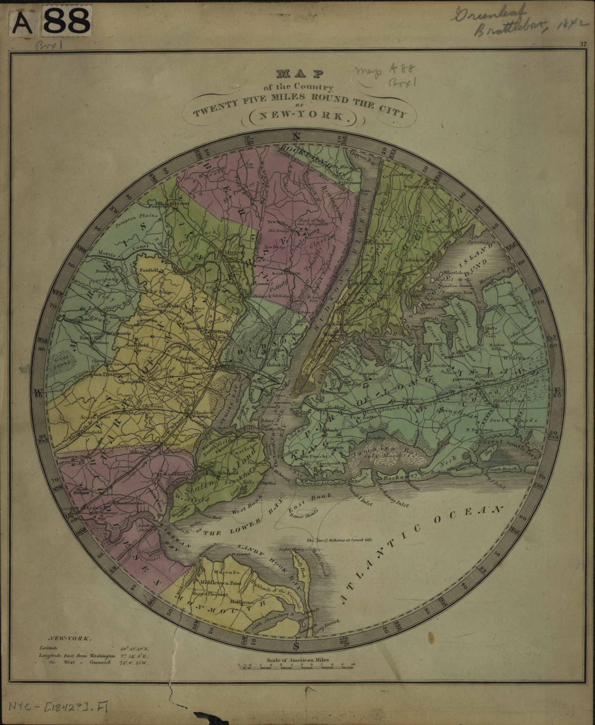
Creator
Greenleaf, J.,Publisher
Brooklyn Historical SocietyCitation
Map of the country twenty five miles round the city of New York; [1842], Map Collection, NYC-[1842?].Fl; Brooklyn Historical Society.Scale
Scale [ca. 1:281,600]Loading zoom image... 