
Map of the southern part of the state of New York including Long Island, the Sound, the state of Connecticut, part of the state of New Jersey and islands adjacent. Compiled from actual late surveys: designed, drawn … by Wm. Damerum 1815
Map No. E-US-1815.Folded
Covers New York north to Clermont and west to Neponagh, New Jersey south to Sandy Hook and west to Chatham. Shows county borders in color. Relief shown pictorially. Depths shown by isolines. Longitude in degrees west of Greenwich. Latitude in degrees north of the equator. Conforms to Thompson II : 57, without the words “General Surveyor” beneath Damerum’s name. Cut into 15 sections, mounted on linen, encased in folder. Includes decorative cartouche. BHS copy not encased in folder bound in cover.
Map area shown
Genre
Bathymetric mapsRelation
Full catalog recordSize
62 × 74 cmDownload
Low Resolution Image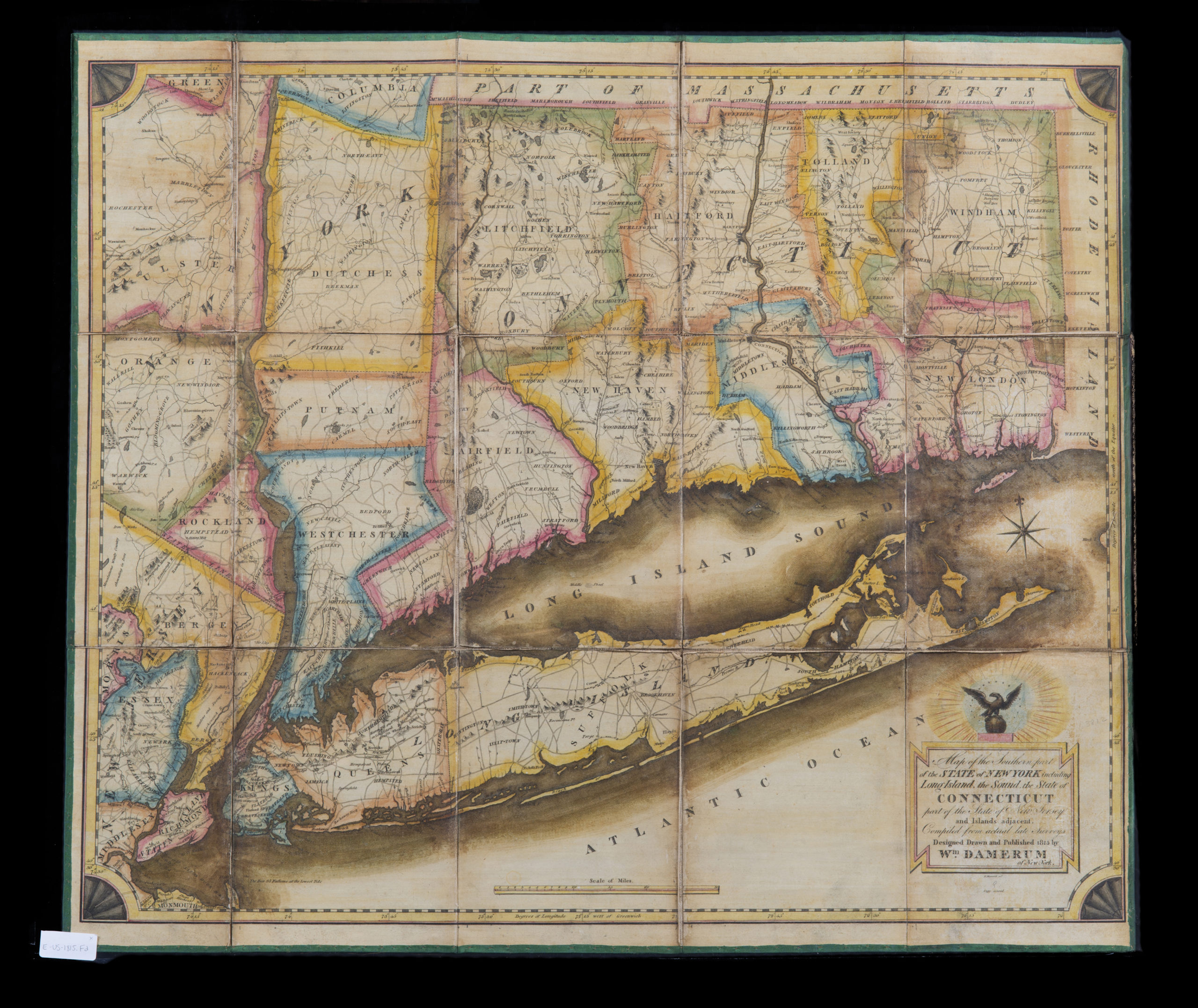
Creator
Damerum, William,Publisher
Brooklyn Historical SocietyCitation
Map of the southern part of the state of New York including Long Island, the Sound, the state of Connecticut, part of the state of New Jersey and islands adjacent. Compiled from actual late surveys: designed, drawn … by Wm. Damerum; 1815, Map Collection, E-US-1815.Folded; Brooklyn Historical Society.Scale
Scale [ca. 1:316,800]Loading zoom image... 