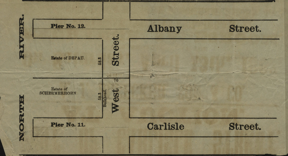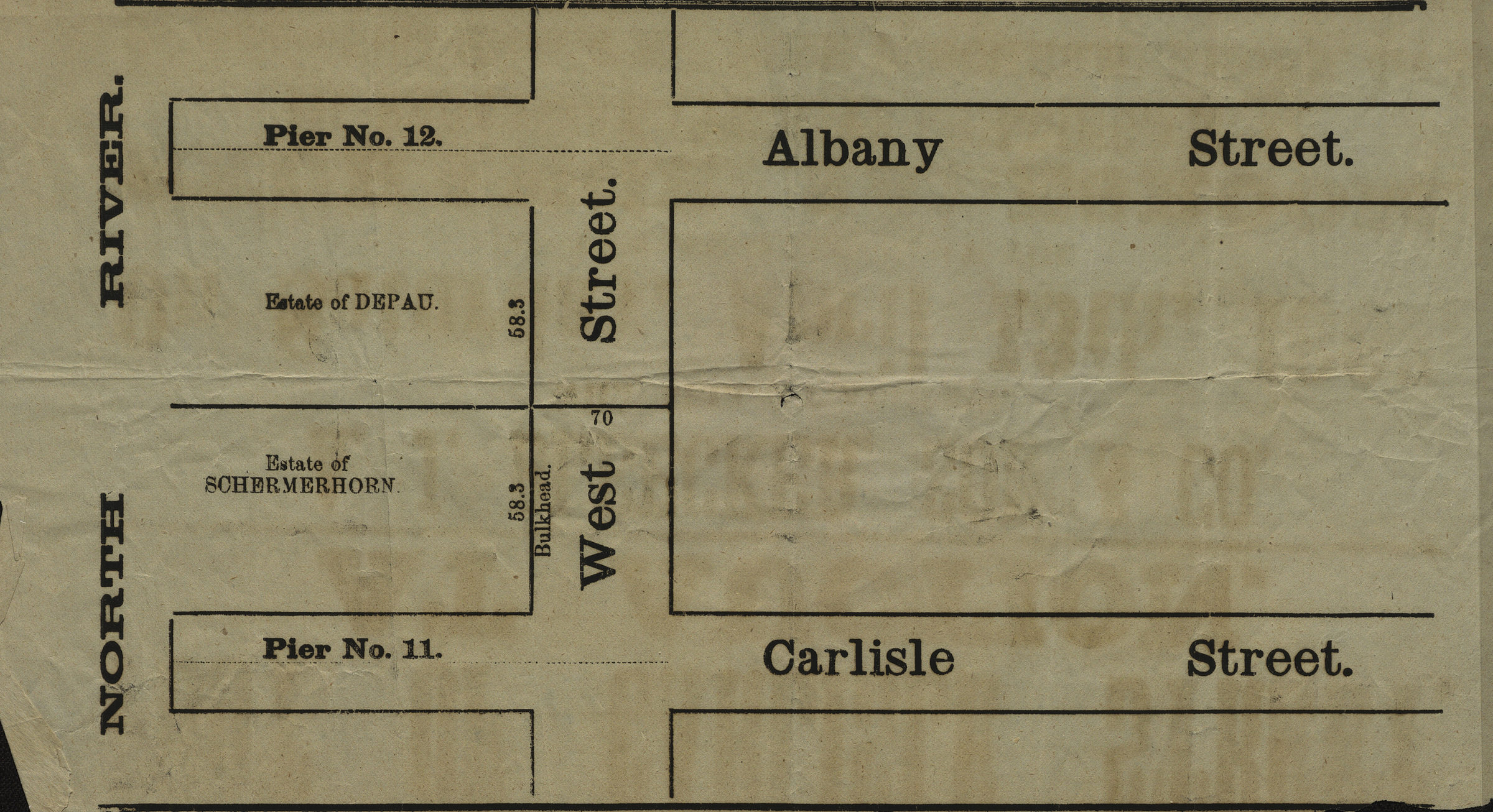
[Map showing area north from Carlisle St. to Albany St. and east from the North River to approximately West St.]. [18??]
Map No. M-[18--?].Fl
Cadastral map covering area in modern-day Battery Park City. Shows property (including dimensions), portions of the Depau and Schermerhorn estates, and piers. Title devised by cataloger. Extracted from a larger map?
Map area shown
Genre
Cadastral mapsRelation
Full catalog recordSize
16 × 31 cmDownload
Low Resolution Image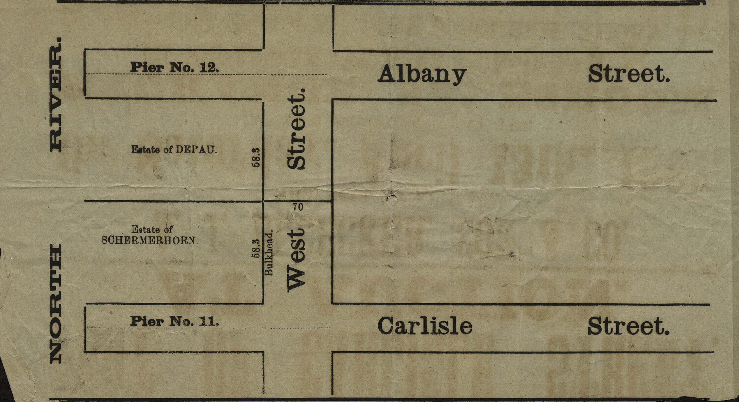
Creator
Publisher
Brooklyn Historical SocietyCitation
[Map showing area north from Carlisle St. to Albany St. and east from the North River to approximately West St.].; [18??], Map Collection, M-[18--?].Fl; Brooklyn Historical Society.Scale
Scale not givenLoading zoom image...