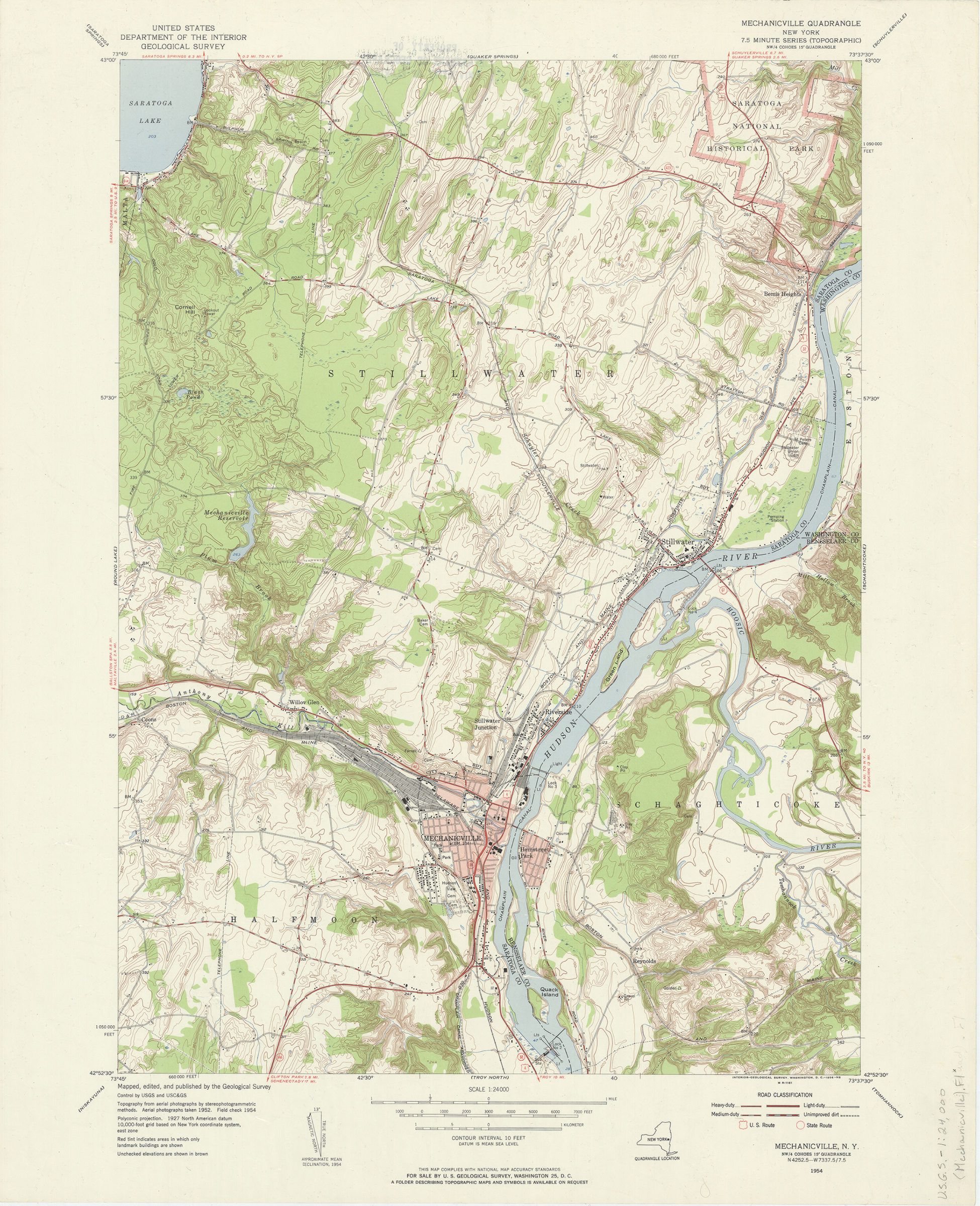
Mechanicville quadrangle, New York: mapped, edited, and published by the Geological Survey 1956
Map No. USGS-1:24,000 (Mechanicville).Fl
Shows portions of Saratoga, Rensselaer, and Washington Counties. Relief shown by contours and spot heights. “Topography from aerial photographs by stereophotogrammetric methods. Aerial photographs taken 1952. Field check 1954.” “Contour interval 10 feet.” “NW/4 Cohoes 15? quadrangle.” Includes quadrangle location map, metric conversion scale, and declination diagram. “M R-1161.”
Map area shown
Genre
Topographic mapsRelation
Full catalog recordSize
69 × 56 cmDownload
Low Resolution Image
Creator
Geological Survey (U.S.),Publisher
Brooklyn Historical SocietyCitation
Mechanicville quadrangle, New York: mapped, edited, and published by the Geological Survey; 1956, Map Collection, USGS-1:24,000 (Mechanicville).Fl; Brooklyn Historical Society.Scale
Scale 1:24,000Loading zoom image... 