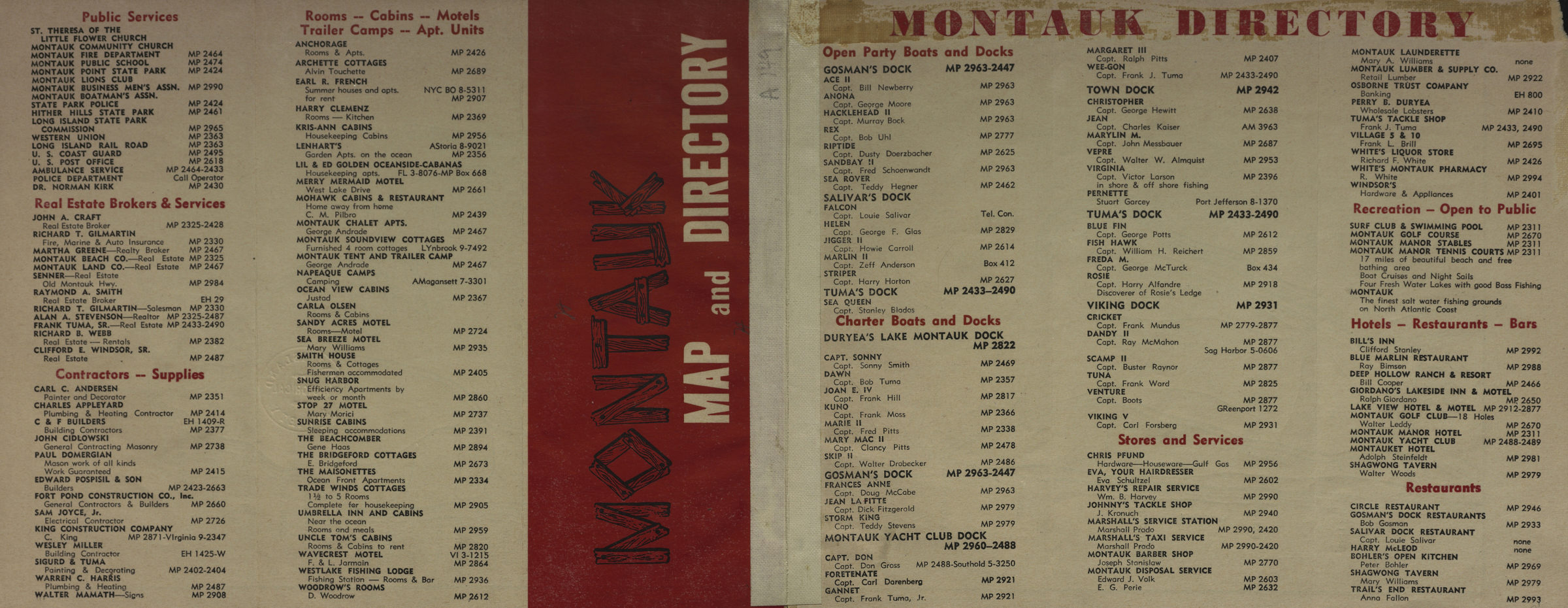
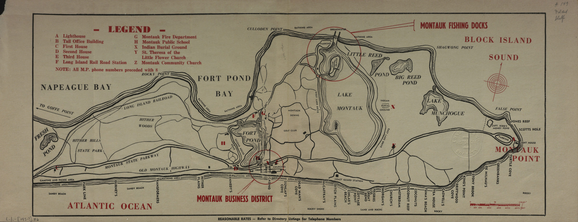
Montauk map and directory [195?]
Map No. L.I.-[195-?]b.Fl
Panel title. Covers the South Fork of Long Island from Fresh Pond to Montauk Point. Shows lakes and ponds, major roads, bathing areas, and places of interest. On verso: directory of businesses.
Map area shown
Genre
Tourist mapsRelation
Full catalog recordSize
22 × 56 cmDownload
Low Resolution Image
Creator
Publisher
Brooklyn Historical SocietyCitation
Montauk map and directory; [195?], Map Collection, L.I.-[195-?]b.Fl; Brooklyn Historical Society.Scale
Scale approximately 1:33,Loading zoom image... 