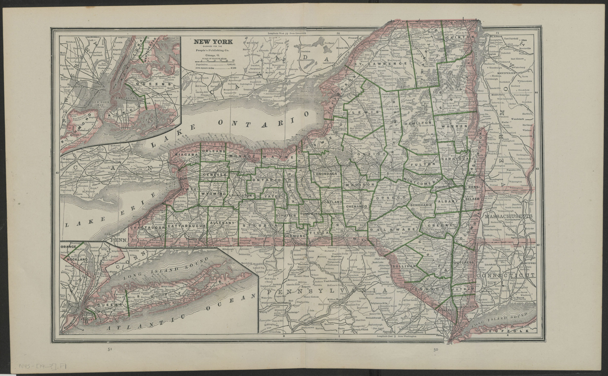
New York [19??]
Map No. NYS-[19--?].Fl
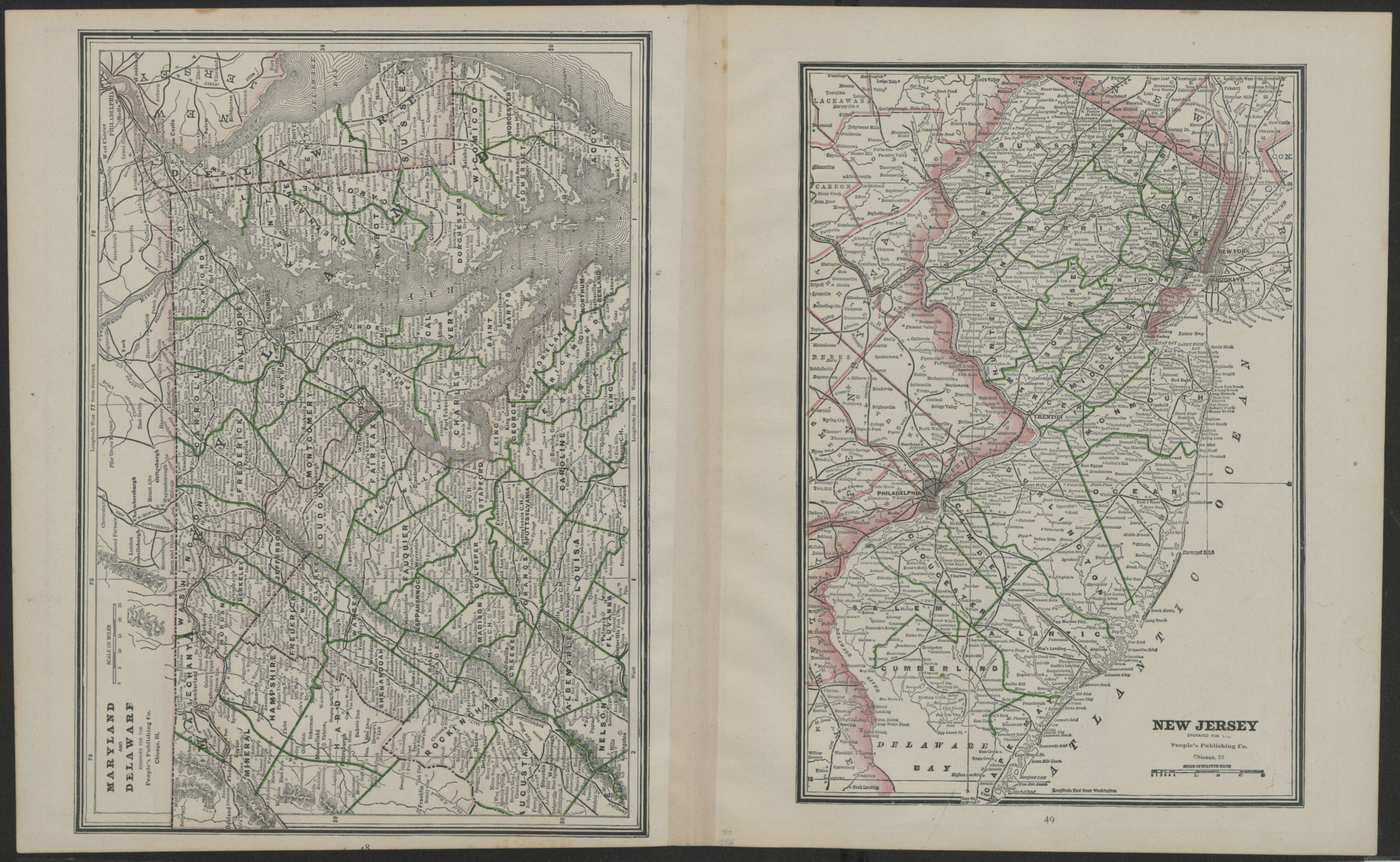
Shows counties. Extracted from an unknown atlas. Includes inset maps of the New York Metropolitan area and Long Island. On verso: maps of Maryland and Delaware, and New Jersey.
Map area shown
Genre
MapRelation
Full catalog recordSize
28 x41 cmDownload
Low Resolution Image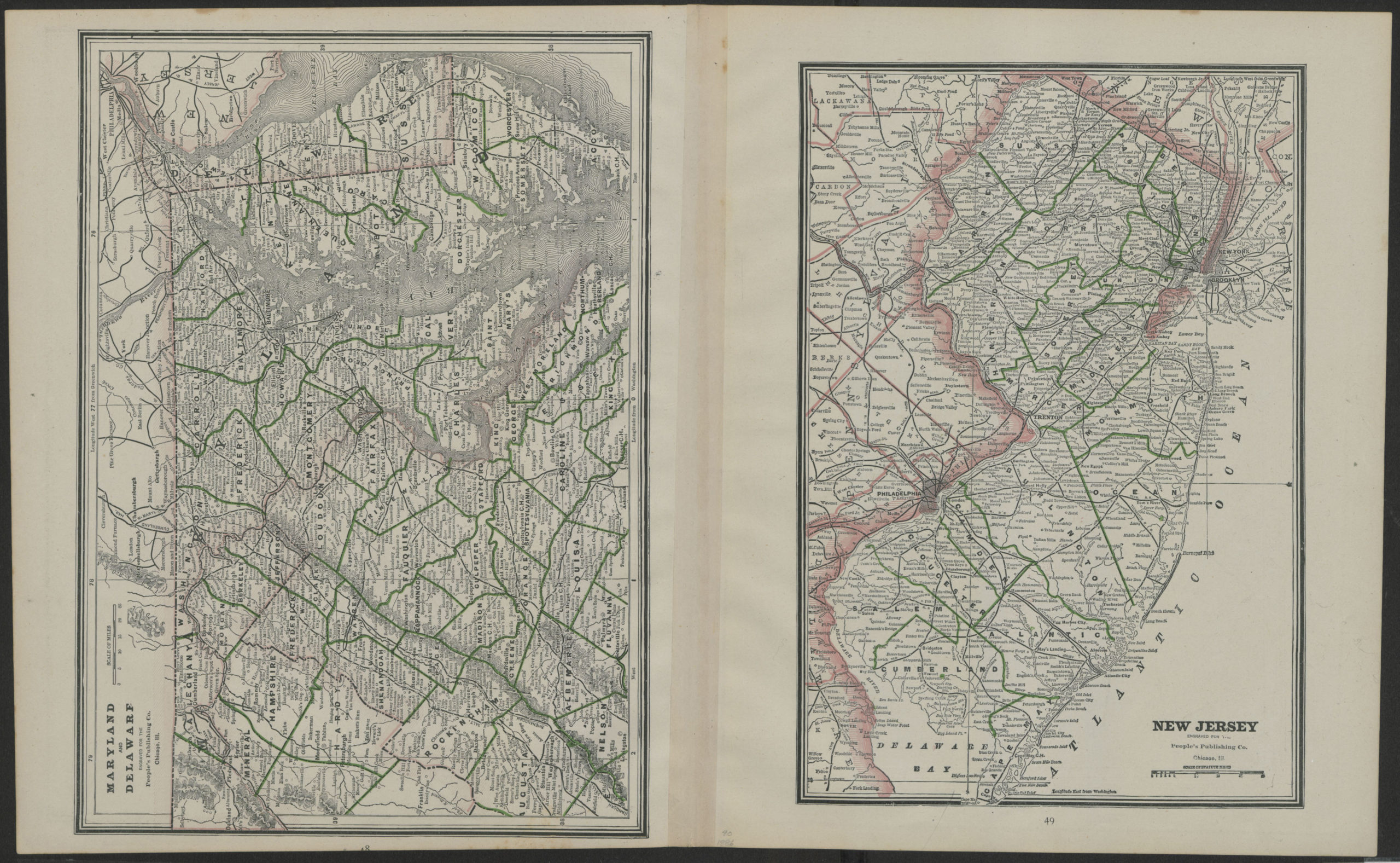
Creator
People's Publishing Company,Publisher
Brooklyn Historical SocietyCitation
New York; [19??], Map Collection, NYS-[19--?].Fl; Brooklyn Historical Society.Scale
Scale approximately 1:1,3Loading zoom image... 