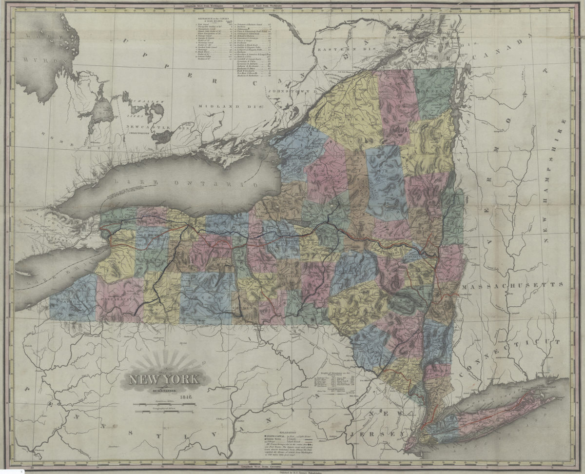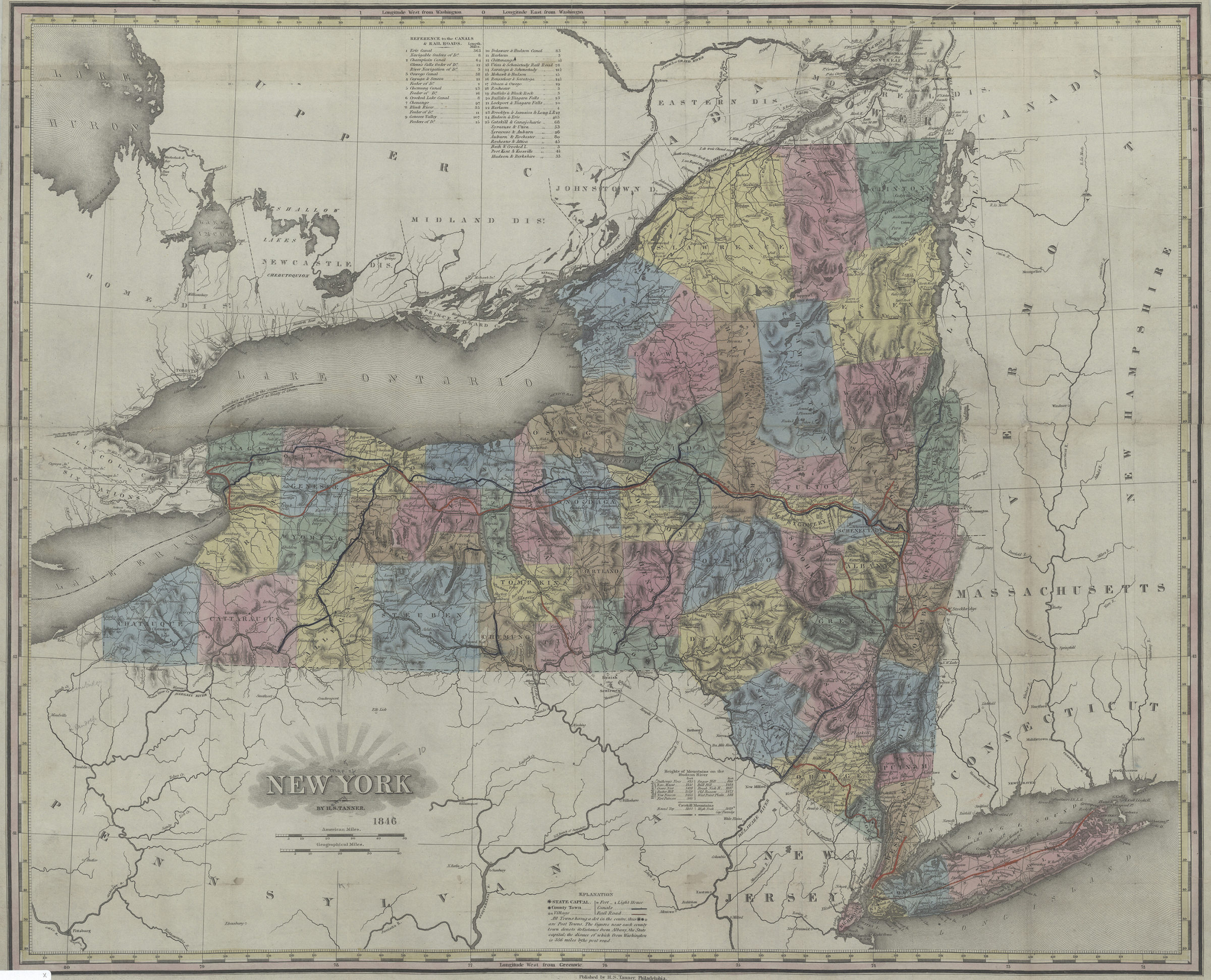
New York: by H.S. Tanner 1846
Map No. NYS-1846.Fl
Shows counties, rivers, streams, lakes, canals, railroads, forts and lighthouses. Relief shown by hachures and spot heights in feet. Prime meridians: Washington and Greenwich. Includes index to the canals & railroads with lengths as well as a chart of the heights of mountains on the Hudson River and in the Catskills. BHS copy mounted on linen and annotated in red and blue ink.
Map area shown
Genre
Topographic mapsRelation
Full catalog recordSize
52 × 65 cmDownload
Low Resolution Image
Creator
Tanner, Henry Schenck,Publisher
Brooklyn Historical SocietyCitation
New York: by H.S. Tanner; 1846, Map Collection, NYS-1846.Fl; Brooklyn Historical Society.Scale
Scale [ca. 1:1,150,000]Loading zoom image...