New York statewide comprehensive recreation plan [1990]
Map No. NYS-[1990?].Fl.O
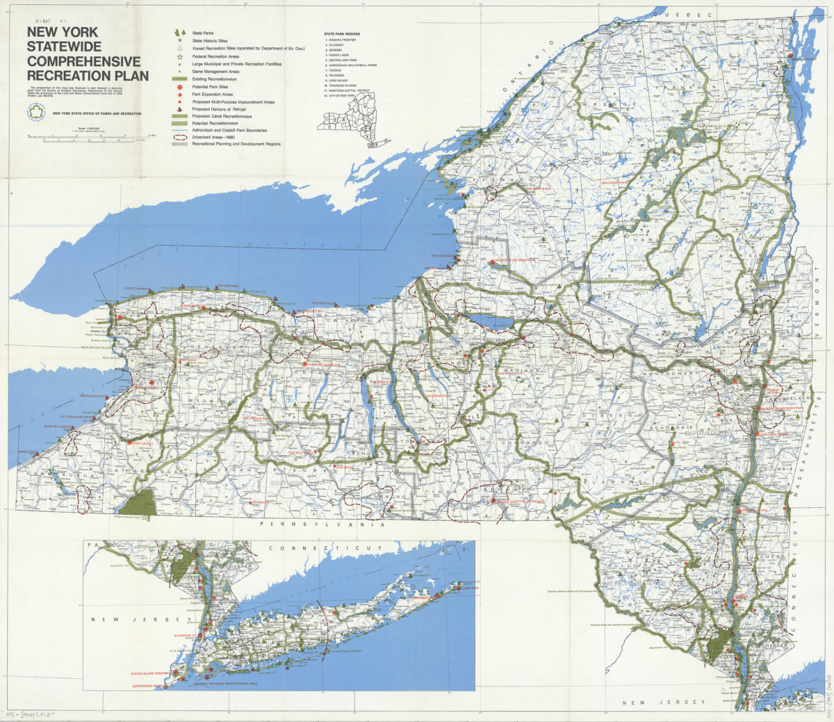
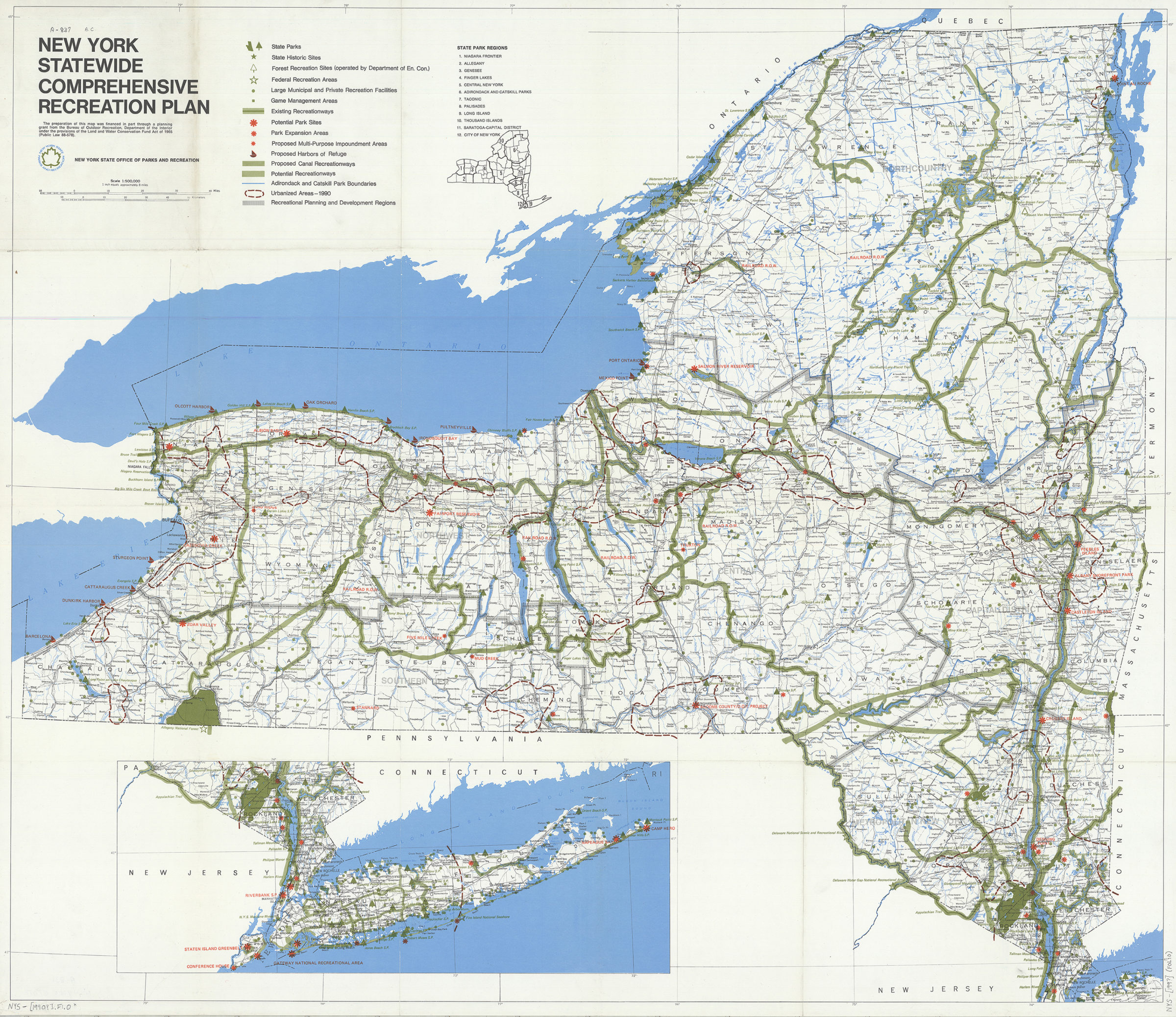
Shows Federal, State, local and private parks, historic sites, recreation areas, preserves, and urbanized areas. Shows existing and potential recreational sites. Includes legend and location map of State park regions. Mapping continued on inset.
Map area shown
Genre
MapRelation
Full catalog recordSize
94 × 109 cmDownload
Low Resolution Image
Creator
New York (State); Office of Parks and Recreation,Publisher
Brooklyn Historical SocietyCitation
New York statewide comprehensive recreation plan; [1990], Map Collection, NYS-[1990?].Fl.O; Brooklyn Historical Society.Scale
Scale 1:500,000Loading zoom image...