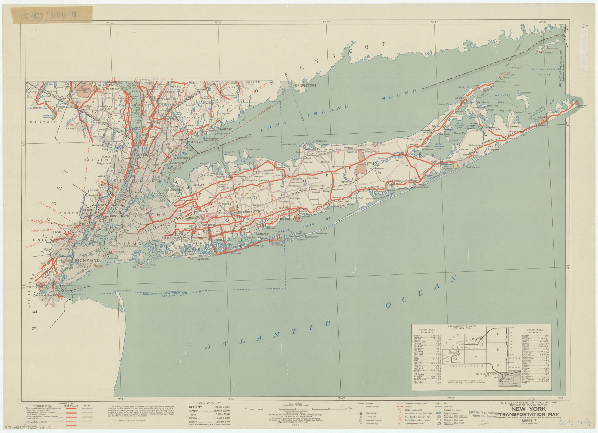
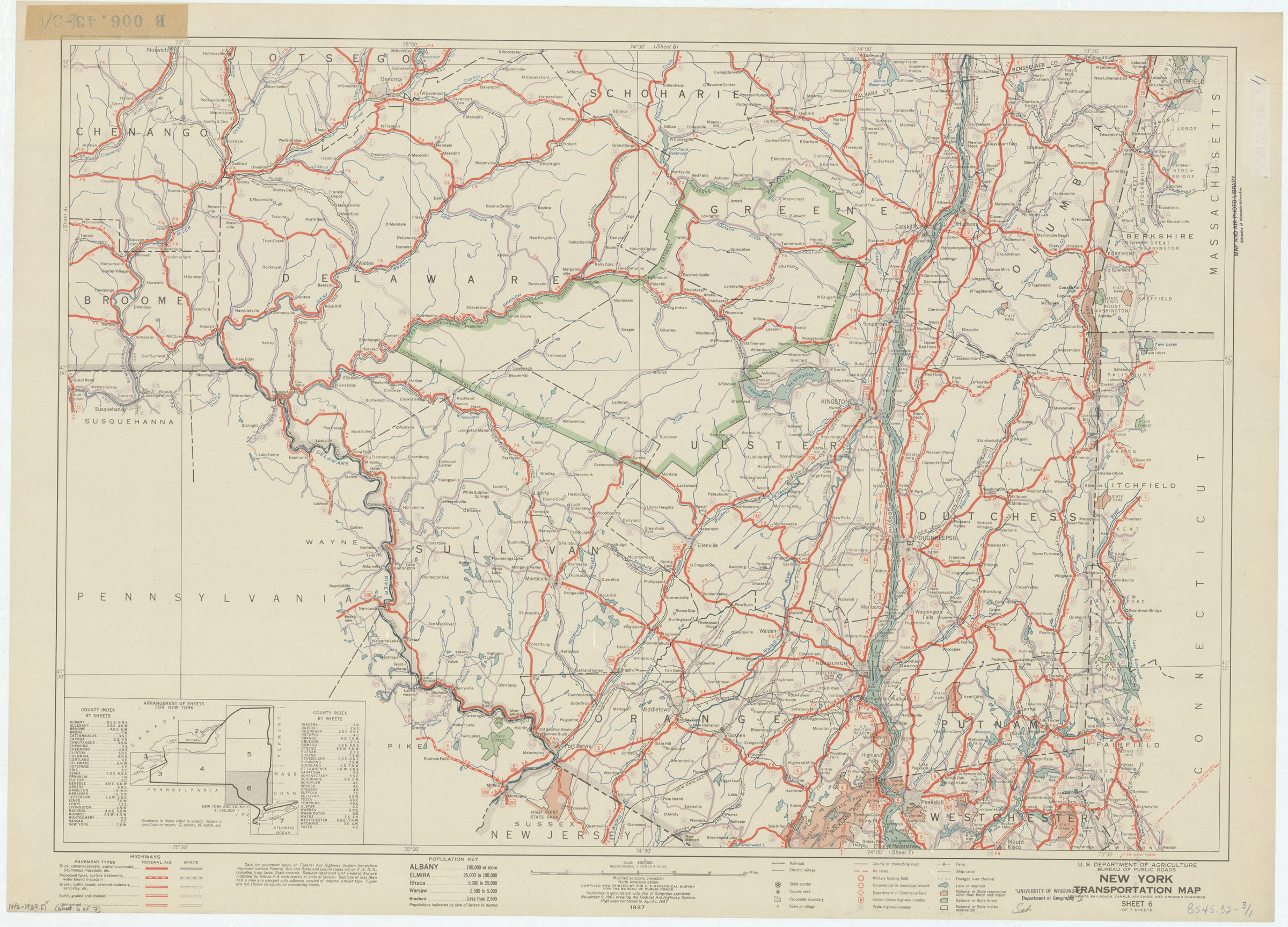
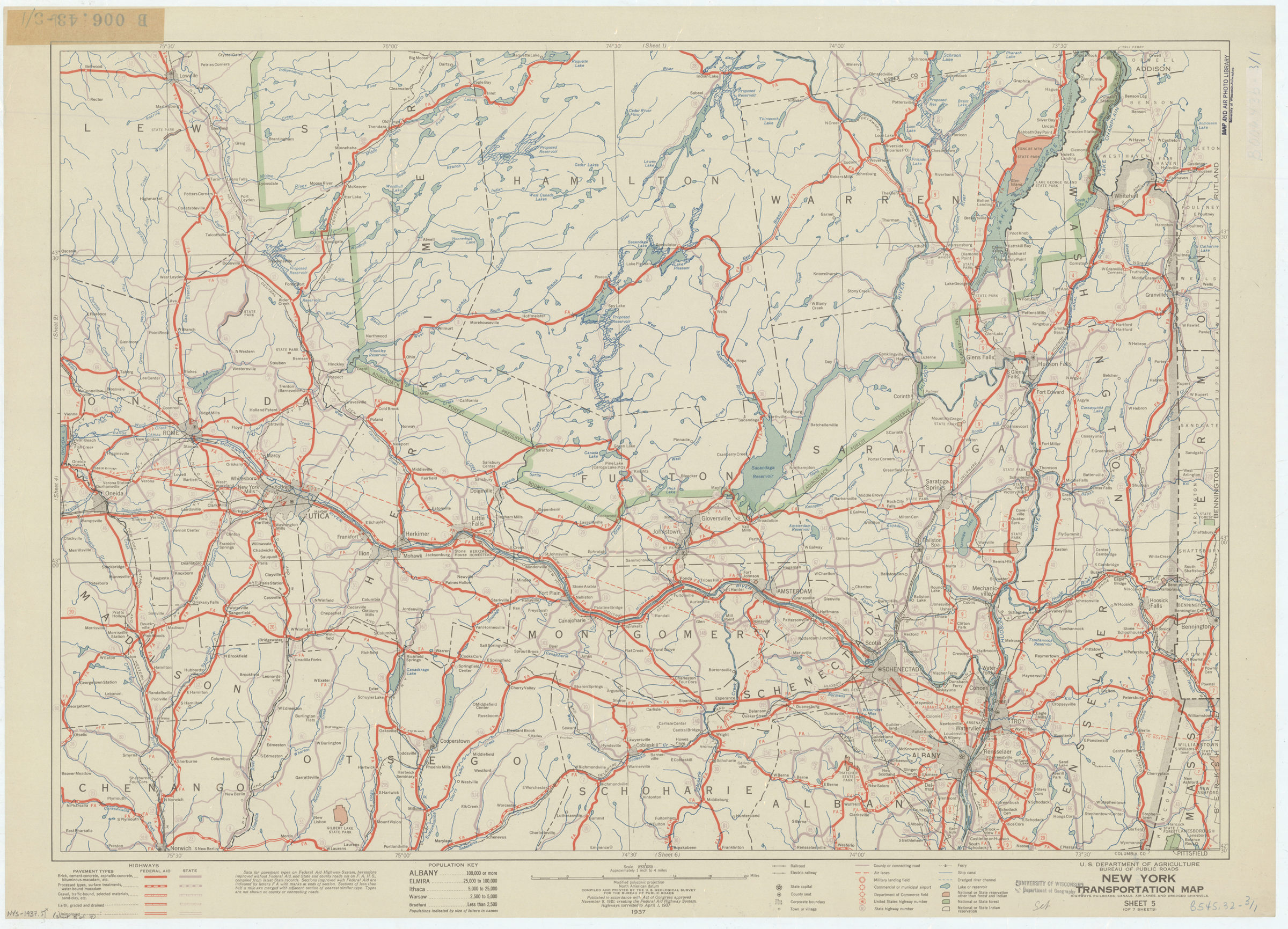
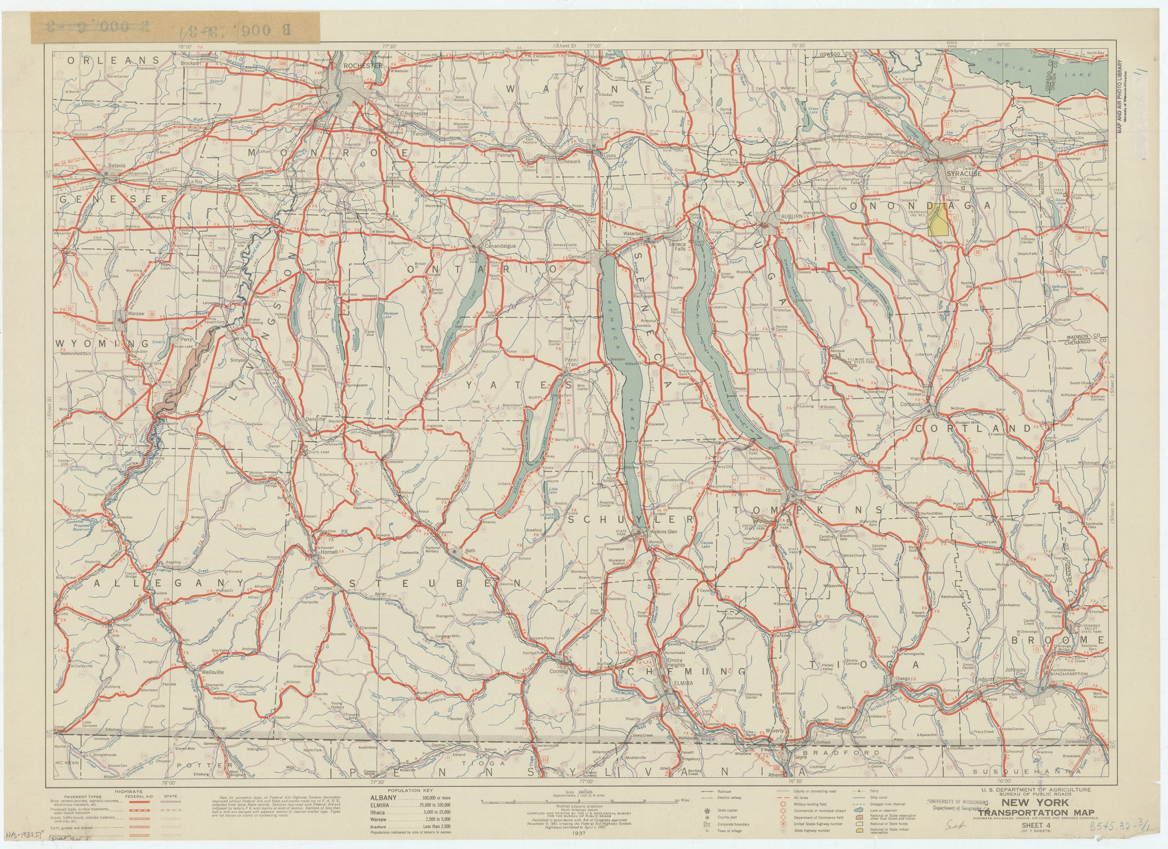
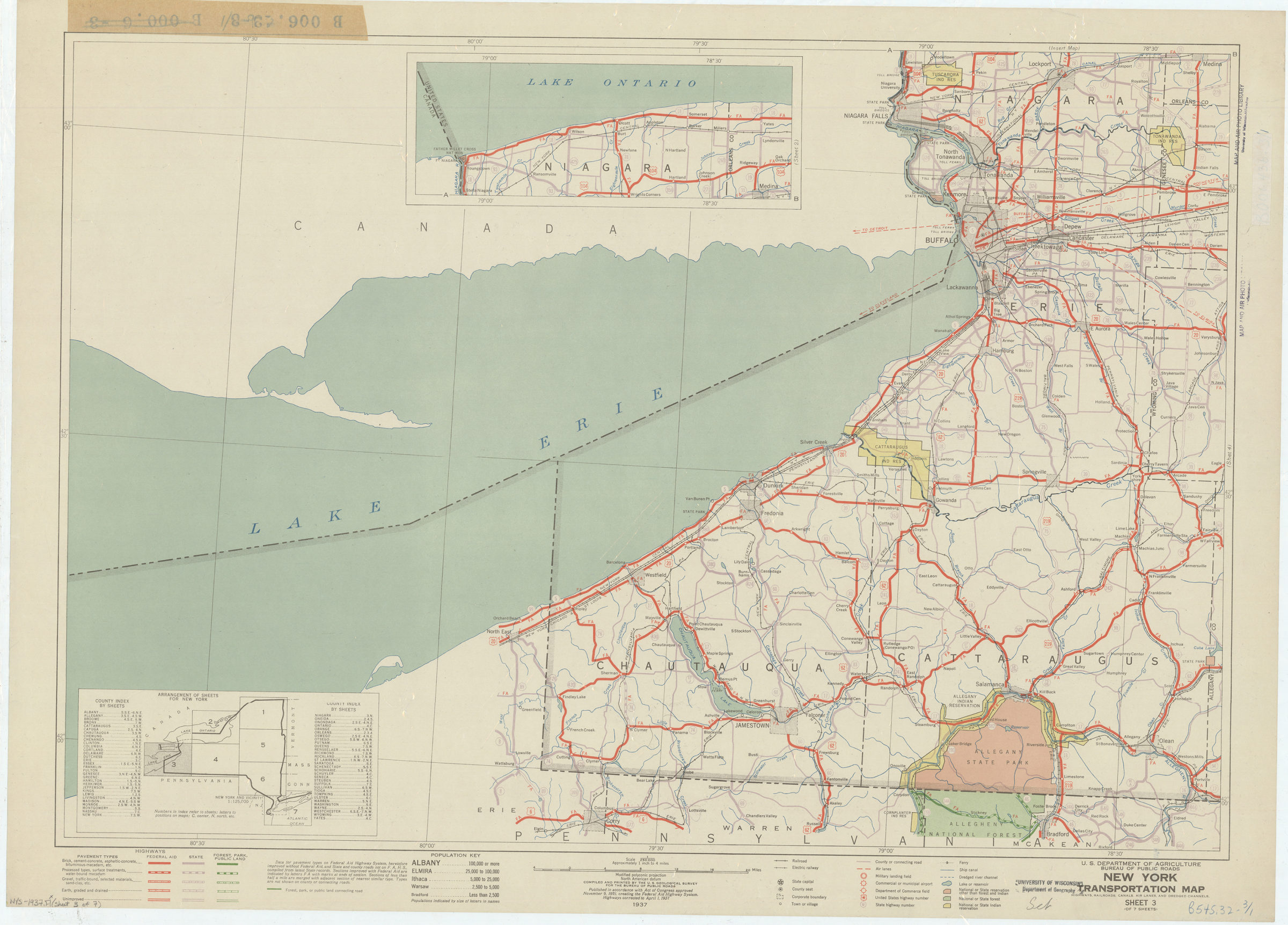
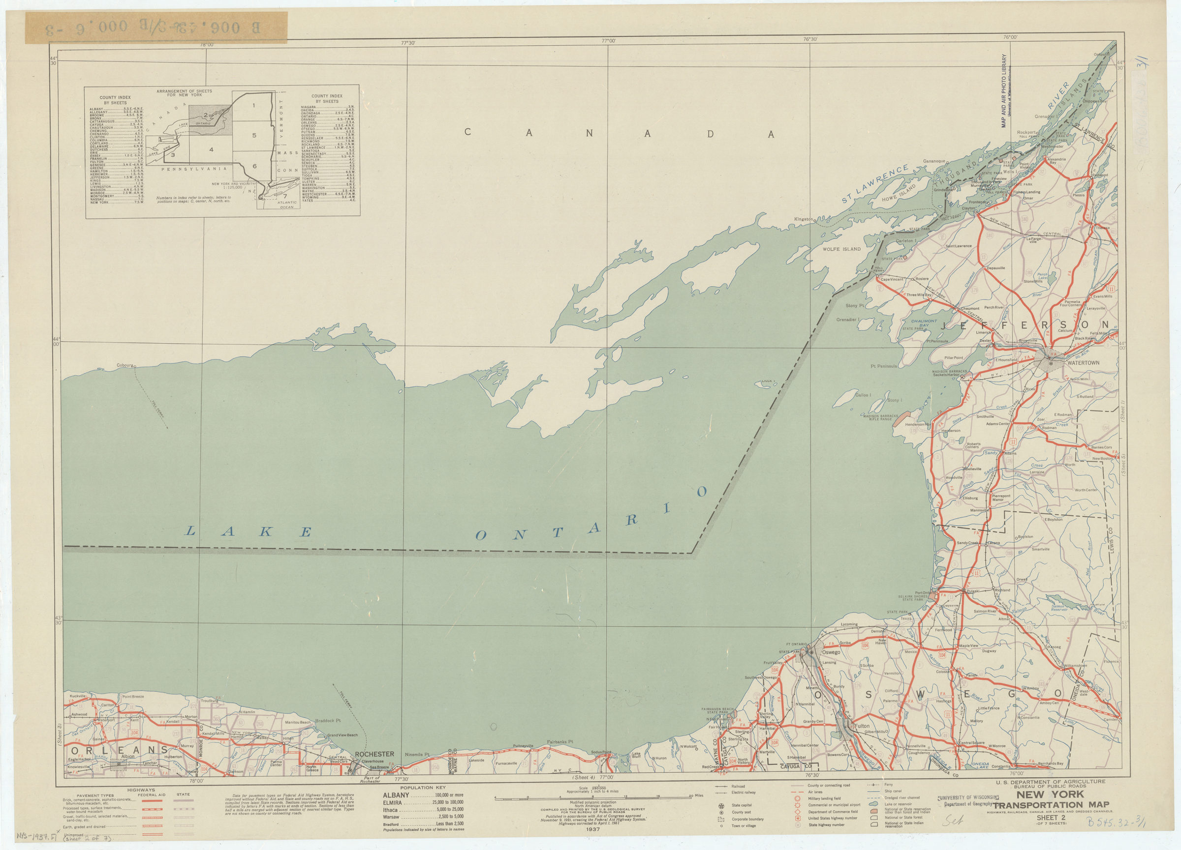

New York transportation map: highways, railroads, canals, air lanes, and dredged channels: compiled and printed by the U.S. Geological Survey for the Bureau of Public Roads 1937
Map No. NYS-1937.Fl
Published in accordance with Act of Congress approved November 9, 1921, creating the Federal Aid Highway System highways corrected to April 1, 1937. Some sheets have an index map.
Subjects
Places
Map area shown
Genre
Transportation mapsRelation
Full catalog recordSize
58 × 83 cmDownload
Low Resolution Image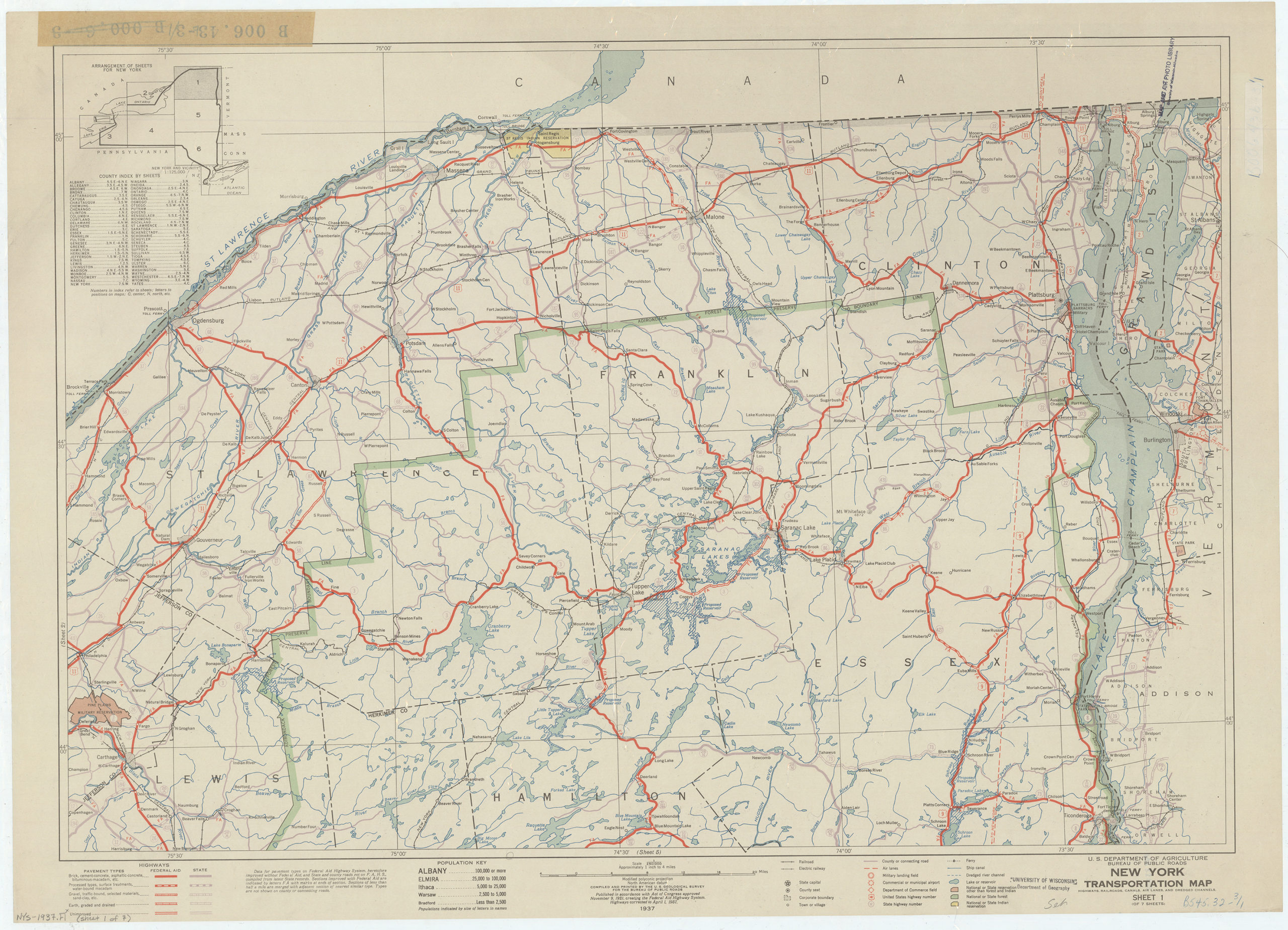
Creator
United States; Bureau of Public Roads,Publisher
Brooklyn Historical SocietyCitation
New York transportation map: highways, railroads, canals, air lanes, and dredged channels: compiled and printed by the U.S. Geological Survey for the Bureau of Public Roads; 1937, Map Collection, NYS-1937.Fl; Brooklyn Historical Society.Scale
Scale 1:250,000. [1 in toLoading zoom image... 