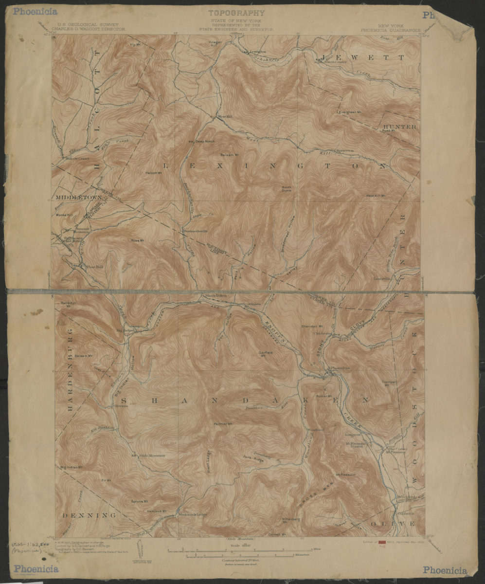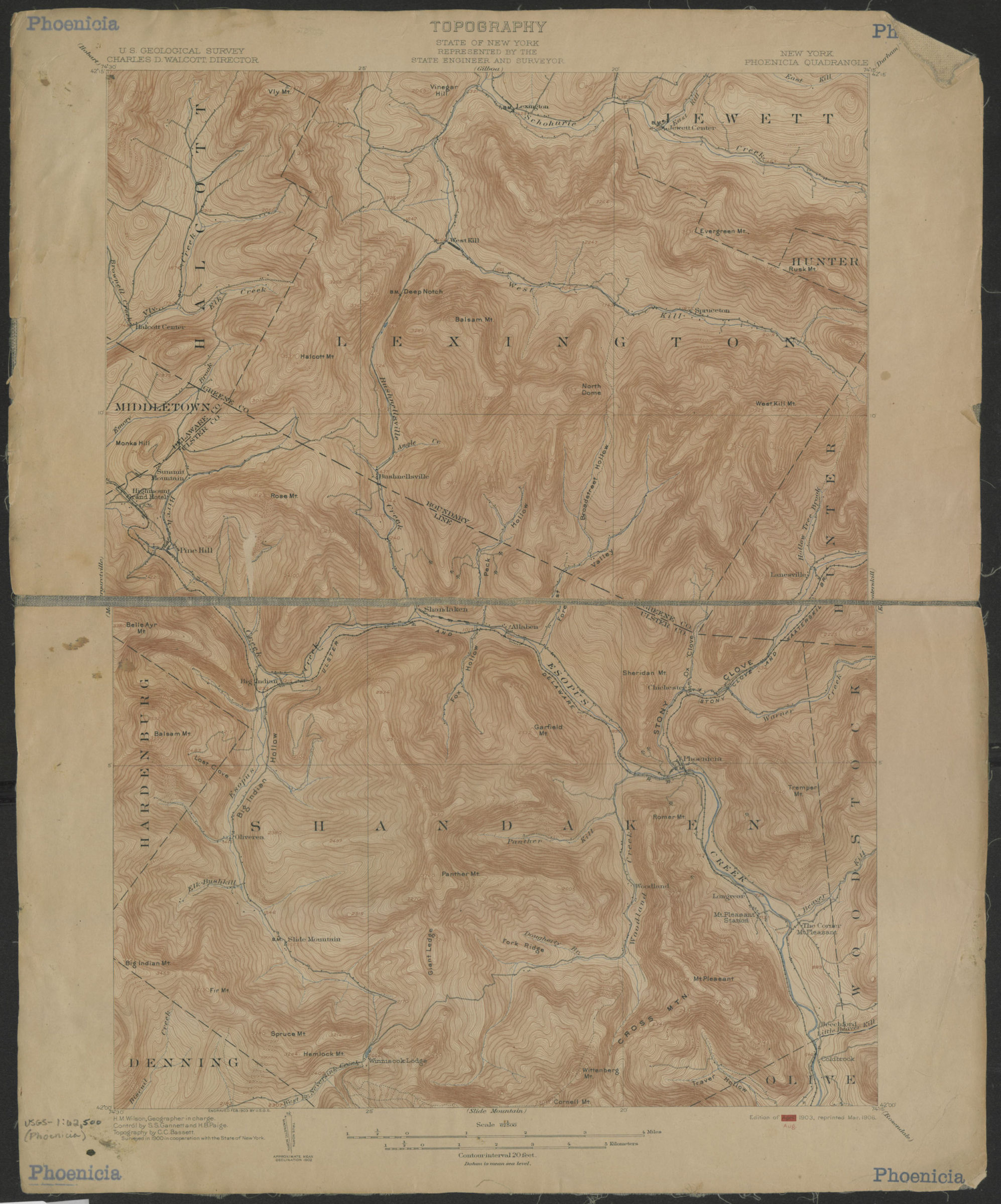
Phoenicia quadrangle, New York: U.S. Geological Survey 1903
Map No. USGS-1:62,500 (Phoenicia).Fl
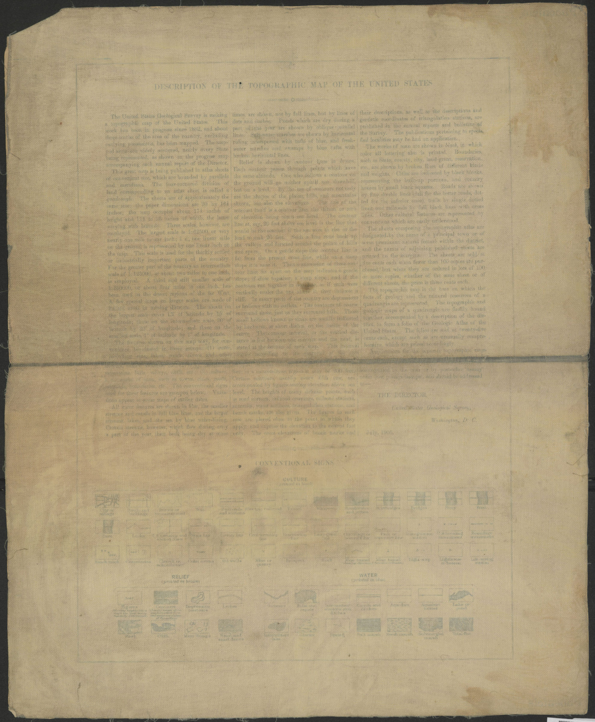
Shows portions of Ulster, Greene and Delaware Counties. “Surveyed in 1900 in cooperation with the State of New York.” Relief shown by contours and spot heights. “H.M. Wilson, Geographer in charge. Control by S.S. Gannett and H.B. Paige. Topography by C.C. Bassett.” “Engraved Feb.1903 by the U.S.G.S.” “”Edition of Aug. 1903, reprinted Mar. 1906.” Text and legend on verso. BHS copy dissected and mounted on linen.
Map area shown
Genre
Topographic mapsRelation
Full catalog recordSize
51 × 42 cmDownload
Low Resolution Image
Creator
Geological Survey (U.S.),Publisher
Brooklyn Historical SocietyCitation
Phoenicia quadrangle, New York: U.S. Geological Survey; 1903, Map Collection, USGS-1:62,500 (Phoenicia).Fl; Brooklyn Historical Society.Scale
Scale 1:62,500Loading zoom image...