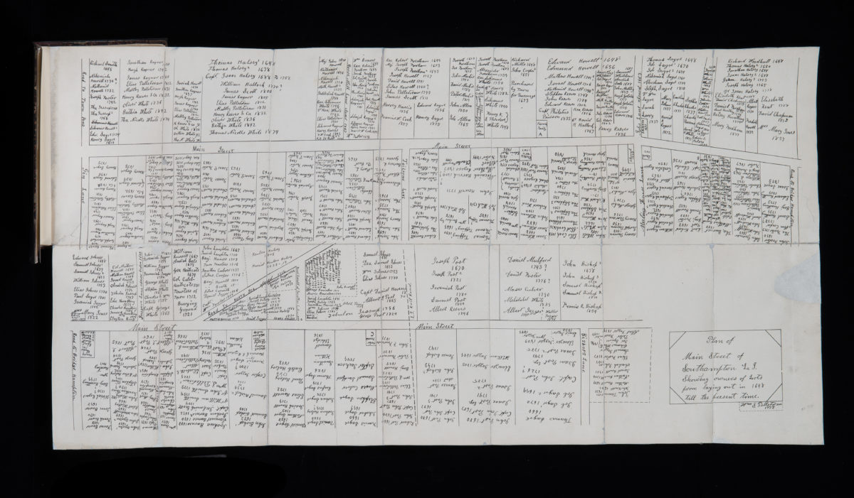
Plan of Main Street of Southampton, L.I., showing owners of lots from laying out in 1648 till the present time: by William S. Pelletreau 1878
Map No. L.I.-1878.Fd
Cadatral map showing property owners from 1648 to 1878 on Southampton’s Main Street from Gin Lane to Bishops Lane. BHS copy is folded into a book sized 21 x 15 cm.
Map area shown
Genre
Cadastral mapsRelation
Full catalog recordSize
83 × 41 cmDownload
Low Resolution Image
Creator
Pelletreau, William S.,Publisher
Brooklyn Historical SocietyCitation
Plan of Main Street of Southampton, L.I., showing owners of lots from laying out in 1648 till the present time: by William S. Pelletreau; 1878, Map Collection, L.I.-1878.Fd; Brooklyn Historical Society.Scale
Scale not givenLoading zoom image...