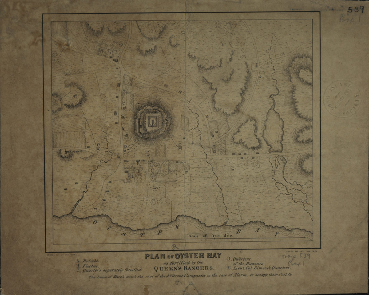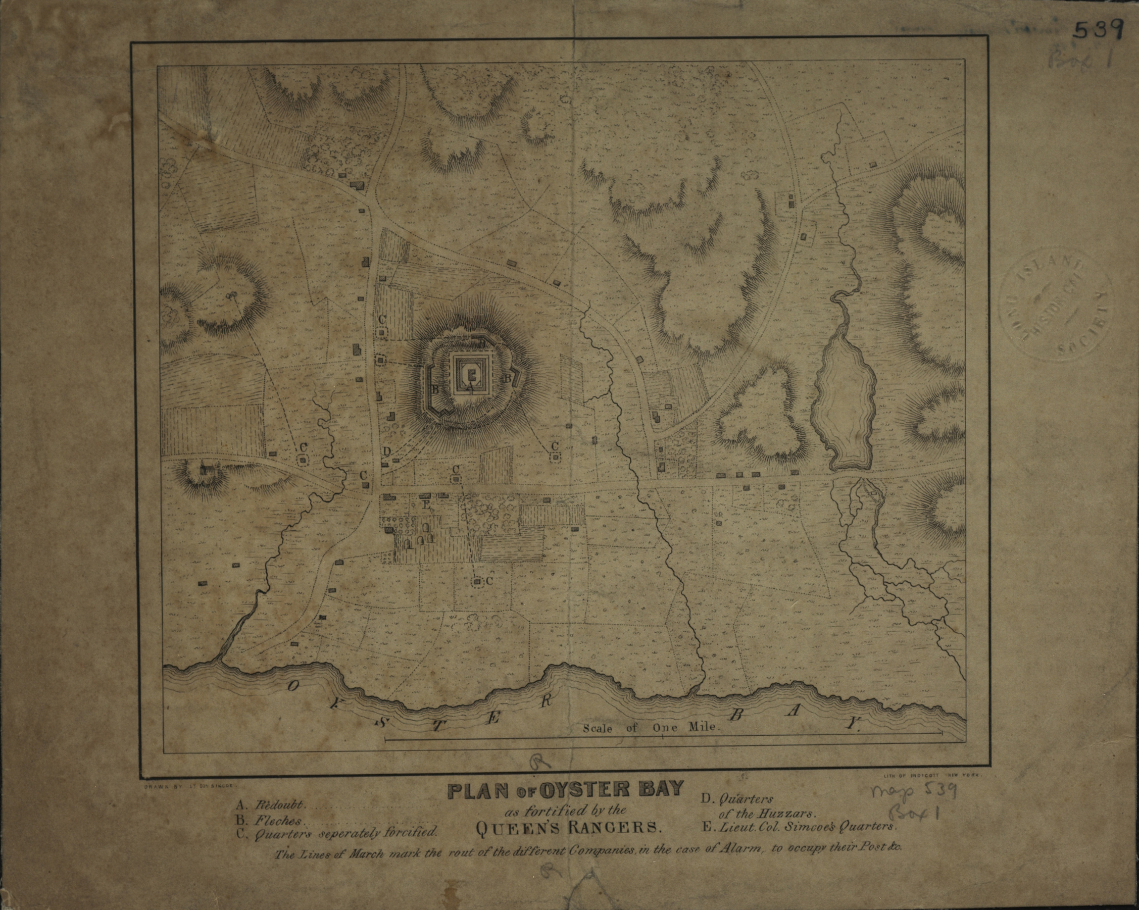
Plan of Oyster Bay as fortified by the Queen’s Rangers: drawn by Lt. Col. Simcoe [1844]
Map No. L.I.-[1787?] (184-?).Fl
Shows company marching lines in case of alarm. Relief shown by hachures. Detached from Simcoe’s military journal, 1844. Includes index to points of interest.
Map area shown
Genre
MapRelation
Full catalog recordSize
18 × 21 cmDownload
Low Resolution ImageCreator
Simcoe, John Graves, Simcoe, John Graves,Publisher
Brooklyn Historical Society, Brooklyn Historical SocietyCitation
Plan of Oyster Bay as fortified by the Queen’s Rangers: drawn by Lt. Col. Simcoe; [1844], Map Collection, L.I.-[1787?] (184-?).Fl; Brooklyn Historical Society.Scale
Scale [ca. 1:11,300]Loading zoom image...