Center for Brooklyn History
Map Collections
Search
About
Othmer Library & Archives
Submit search query
Refine 9 records
Clear filter
1
Location
Fairfield County (Conn.)
5
Glen Cove (N.Y.)
1
Hell Gate (New York, N.Y.)
2
Hicksville (N.Y.)
1
Huntington (N.Y.)
7
Long Island (N.Y.)
197
Long Island Sound (N.Y. and Conn.)
12
Nassau County (N.Y.)
24
North Hempstead (N.Y. : Town)
4
Oyster Bay (N.Y.)
9
Westchester County (N.Y.)
11
Subject
Fortification
7
Indian land transfers
1
Landowners
434
Nautical charts
14
Real property
619
Date
19th Century
945
20th Century
469
or enter range:
from
to
Genres
Cadastral maps
597
Early maps
35
Historical maps
53
Map
191
Nautical charts
30
Topographic maps
70
Sort by:
Date (earliest)
Date (most recent)
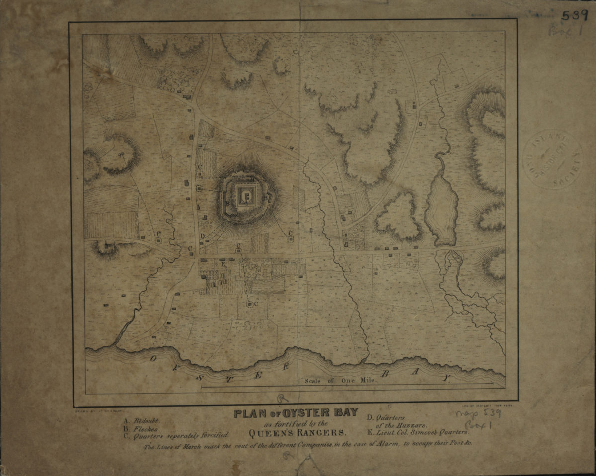
Plan of Oyster Bay as fortified by the Queen’s Rangers: drawn by Lt. Col. Simcoe
Plan of Oyster Bay as fortified by the Queen’s Rangers: drawn by Lt. Col. Simcoe
[1844]
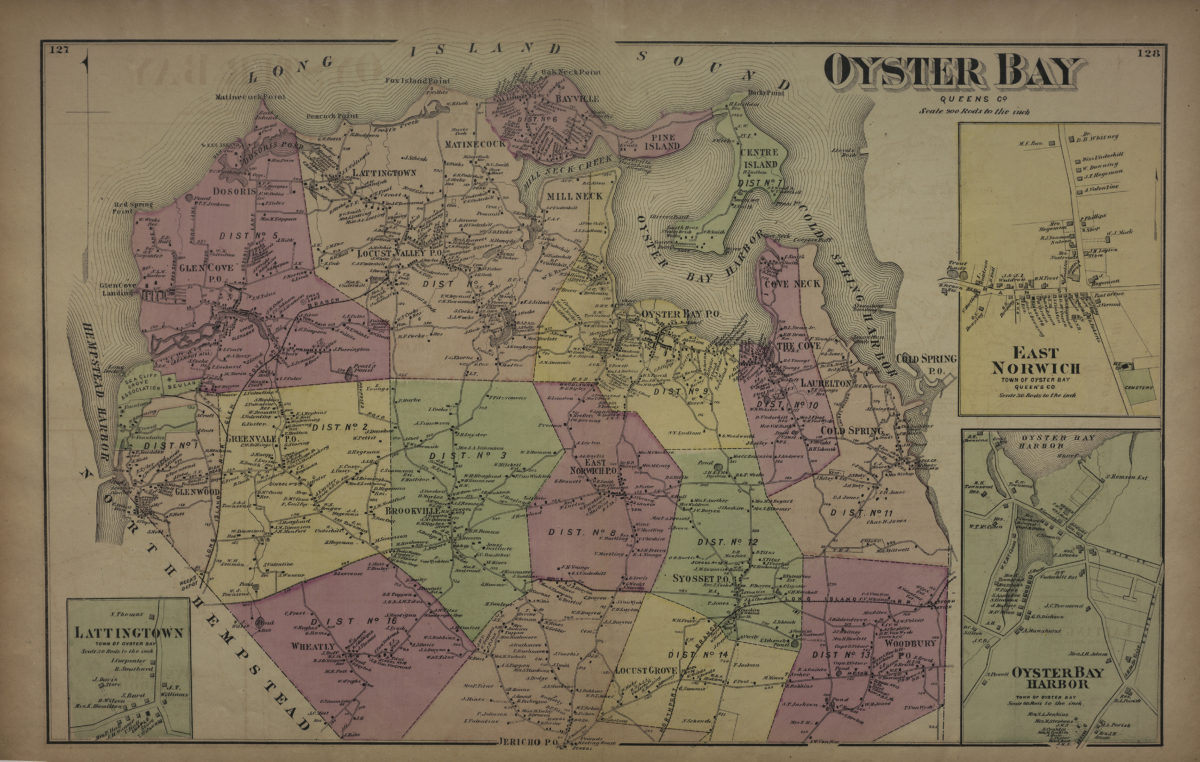
Oyster Bay, Queens Co
Oyster Bay, Queens Co
[1873]
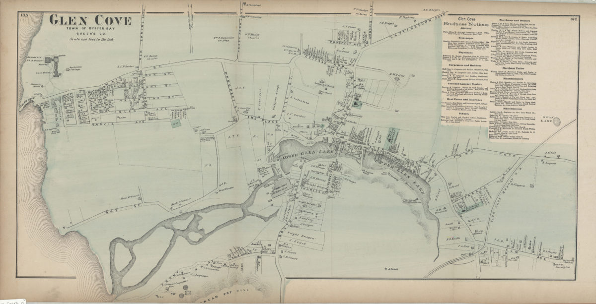
Glen Cove, town of Oyster Bay, Queen’s Co
Glen Cove, town of Oyster Bay, Queen’s Co
[1873]
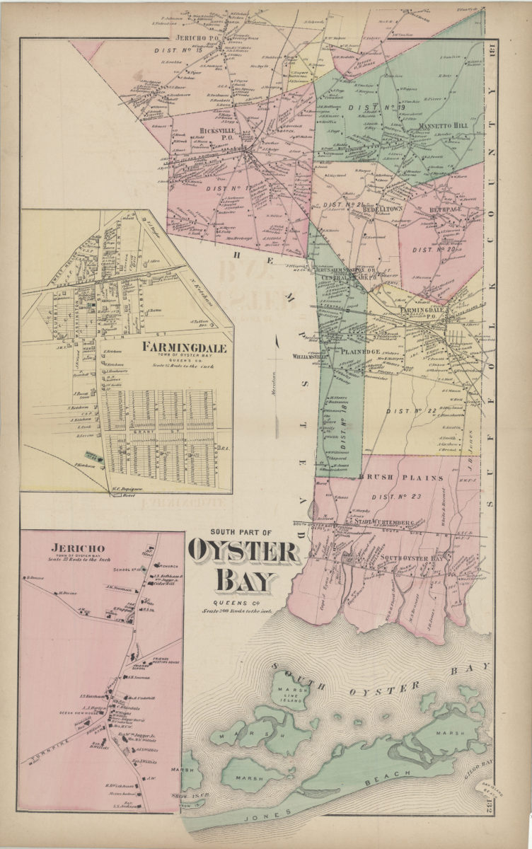
South part of Oyster Bay, Queens Co
South part of Oyster Bay, Queens Co
[1873]
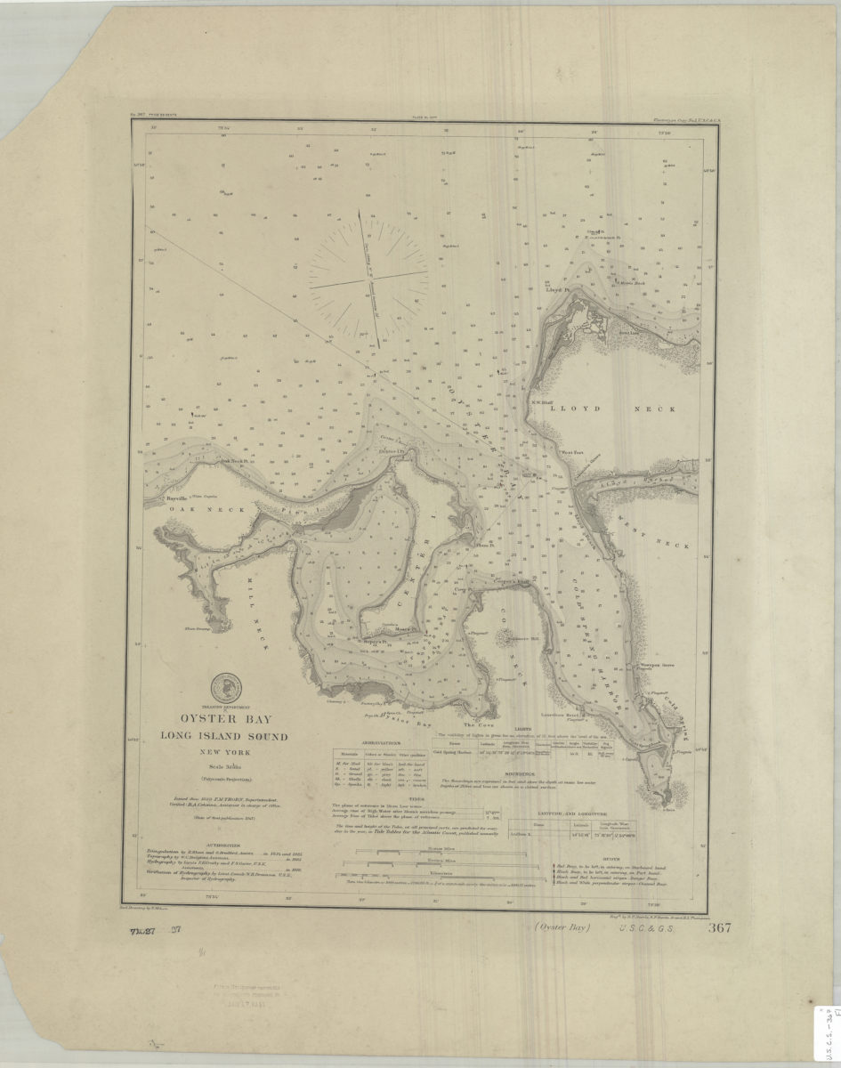
Oyster Bay, Long Island Sound, New York: U.S. Coast and Geodetic Survey ; red. drawing by E. Molkow
Oyster Bay, Long Island Sound, New York: U.S. Coast and Geodetic Survey ; red. drawing by E. Molkow
1889
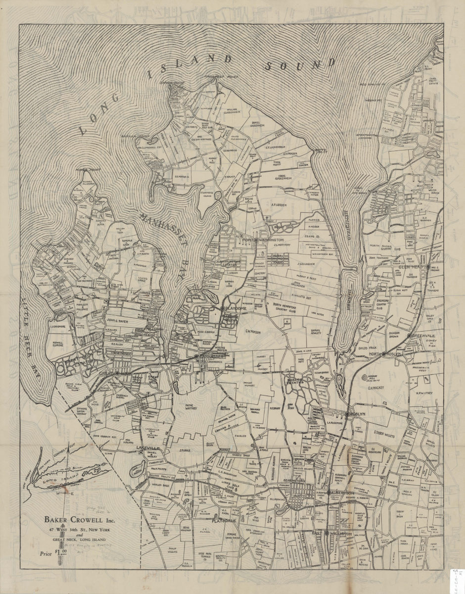
Map of the town of Oyster Bay, N.Y.: John Cox Jr
Map of the town of Oyster Bay, N.Y.: John Cox Jr
[19??]
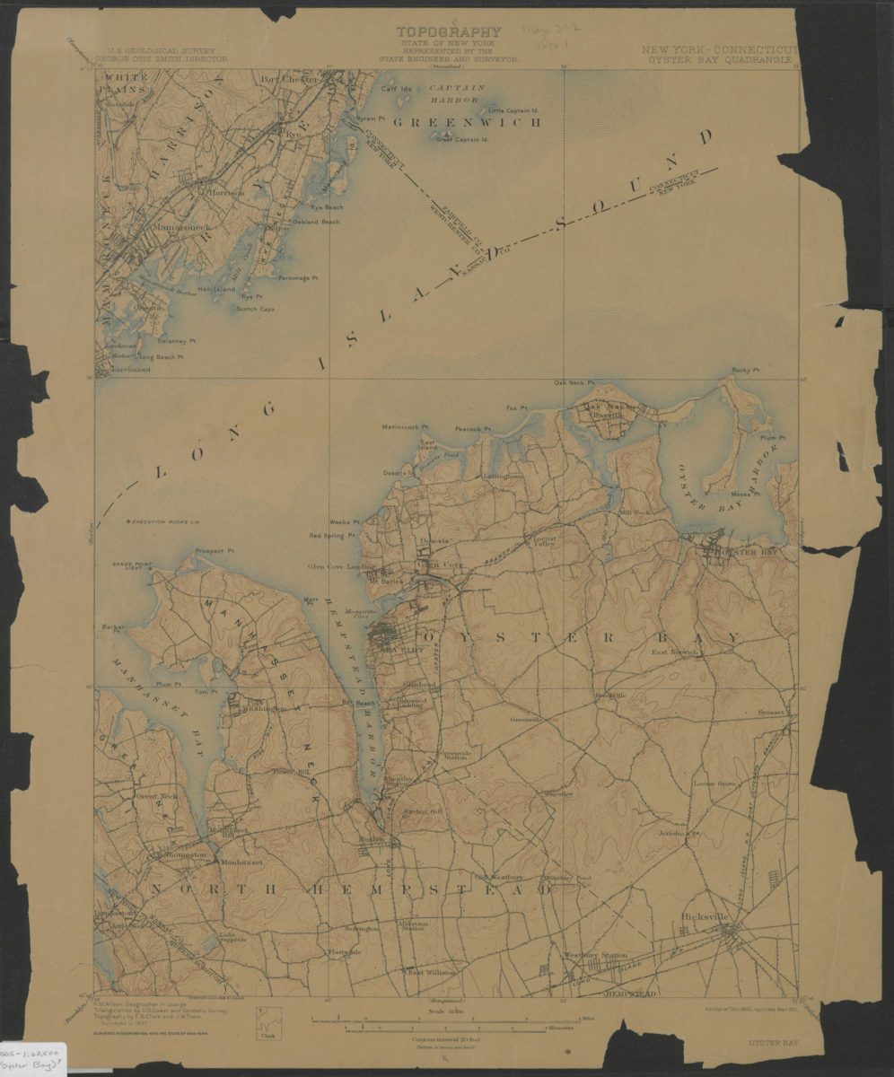
Oyster Bay quadrangle, New York – Connecticut: U.S. Geological Survey
Oyster Bay quadrangle, New York – Connecticut: U.S. Geological Survey
1900; 1911
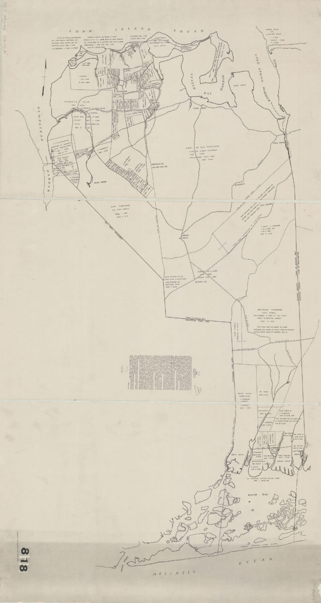
[Property maps of North Hempstead and Oyster Bay Townships, Nassau County, N.Y.]
[Property maps of North Hempstead and Oyster Bay Townships, Nassau County, N.Y.]
[19??]
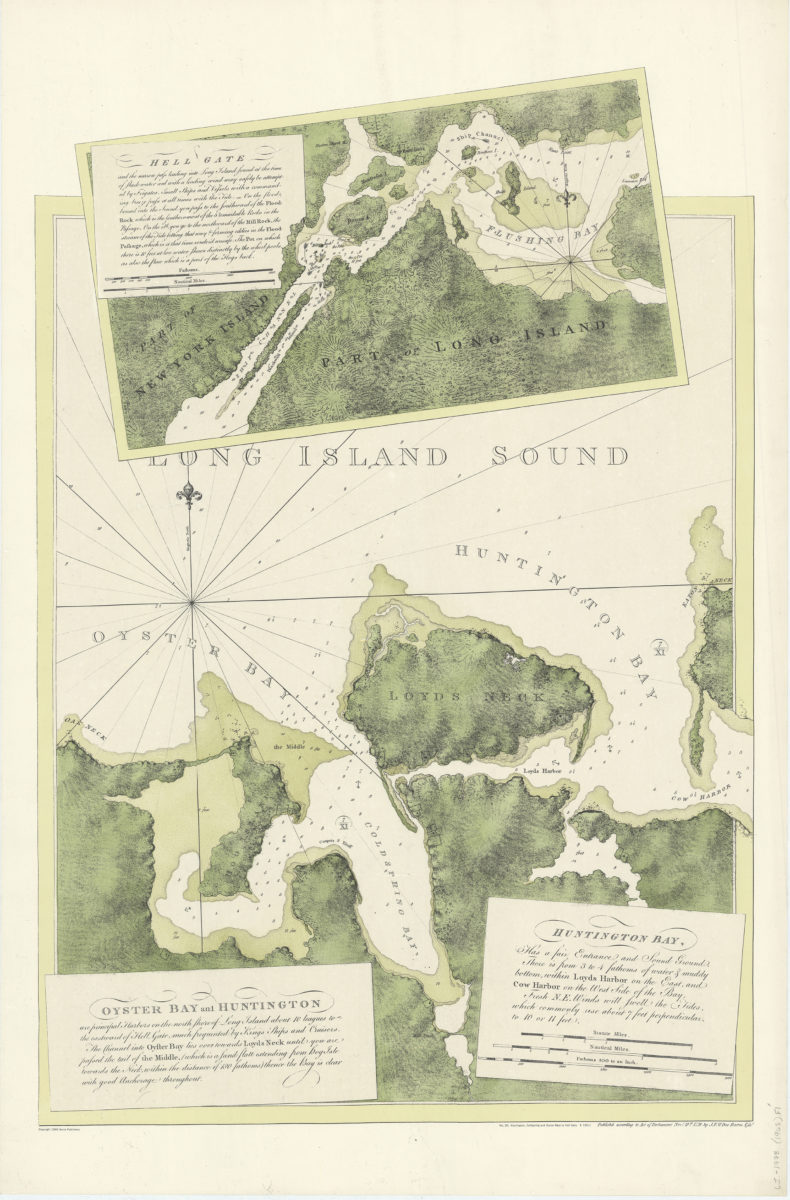
Oyster Bay and Huntington: Huntingon Bay
Oyster Bay and Huntington: Huntingon Bay
[ca. 1968]