Center for Brooklyn History
Map Collections
Search
About
Othmer Library & Archives
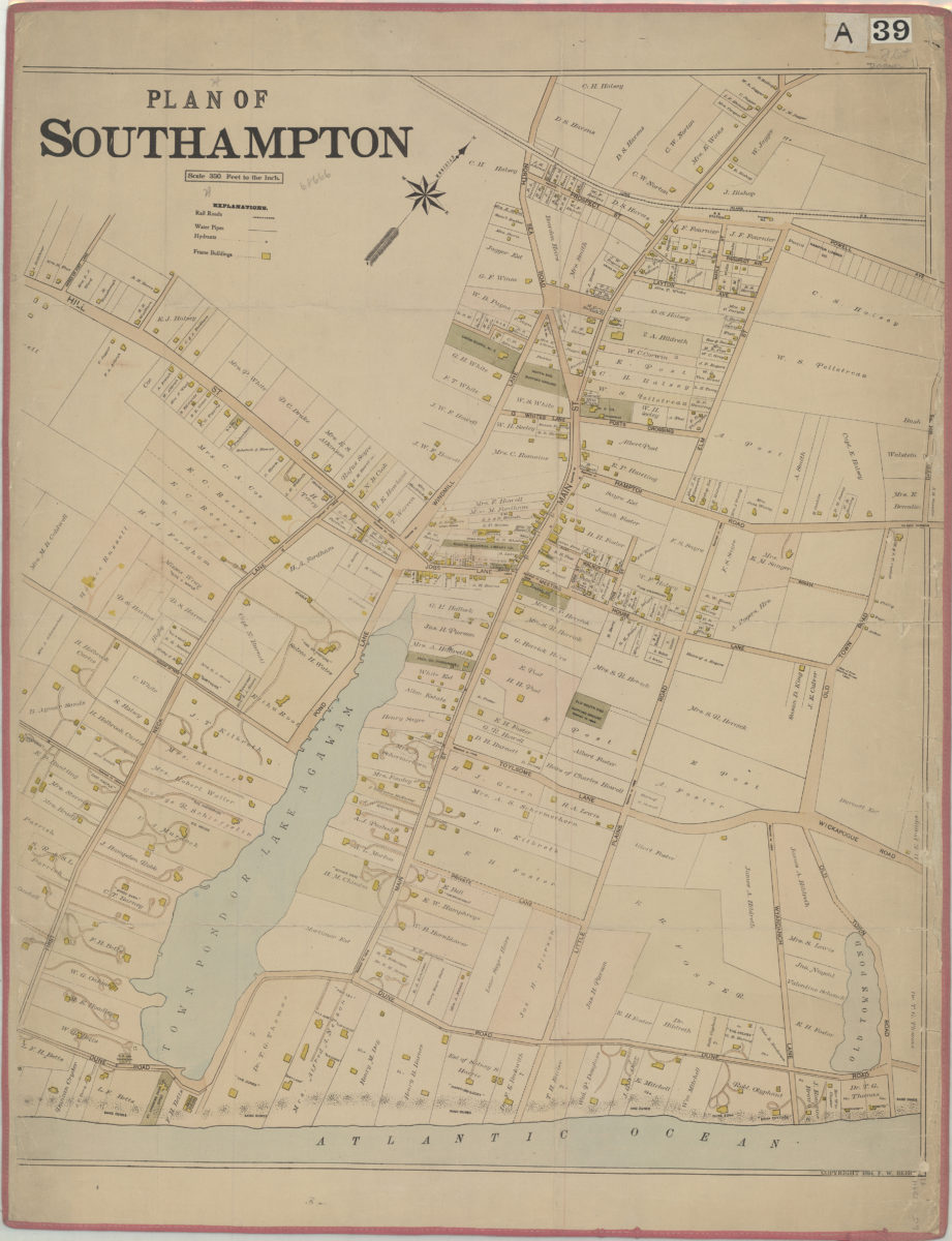
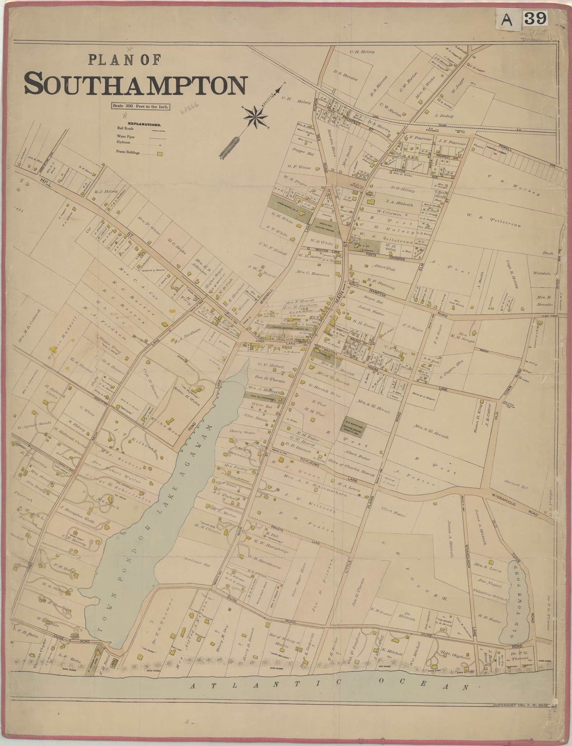
Plan of Southampton
[ca. 1894]
Map No. L.I.-1894.Fl
Subjects
Landowners
Real property
Places
Long Island (N.Y.)
Southampton (N.Y.)
Map area shown
Genre
Cadastral maps
Download
Low Resolution Image
Citation
Plan of Southampton; , , ; Brooklyn Historical Society.
Loading zoom image...