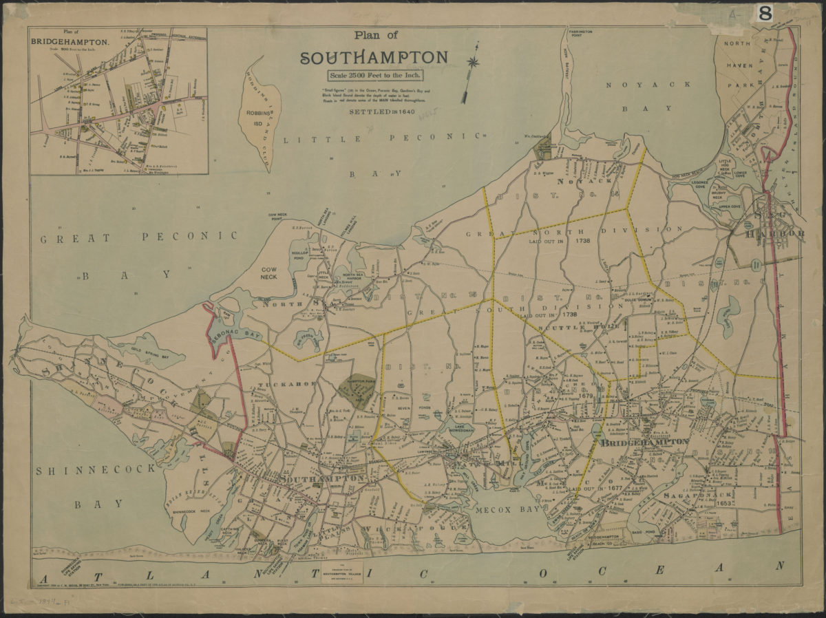
Plan of Southampton [ca. 1894]
Map No. L.I.-1894a.Fl
Covers area east from Shinnecock Canal to Sag Harbor and north to North Haven Park. Shows names of property owners, churches, schools, school districts, clubs, parks, and dates when areas were “laid out.” Depths shown by soundings in feet. Oriented with north to the upper right. “Published as a part of the Atlas of Suffolk Co., N.Y.” “Copyright 1894 by F.W. Beers, 36 Vesey St., New York.” “For enlarged plan of Southampton Village see sections 3 & 4.” “Settled in 1640.” Includes key and inset. Inset: Plan of Bridgehampton (Scale [ca. 1:10,800]).
Map area shown
Relation
Full catalog recordSize
55 × 74 cmDownload
Low Resolution Image
Creator
Beers, F. W.,Publisher
Brooklyn Historical SocietyCitation
Plan of Southampton; [ca. 1894], Map Collection, L.I.-1894a.Fl; Brooklyn Historical Society.Scale
Scale [1:30,000] 1 in toLoading zoom image...