
Pocket map of greater New York: showing the good roads in and about greater New York, together with a map of New York City proper [ca. 1896]
Map No. NYC-1896.Fl
“Map of New York City” also shows routes of surface railroads, elevated railroads and stations, and steam railroads. Relief shown by isolines on “Map of greater New York.” Cover title. “Copyright 1896 by G.W. & C.B. Colton & Co.”–Lower left margin of both maps. “Compliments of A.D. Hawkins, 225 Greene Avenue, Brooklyn”–Cover. On cover: Ill. and publisher’s advertisments. Includes “Interesting facts about greater New York,” key, ill., and inset continuation map. Inset continuation map: Plan of the northern portion of the city of New York (Scale [ca. 1:43,636]). Map of greater New York. Map of New York City.
Map area shown
Genre
Road mapsRelation
Full catalog recordSize
44 × 38 cmDownload
Low Resolution Image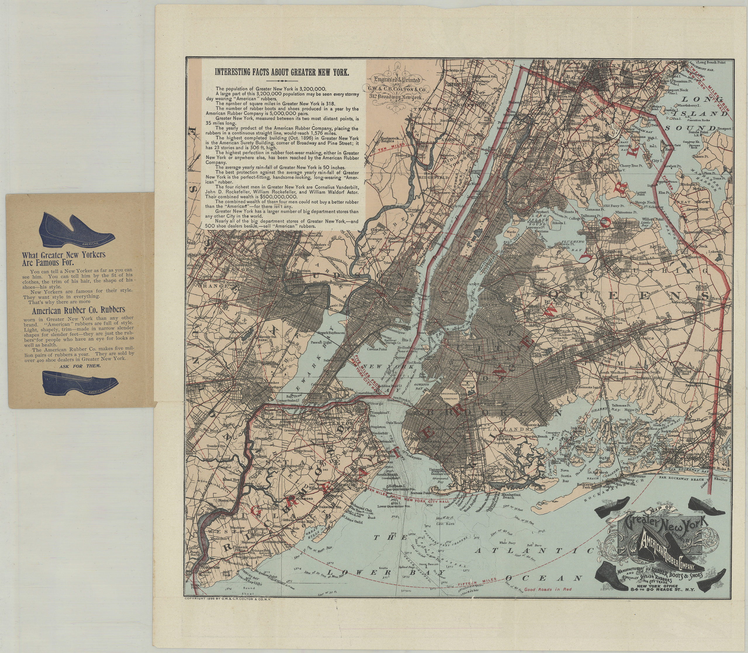
Creator
G.W. & C.B. Colton & Co.,Publisher
Brooklyn Historical SocietyCitation
Pocket map of greater New York: showing the good roads in and about greater New York, together with a map of New York City proper; [ca. 1896], Map Collection, NYC-1896.Fl; Brooklyn Historical Society.Scale
Scales differLoading zoom image... 