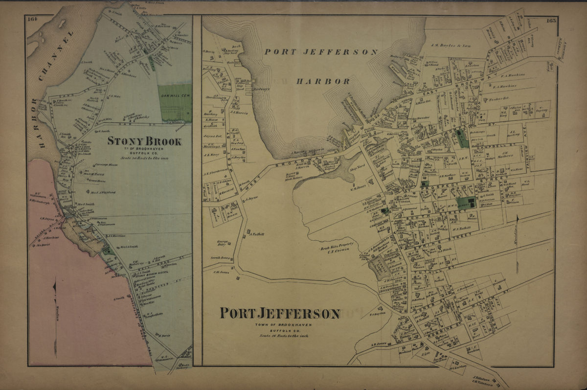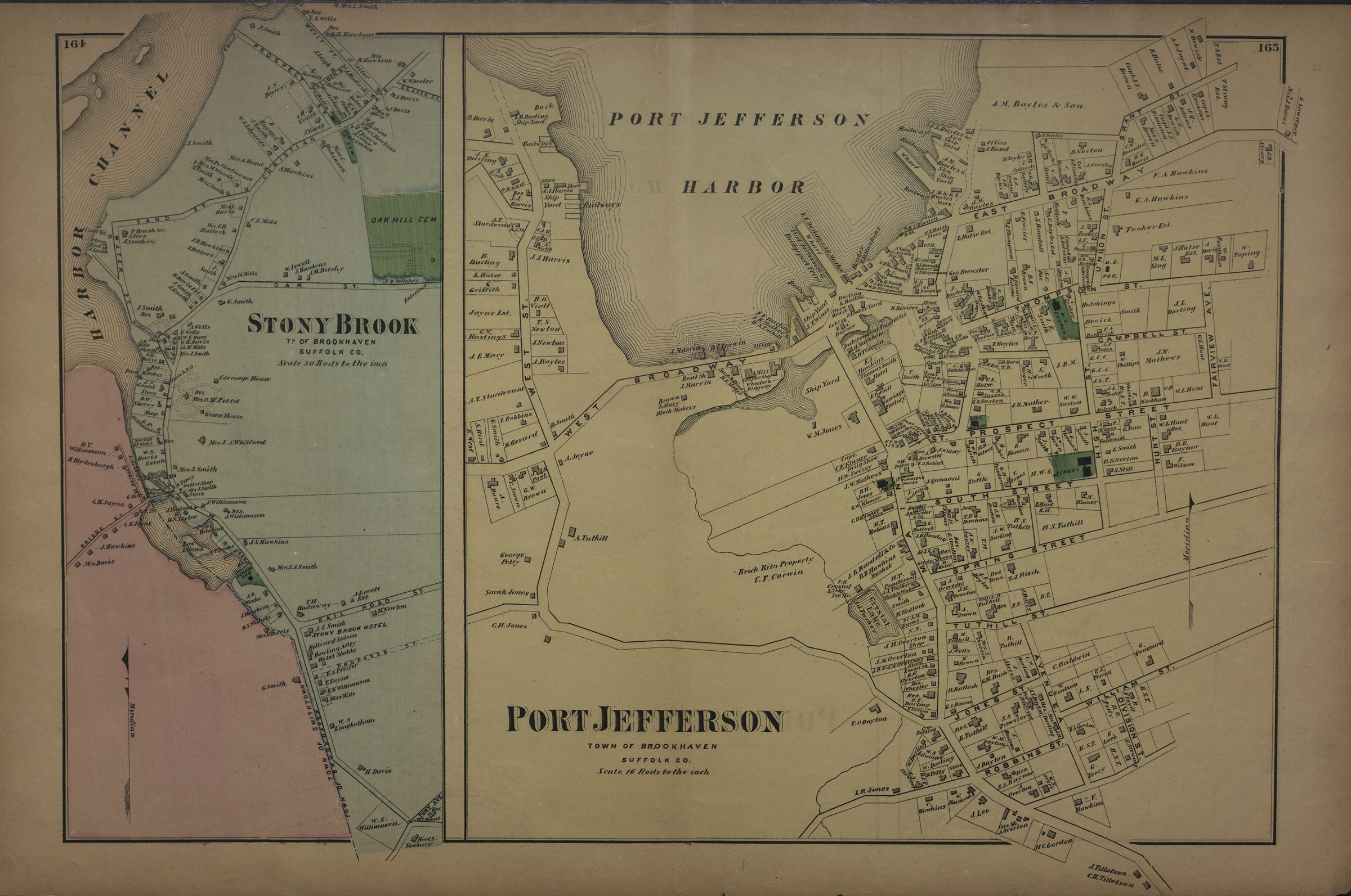
Port Jefferson, town of Brookhaven, Suffolk Co. ; Stony Brook, tn. of Brookhaven, Suffolk Co [1873]
Map No. L.I.-[1873]h.Fl
Cadastral maps. “Port Jefferson …” covers area north from Robbins St. to Grant St. and east from West. St. to Fairview Ave. Shows property (including lots and buildings), names of landowners, churches, schools, and businesses. “Stony Brook …” covers area north from Tony Ave. to Geader St. and east from the Harbor Channel to Oak Hill Cemetery. Shows property (including lots and buildings), names of landowners, and businesses. Extracted from: Atlas of Long Island, New York. New York : Beers, Comstock & Cline, 1873. “164”–Upper left corner. “165”–Upper right corner.
Map area shown
Genre
Cadastral mapsRelation
Full catalog recordSize
38 × 61 cmDownload
Low Resolution Image
Creator
Beers, F. W.; Beers, Comstock & Cline,Publisher
Brooklyn Historical SocietyCitation
Port Jefferson, town of Brookhaven, Suffolk Co. ; Stony Brook, tn. of Brookhaven, Suffolk Co; [1873], Map Collection, L.I.-[1873]h.Fl; Brooklyn Historical Society.Scale
Scales differLoading zoom image...